ESA – New remote sensing tech on satellite for atmospheric measurements

VEGA Rocket

ESA – New remote sensing tech on satellite for atmospheric measurements

3 SEPTEMBER 2020

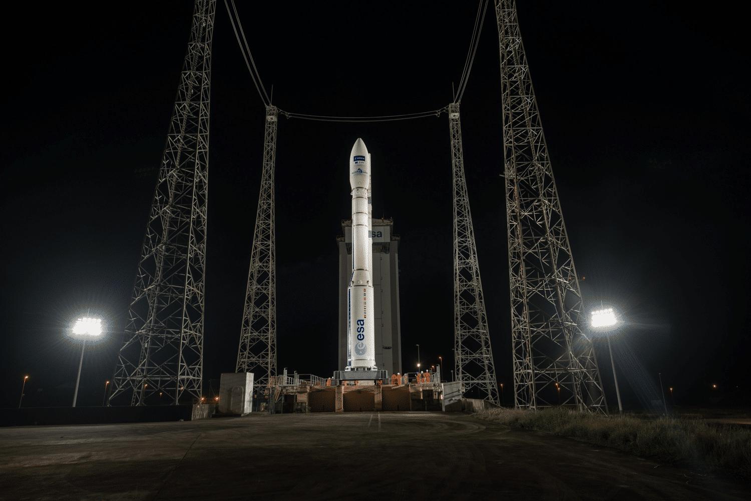
On September 3rd 2020, ESA has launched 42 small satellites aboard a Vega rocket from Kourou in French Guiana for the Copernicus Project.

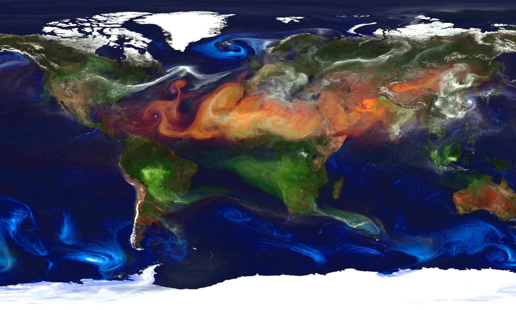
This new type of satellites capable of measuring CO2 emissions to the nearest kilometer and pinpointing their origin.

One of these nanosatellites, PICASSO, carries remote sensing technology developed which will be used to undertake measurements in the upper layers of Earth’s atmosphere.

PICASSO stands for Pico-Satellite for Atmospheric and Space Science Observations and it’s the first CubeSat nanosatellite mission of the Royal Belgian Institute for Space Aeronomy.

Weighing only 3.5kg, it carries two measuring instruments for atmospheric research: A Visible Spectral Imager for Occultation and Nightglow (VISION) and a system to conduct plasma measurements in the ionosphere, the Sweeping Langmuir Probe (SLP).

This project of analysis and collection of satellite data will be carried out over 5 years. The aim is to obtain as much precise information as possible on the quantification of gases in the air.

We will be able to know exactly the real CO2 emission by country, cities and the origin of gases (if it’s anthropogenic or natural).

Thanks to this initiative, more and more surveillance systems will be sent into space over the next few years, which will help develop the market for remote sensing solutions.

Cimel will be part of this development by bringing additional data thanks to its photometers and LiDARs to help calibrate and validate data from satellites.

Credits: ESA-M. Pedoussaut

Earth Observation Satellites & Ground Monitoring  Solutions – an essential synergy for Air Quality and Climate Change

Earth Observation Satellites & Ground Monitoring  Solutions – an essential synergy for Air Quality and Climate Change

April 30, 2020

Atmospheric monitoring and climate analysis are strategic missions in order to improve the understanding of air quality dynamics and climate change evolutions. This in turn is a pre-requisite for providing reliable information reports with real data measurements and to help decision makers and end-users to understand the impacts and causes of air pollution with atmospheric impacts and to act upon it.

Satellite data is key for atmospheric and climate monitoring by providing a continuous and global view of the Earth parameters. These data are essential inputs for forecast models by improving their accuracy.

By combining satellite observations with models of the atmosphere and measurements from ground-based instruments, like Cimel Remote Sensing Solutions, it is possible to measure accurately and forecast aerosols (particles suspended in the air), as well as quantify gases level (ozonenitrogen dioxidesulphur dioxidecarbon monoxide…) and several other kind of environmental parameters (planetary boundary layer, water leaving reflectance for Ocean color, solar radiation, water vapor, atmospheric concentration profiles PM2.5/PM10…).

Cimel solutions keep working continuously and automatically, to help the calibration of satellite instruments and validate their data. Furthermore, Cimel is always active to support the various research activities from the worldwide scientific community.

In this video, different aerosols are highlighted by color, including dust (orange), sea salt (blue), nitrates (pink) and carbonaceous (red), with brighter regions corresponding to higher aerosol amounts.

See more on: https://lnkd.in/edPSdrM

Credit: NASA Goddard Space Flight Center