SORBETTO Winter School

SOlar Radiation Based Established Techniques for aTmospheric Observations (SORBETTO) Winter school.

Keywords : Aerosols, Monitoring, Earth observation, Remote sensing, Wavelength, LiDAR, Photometer, Radiation, Atmosphere, CAL/VAL, SORBETTO.

February 14th 2023

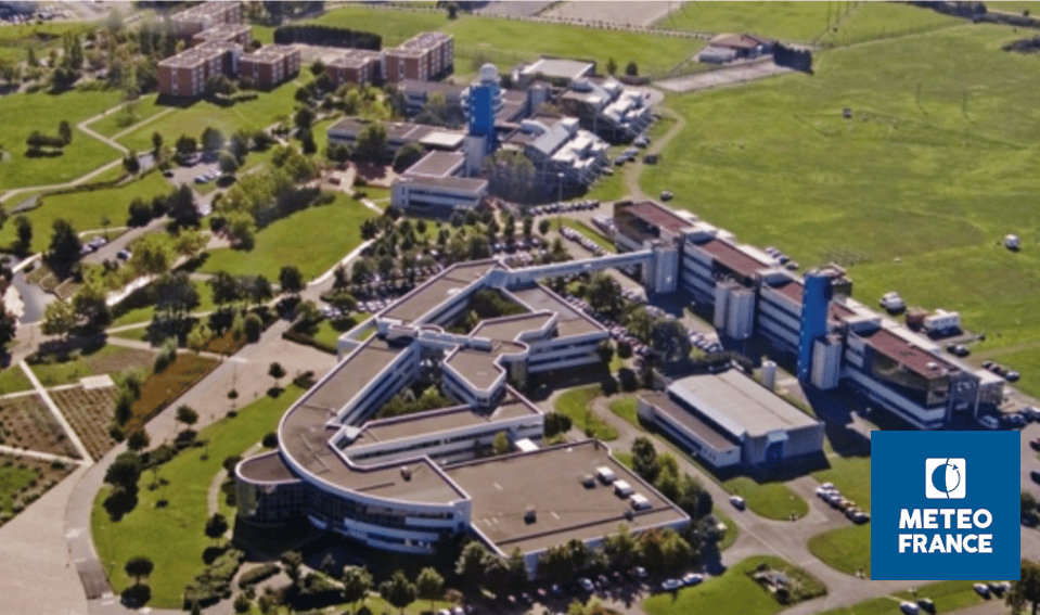
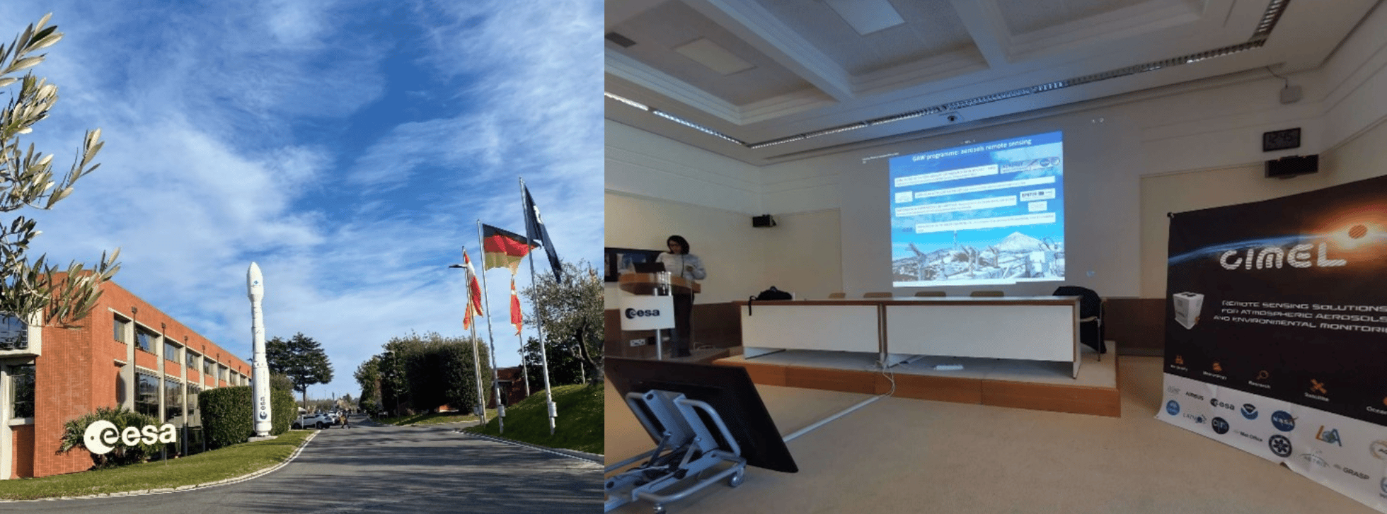
SOlar Radiation Based Established Techniques for aTmospheric Observations (SORBETTO) Winter school took place from February 6th to 10th at ESA-ESRIN (European Space Research Institute), in Frascati, Italy and was organized in collaboration with Sapienza University (Roma) and CNR-ISAC (National Research Council – Institute of Atmospheric Sciences and Climate).

SORBETTO is an important training event for young researchers collaborating within the international aerosol’s scientific community (gas and aerosol observations for climatological, meteorological, local and global air pollution studies, remote sensing and in-situ measurements, calibration of satellite measurements…).

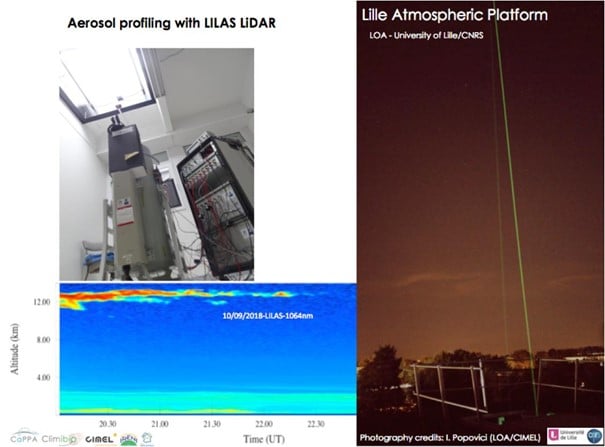
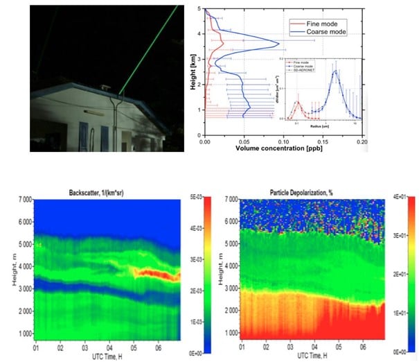
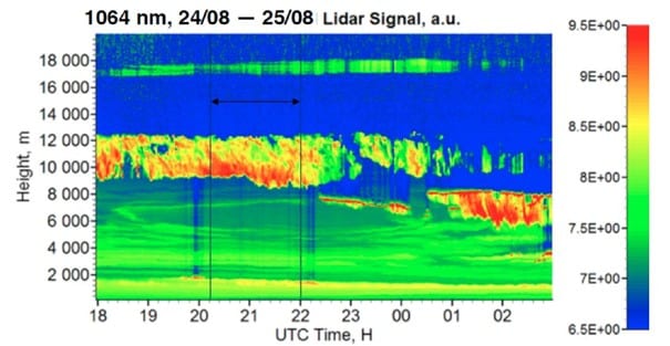
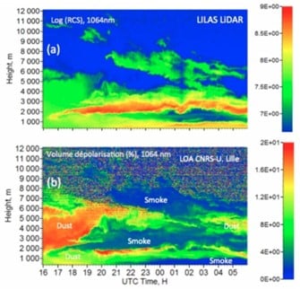
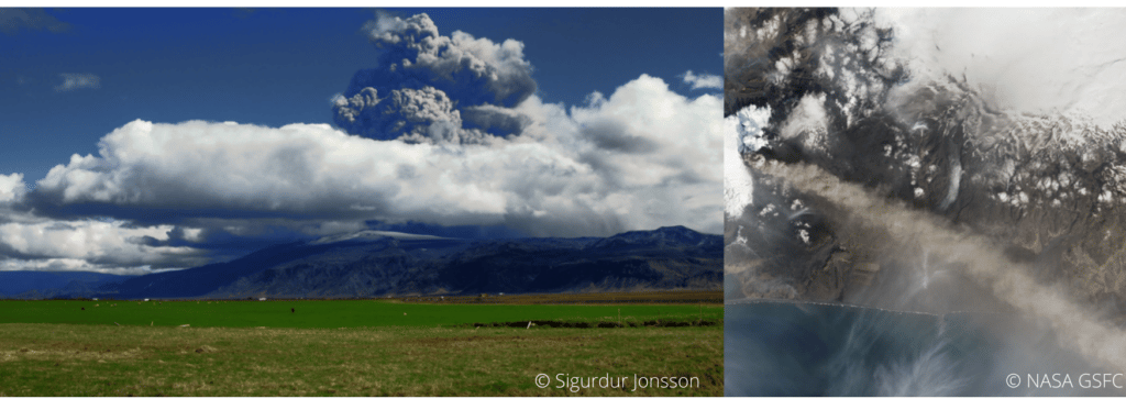
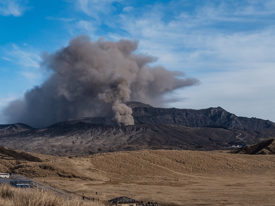
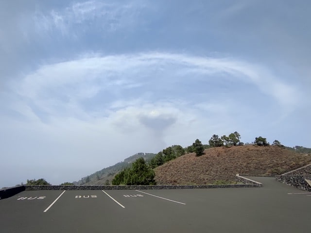
Ground-based instruments deployed in Networks such as AERONET are key players to perform high quality observations that contribute to the Validation and Calibration (CAL/VAL) of satellite missions. Instruments such as Sun Sky Lunar Photometers or LiDARs allow to check that information derived from satellite sensors is comparable to ground measurements and thus, to validate their accuracy.


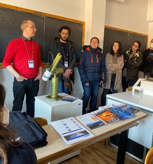
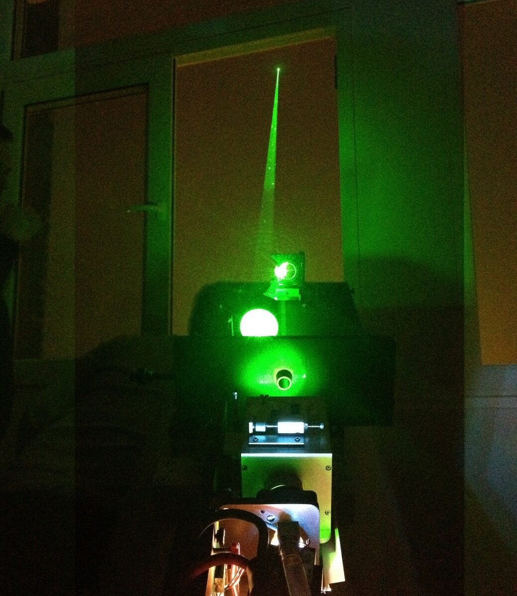
CIMEL Team operating an instrumental demonstration of CE318-T Sun Sky Lunar Photometer at University of Sapienza, 9th 2023.

The instrument show held on Thursday 9th at Sapienza University was the opportunity for students to attend a presentation of various solutions such as CIMEL CE318-T Sun Sky Lunar Photometer, exclusive instrument of NASA Aerosol Network AERONET.

It was a pleasure for CIMEL to attend the event with our great and exclusive Italian Business Partner XEarPro Srl. With 20 years of experience in the field of environmental monitoring, XEarpro Srl contributes in the development of applications and solutions to safeguard the environment around us. We collaborate closely to meet the needs of the Italian scientific community in term of aerosols remote sensing instruments. 

LiDAR LILAS

Multi-wavelength LILAS LiDAR Raman at the Laboratory of Atmospheric Optic (LOA).

Keywords : Aerosols, LiDARs, MicroLiDARs, monitoring, Earth observation, remote sensing, Raman, wavelengths, ash, dust, sand.

July 29th 2022

The Laboratoire d’optique atmosphérique (LOA) is a joint research unit of the National Center for Scientific Research (CNRS) of France and the University of Lille – Sciences and Technologies. The LOA studies the different components of the atmosphere, mainly clouds, aerosols and gas. In collaboration with the LOA, CIMEL created a joint research laboratory : AGORA-LAB.

Since 2005, the LOA has started the systematic observation of aerosols by LiDAR and has developed a database and an automated real-time data processing system. Its collaboration with CIMEL allowed the creation of the multi-wavelength LILAS LiDAR which was integrated into the European network EARLINET/ACTRIS in 2015.

The LILAS LiDAR was specifically designed and adjusted by CIMEL to meet a specific need of the LOA. The transportable multi-wavelength Raman research LiDAR LILAS offers a significant qualitative and quantitative value on aerosol parameters measured at night and during the day, in particular through its combination with CIMEL sun/sky/lunar photometers.

LILAS also allows the observation of clouds and the obtention water vapor and methane profiles. It also gives access to essential climate variables such as the absorption profile of atmospheric aerosols. Its maximum range can reach 20 km and allows it to study the lower stratosphere which can be useful in case of major volcanic eruption for example.

For the Data treatment, the AUSTRAL (AUtomated Server for the TReatment of Atmospheric Lidars) web server data is the processing tool, which provides real-time quicklooks of the LiDAR Range Corrected Signals (RCS) and Volume Depolarization Ratio (VDR) as well as Klett inversion results (extinction and backscatter coefficient profiles).

To answer the need of various stakeholders, the CE710 LiDAR is a fully customizable high power multi-channel aerosols LiDAR resulting from the collaboration between the LOA, CIMEL and Dr. Igor Veselovskii institute. Depending on the requirements and budgets of each, it exists multiple options to customize the LiDAR. For exemple, the choice of the laser type and the wavelengths, the depolarization options or the Raman options (and many more).

Thanks to its precision in the detection of aerosols, the LILAS CE710 LiDAR has highlighted many atmospheric natural events such as volcanic eruptions (ash) or dust and sand events for example but also biomass burning particles coming from fires. LILAS data and all the LiDAR’s activities between the LOA and CIMEL bring a precious monitoring tool to understand atmospheric phenomenas over France, Europe and worldwide.


Figure 1 : View of LILAS (telescope, laser, and acquisition bay) in vertical view, open roof hatch and example of observed aerosol profiles. LILAS is a transportable multi-wavelength Elastic & Raman LiDAR. It has 3 elastic channels (355, 532 and 1064 nm), 3 Raman channels (387, 407 and 530 nm) and 3 depolarized channels (355, 532 and 1064 nm).

Figure 2: Night time LILAS operation during SHADOW-2 campaign in Senegal (Credits: Q. Hu, LOA)

Figure 3 : Detection of smoke particles injected up to 17 km into the stratosphere by intense pyro-convection generated by the Canadian wildfires of summer 2017 (Hu et al., 2018).

Figure 4: Illustration of the extreme event in October 2017. LiDAR LILAS time series from 16/10/17-16:00 to 17/10/17-06:00 UTC at the Lille site (LOA). (a) The reddest regions indicate a high concentration of particles while the blue regions indicate a very low concentration of particles. (b) Aerosol depolarization which informs us about the shape of the particles and thus their nature, desert or fire particles.
 Graphic credits Q. Hu, LOA

Figure 5: LiDAR LILAS LOA
Communications and posters
  • Podvin T., P. Goloub, D. Tanré, I. Veselovskii, V. Bovchaliuk, M. Korensky, A. Mortier, S. Victori, .LILAS, un LIDAR multispectral et Raman pour l’étude des aérosols, de la vapeur d’eau et des nuages, Atelier Experimentation et Instrumentation 2014 (oral presentation)
  • Podvin T, Q. Hu, P. Goloub,  O. Dubovik, I. Veselovskii, V. Bovchaliuk, A. Lopatin, B. Torres, D. Tanré, C. Deroo, T. Lapyonok, F. Ducos, A. Diallo. , LILAS, le Lidar multi spectral Raman polarisé et quelques résultats d’inversions, Atelier Experimentation et Instrumentation 2017 (poster presentation).
  • Hu et al., Aerosol absorption measurements and retrievals in SHADOW2 campaign, ICAC 2017, International Conference on Aerosol Cycle, 21 – 23 Mar, Lille
  • Hu et al., A test of new approaches to retrieve aerosol properties from Photometer-LiDAR joint measurements, ESA/IDEAS Workshop 2017, Lille, 06-07 Apr 2017
  • Hu et al., Retrieval of aerosol properties with Sun/Sky-photometer and LiDAR measurements, ACTRIS-FR, Workshop, Autrans Méaudre en Vercors, 3-5 mai 2017
  • Hu et al., Retrieval of aerosol properties with Sun/Sky-photometer and LiDAR measurements, 28th ILRC, international LiDAR and Radar conference, Bucharest, 25 – 30 June
  • Hu et al., Lidar measurements with 3-depolarization in Lille, 3rd ACTRIS-2 WP2 Workshop, Delft, 13-17 Nov 2017.

Méteo France

METEO-FRANCE network of CIMEL’s instruments

Keywords : Aerosols, LiDARs, monitoring, Earth observation, remote sensing, CAL/VAL, atmosphere, air quality, photometers, aviation, volcanos survey, volcanic ashes, atmospheric monitoring

July 06th 2022

Météo-France is a public administrative institution, the official meteorological and climatological service in France. As such, it exercises the State’s responsibilities in terms of meteorological safety. The institution is also in charge of managing and modernizing an observation network of the atmosphere, the surface ocean and the snow cover in France and overseas.

The institution is also present on an international level as it contributes to the programs and activities of the World Meteorological Organization (WMO) which sets standards that meet the shared needs of its Member States.

Météo-France’s research department, the Centre national de recherches météorologiques (CNRM), is a joint research unit with the CNRS. Météo-France is also a joint supervisor of the Laboratoire de l’Atmosphère et des CYclones (LaCy), the Service des Avions Français Instrumentés pour la Recherche et l’Environnement (SAFIRE), and the Observatoire Midi-Pyrénées (OMP).

Météo-France core missions are linked to the needs related to the protection of people and property: weather forecasting, knowledge of the climate and its evolution, physics and dynamics of the atmosphere and interactions between men, the climate and the atmosphere…

The knowledge of weather conditions is of huge importance for the aviation industry for example. Landing, taking off and even flying safely depends on weather conditions. The perfect example of this huge importance is the eruption of the volcano Eyjafjallajökull which occurred in April 2010. The Icelandic volcano released a thick ash of smoke which disrupted European air traffic, causing five days of complete interruption of traffic: the largest closure of airspace decreed in Europe, not without financial consequences as it led to considerable losses.

Indeed, volcanic ash which tends to settle in the atmosphere is dangerous as it can be sucked into the plane’s engines, then, melt, and finally clog the jet engines. It can cause air plane accidents.

Hence the importance of using state-of-the-art remote sensing measuring instruments to determine for instance the localization, the characterization and the concentration of aerosols in the atmosphere. For this purpose, Météo-France works in collaboration with the LOA (Laboratoire d’Optique Atmosphérique) to manage and maintain a network of efficient solutions and link several instruments such as LiDARs and CIMEL photometers (ready-to-use by AERONET) for more accurate data and considerably reduced uncertainties.

To this end, CIMEL works in close collaboration with Météo-France and ensures to provide quality and constantly improved instruments to meet the urgent needs in terms of security.

Actually, CIMEL also provides instrument synergies between Photometers and LiDARs through a unique monitoring software iAAMS, dedicated to the aerosols study and analysis. The obtained parameters are the characterization of aerosol types, the extinction and backscatter profile of mass concentration. Cimel’s AAMS is able to automatically locate, identify and quantify aerosols, layer by layer, day and night.

VOLCANO MOUNT ASO

Volcano eruption of Mount Aso in Japan – A peak of AOD due to volcanic ashes

Keywords : Photometer, Aerosols Optical Depth, Atmosphere, volcanic eruption, Ashes.

17th November 2021

The volcano of Mount Aso located in the south of the Japanese archipelago on the island of Kyushu erupted this Wednesday, October 20, releasing volcanic ashes up to 3,5 kilometers in the atmosphere during the strongest eruption time.

The volcano had not been active since 2016, local authorities are advising residents to remain vigilant of volcanic ashes and gases on the leeward side of the Nakadake crater. As a matter of fact, the gas and projectiles created a cloud that is denser than the surrounding air and which is an extremely hot ash plume due to the turbulence between the flow and the overlying air.

One of the Cimel CE318-T photometer is currently providing atmospheric aerosols measurements near the volcano eruption. Indeed, the NASA AERONET site based on the offshore platform of Ariake observation tower located in Ariake Sea in Japan, is about 5 kilometers from the coast of Saga city in Ariake Sea.


Figure 1: Google Earth satellite image showing the position of the NASA AERONET Ariake Tower site in relation to the Mount Aso volcano in Kyushu Island (Japan).

Figure 2: Data provided by the Cimel photometer in the Ariake Tower operated by Saga University, depicting Aerosols Optical Depth in the atmosphere.

We have collected data recorded by the Cimel CE318 photometer which measures the Aerosols Optical Depth (AOD) in the atmosphere. We note a peak of the AOD on October 21, a day after the volcanic eruption.

With the addition of Cimel CE376 LiDAR, it would be possible to obtain more high added value parameters such as the characterization, location and the extinction and backscatter profile of mass concentration of this kind of ash aerosols in the atmosphere.

See more on our AAMS solution which consists in the synergy between our LiDARs and our photometers.

VOLCANO LA PALMA

La Palma eruption (Canary Islands) – volcanic plumes tracking by our LiDARs

Keywords : LiDARs, Aerosols, Atmosphere, La Palma, Cumbre Vieja volcano, CE376.

6th October 2021

The Cumbre Vieja volcano on La Palma in the Canary Islands erupted on 19th September for the first time since 1971 resulting in large lava flows and evacuations.

Due to the volcanic eruption, nearly 10 000 tons of sulfur dioxide are released in the atmosphere every day. The risks generated are acid rain and deterioration of air quality which can lead to respiratory problems.

In a few words, this phenomenon is due to the fact that the lava of the volcano which reaches 1000°C meets the sea water which is at around 20°C. Therefore, the sodium chloride contained in the sea breaks down the water into oxygen and hydrogen. However, when hydrogen meets chlorine, they turn into hydrochloric acid which is an extremely dangerous gas.

There are many consequences such as the impact on the air quality which directly concerns the surrounding populations who breathe a toxic smoke harmful for their health.

Air traffic is also strongly impacted as all the flights departing from the island have been cancelled. These disturbances are also due to the lack of instruments measuring aerosols (such as LiDARs) to accurately identify the location of the volcanic ash as well as its characteristics and concentration.

Our CE376 LiDARs in AEMET (Izaña) is tracking plumes of the volcanic ash from the volcanic eruption on La Palma and here are some results to illustrate it.

Figure 1: Quicklook revealing the volcano plumes as captured on 24 September by AEMET in Izaña.

The volcano is propelling air into the atmosphere which meets a thermal inversion – a reversal of the normal behavior of temperature in the troposphere where a layer of hot air sits above a layer of cooler air.

Figure 2: Picture by Virgilio Carreño (Izaña Atmospheric research center, AEMET) showing the interaction of the gas and ash plume of the eruptive column leaving the volcano with the altitude thermal inversion layer of the atmosphere through which the Sahara desert dust transcends.

The plume of the Icelandic volcano Bardarbunga pollutes the air in the Nord – Pas de Calais

The plume of the Icelandic volcano Bardarbunga pollutes the air in the Nord – Pas de Calais

At the end of September 2014, the Nord – Pas de Calais region suffered an episode of heavy air pollution due to the eruption of the Icelandic volcano Bardarbunga, which has already been going on for more than a month.

The analysis of observations of the volcanic plume, obtained from the ground, thanks to CIMEL photometers and LiDAR, and by satellite, by a team of researchers, engineers and technicians from the Laboratoire d’optique atmosphérique (LOA, CNRS / Université Lille 1) in collaboration with the association for monitoring air quality atmo Nord – Pas de Calais, allowed them to describe the journey, from Iceland, of the volcanic plume and its arrival in the lowest layers of the French atmosphere.