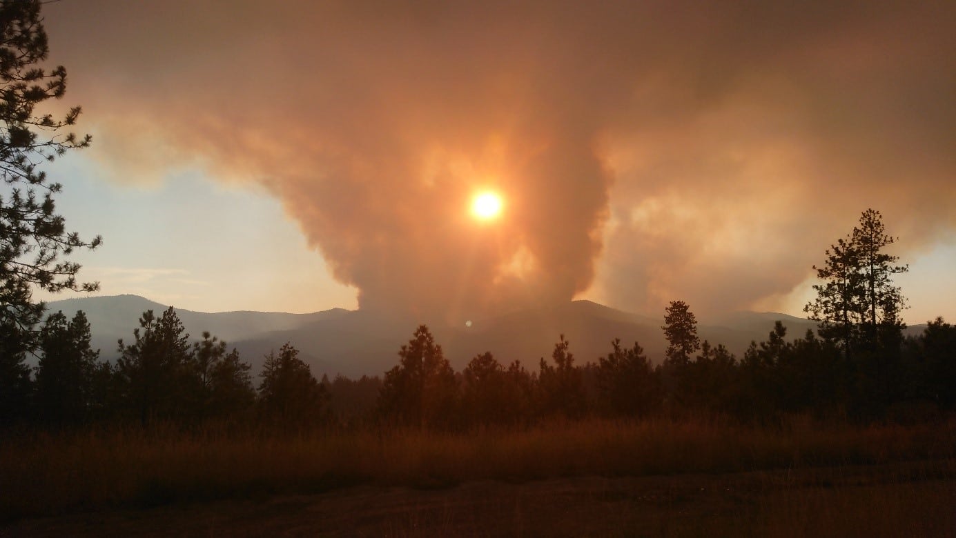
US west coast forests are more and more in the grip of Wildfires.
Keywords : Aerosols, LiDARs, MicroLiDARs, Monitoring, Earth observation, Remote sensing, Wildfire, Smoke, Ash, Fires, Climate Change, Global Warming, Atmospheric Monitoring, Mobile Solutions, Air Quality
June 28th 2022
According to a recent UN report, forest fires will continue to increase by the end of the century. It is especially the case on the west coast of the United States, which is one of the countries most affected by this phenomenon. Whether they are natural or human-caused, these fires are devastating on a large scale.
The global warming makes the conditions more favorable to the start of fires and their proliferation. The climate change is worsening the impacts by prolonging the fire seasons.
California is the most wildfire-prone state in the United States. In 2021, over 9000 wildfires burned in the Southwestern state ravishing nearly 2.23 million acres.
Fires are a danger to life on the planet: smoke inhalation, soil degradation and water pollution, destruction of the habitats of many species… Not to mention the aggravation of global warming due to the destruction of forests, crucial to absorb the carbon that we emit.
Therefore, on summer 2019, NASA initiated FIREX-AQ mission so as to investigate on fire and smoke from wildfire using several measurement instruments across the world, and especially in the US.
NASA uses satellites combined with airborne and ground-based instruments to decipher the impact of wildfires.
The emissions of ash clouds resulting from the fire can be transported thousands of miles and can have an impact on air quality for example as they are responsible for a large fraction of the US PM2.5 emissions. Due to its microscopic size, PM2.5 is easily inhaled and has the potential to travel deep into our respiratory tracts, it can also remain airborne for long periods.
To date, wildfire outputs are still poorly represented in emission inventories.
The overarching objectives of FIREX-AQ are to:
- Provide measurements of trace gas and aerosol emissions for wildfires and prescribed fires in great detail
- Relate them to fuel and fire conditions at the point of emission
- Characterize the conditions relating to plume rise
- Follow plumes downwind to understand chemical transformation and air quality impacts
- Assess the efficacy of satellite detections for estimating the emissions from sampled fires
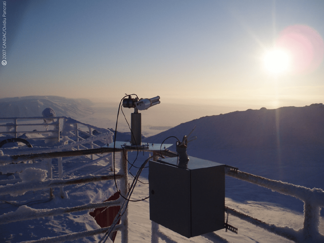
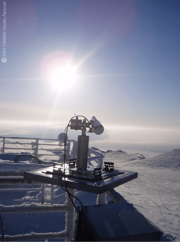
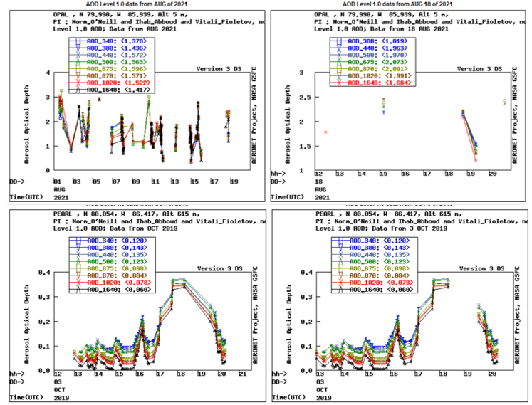
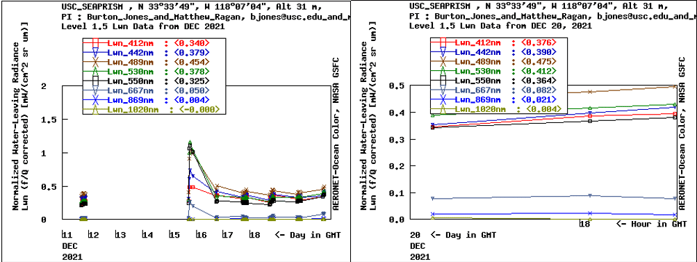
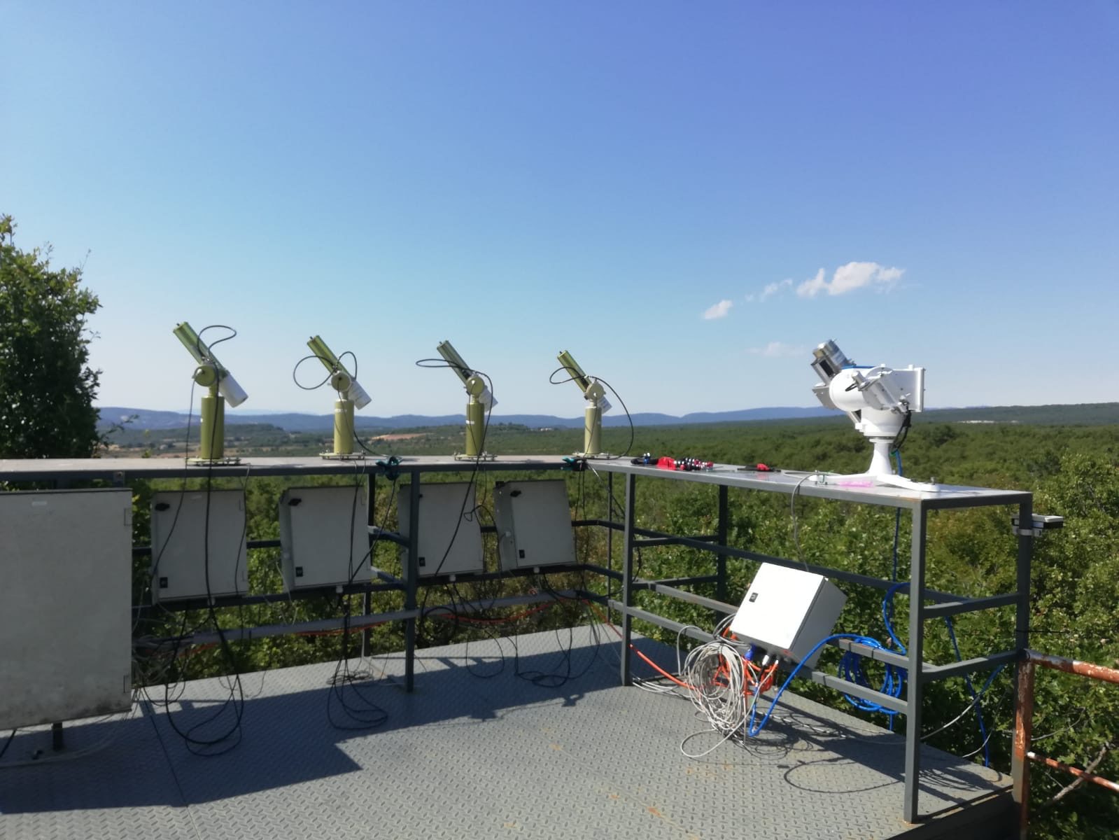
For this purpose, CIMEL provided CE376 micro-LiDARs as well as its network of CE318-T photometers through AERONET. These solutions allowed detailed measurements of aerosols emitted from wildfires and agricultural fires to address science topics and evaluate impacts on local and regional air quality, and how satellite data can be used to estimate emissions more accurately.
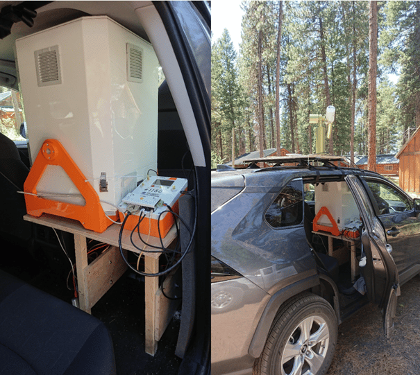
Figure 1: CE376 micro-LiDAR and CE318-T photometers embarked on a car for FIREX-AQ mobile measurements campaign in Western US (2019).
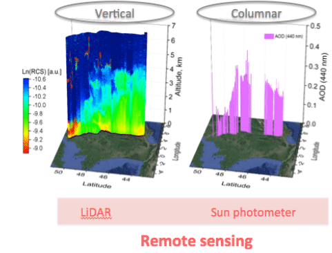
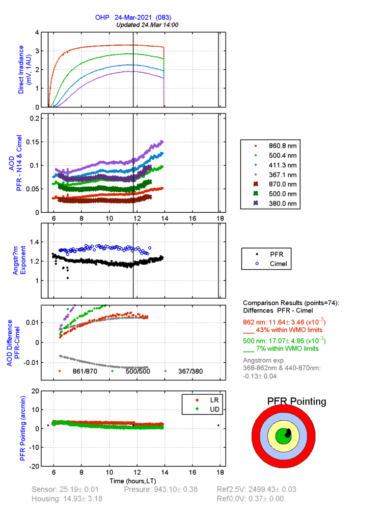
Indeed, the synergy of the photometer with the mobile CE376 LiDAR allows profiling the extinction at 2 wavelengths (532, 808 nm) and of the Angstrom Exponent (AE). AE vertical profile and the depolarization capabilities of the CE376 allow identifying the aerosol type (fine/coarse). Below are some results from the FIREX-AQ 2019 mission:
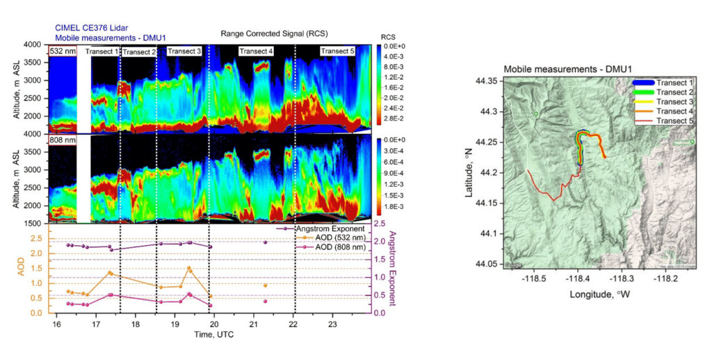
Figure 2: Mapping of smoke vertical and spatial dispersion thanks to mobile LIDAR and photometer measurements by Dr. Ioana POPOVICI.
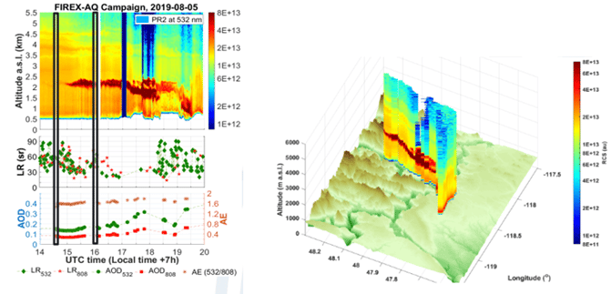
Figure 3: Mapping and modelization from FIREX-AQ campaign in Western US (2019) by LiDAR CE376.
FIREX-AQ experience proved that we are able to embark compact remote sensing instruments and install them quickly on site to access harsh environments and get close to fire sources, which has not been done before. Actually, it is the first time a LIDAR reaches that close to fire sources in a mountainous region.
Bibliography:
https://www.agora-lab.fr/_files/ugd/376d34_4116704968934963a6aea9b5719f2824.pdf
https://ui.adsabs.harvard.edu/abs/2020AGUFMA191…09G/abstract
https://ui.adsabs.harvard.edu/abs/2019AGUFM.A23R3049H/abstract
https://ui.adsabs.harvard.edu/abs/2020AGUFMA191…09G
Citation:
Giles, D. M. and Holben, B. and Eck, T. F. and Slutsker, I. and LaRosa, A. D. and Sorokin, M. G. and Smirnov, A. and Sinyuk, A. and Schafer, J. and Kraft, J. and Scully, A. and Goloub, P. and Podvin, T. and Blarel, L. and Proniewski, L. and Popovici, I. and Dubois, G. and Lapionak, A., (2020), Ground-based Remote Sensing of the Williams Flats Fire Using Mobile AERONET DRAGON Measurements and Retrievals during FIREX-AQ, 2020, AGU Fall Meeting Abstracts.