The Climate and Atmosphere Research Center (CARE-C) of The Cyprus Institute using AAMS solution for atmospheric observation.
Keywords : Aerosols, Monitoring, Earth observation, Remote sensing, Wavelength, LiDAR, Photometer, AAMS, CARE-C.
The Cyprus Institute is non-profit research and educational institution with a strong scientific and technological orientation.
The Institute is divided into four research centers:
- Energy, Environment and Water Research Center (EEWRC)
- Science and Technology in Archeology and Culture Research Center (STARC)
- Computation-based Science and Technology Research Center (caSToRC)
- Climate & Atmosphere Research Center (CARE-C)
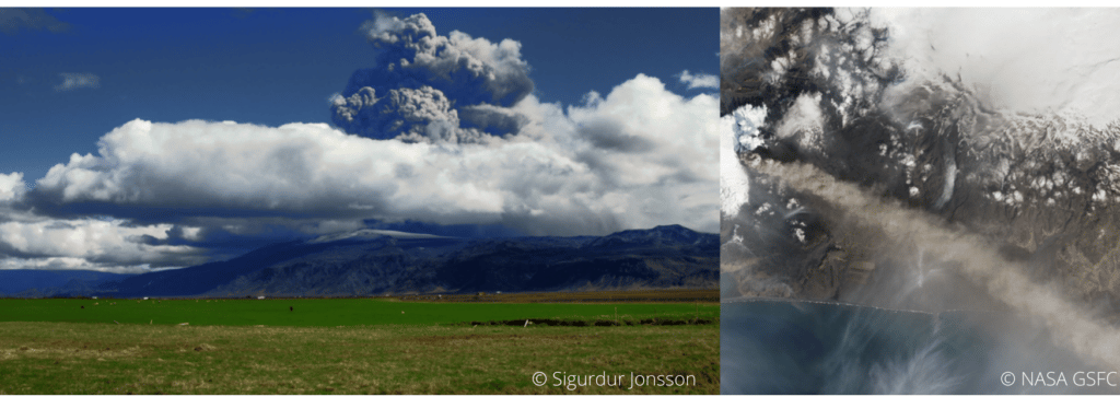
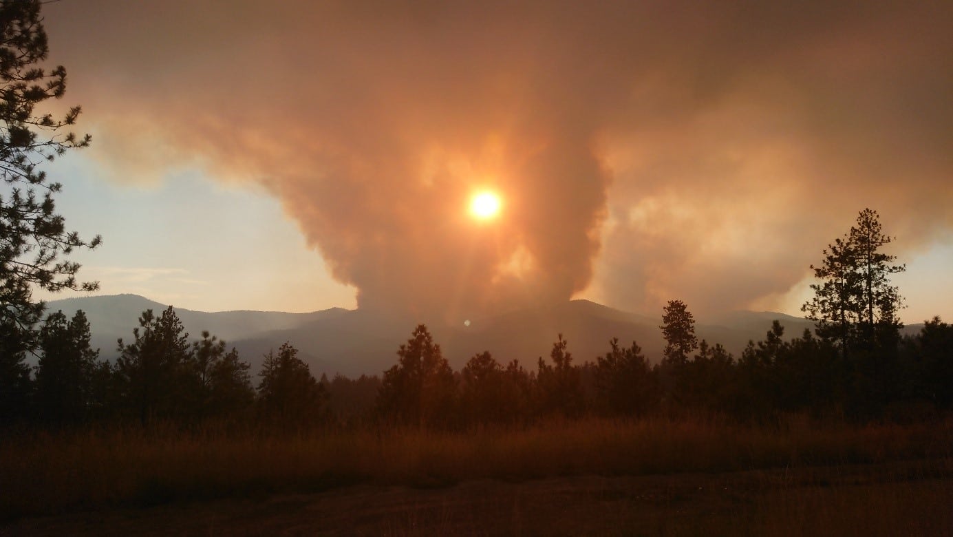
The Climate and Atmosphere Research Center (CARE-C) was founded at the Cyprus Institute in January 2020. It is a regional European Center of Excellence for Climate and Atmosphere Research, based in Cyprus, for the Eastern Mediterranean and Middle East (EMME) region. The aim of the center is to lead some researches about urgent climate change and air pollution challenges such as greenhouse gases, the water cycle, extreme weather, atmospheric dust and their impacts.
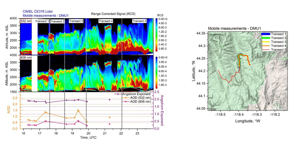
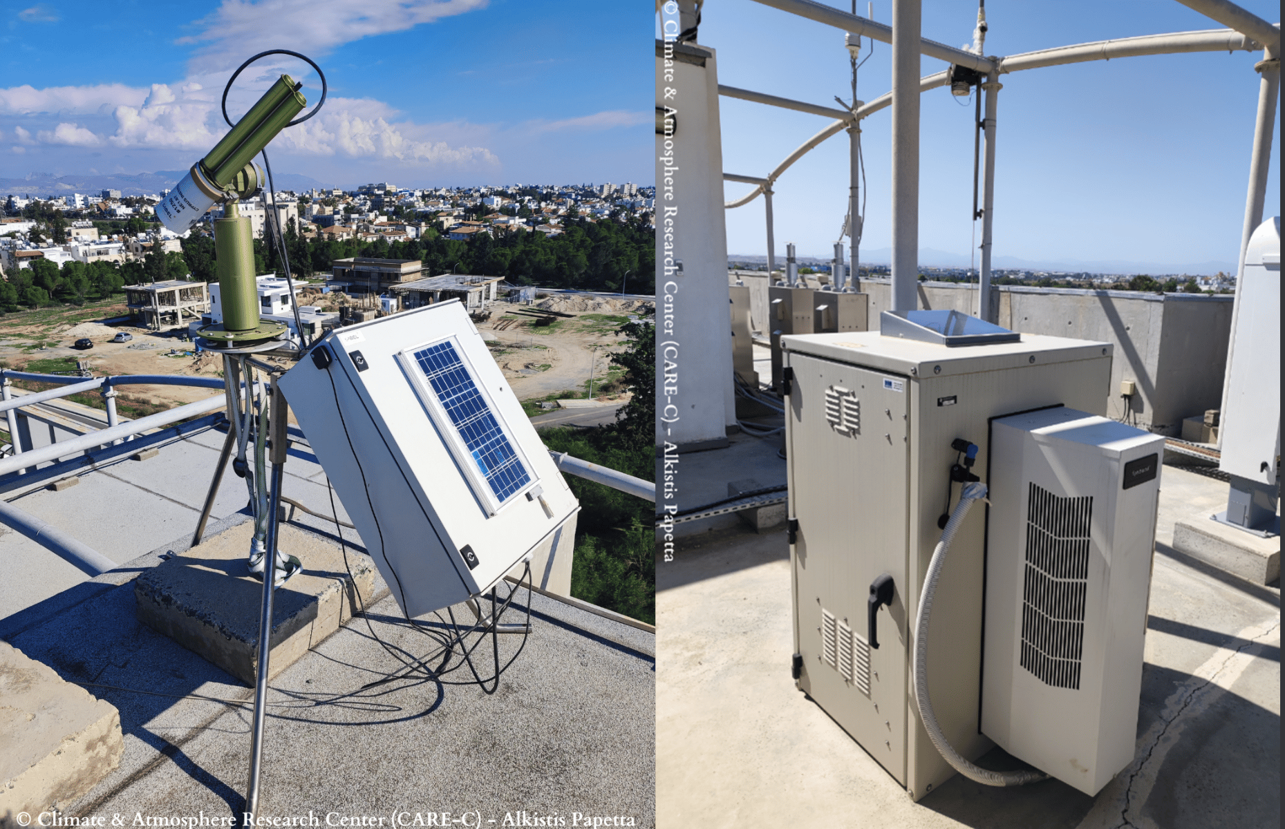
Therefore, the center owns a remote sensing group composed by a network of ground-based instruments located at three Cyprus Atmosphere Observatory (CAO) stations: Nicosia, Agia Marina Xyliatou and Troodos. Among these instruments, three CE318-T – Sun Sky Lunar Multispectral Photometers and a CE376 – Compact LiDAR.
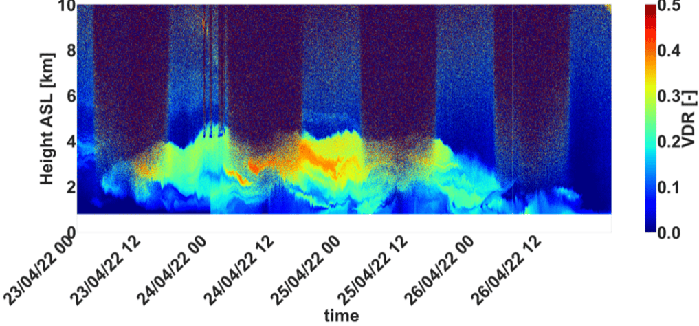
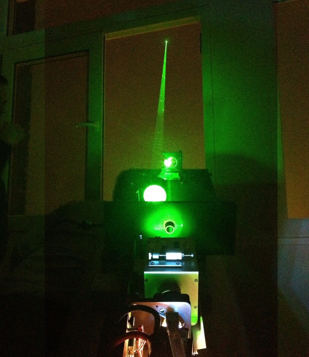
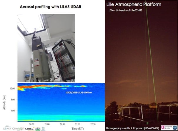
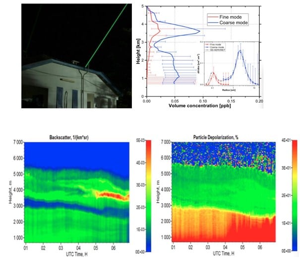
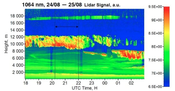
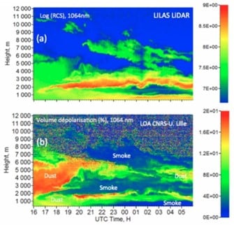
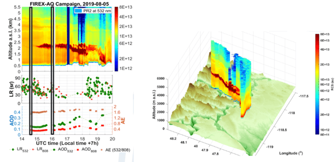
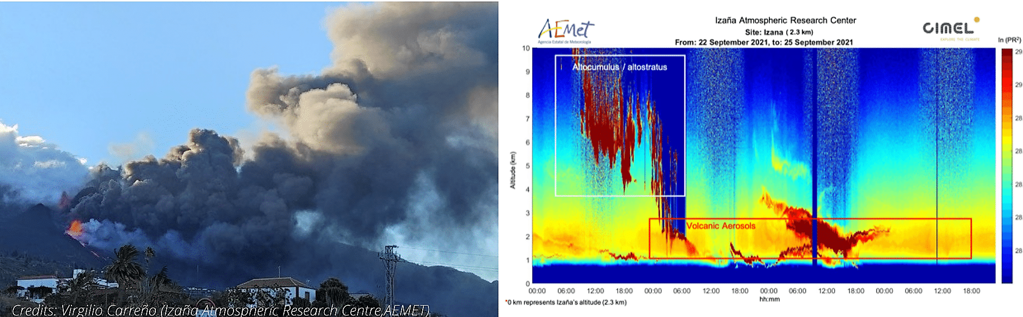
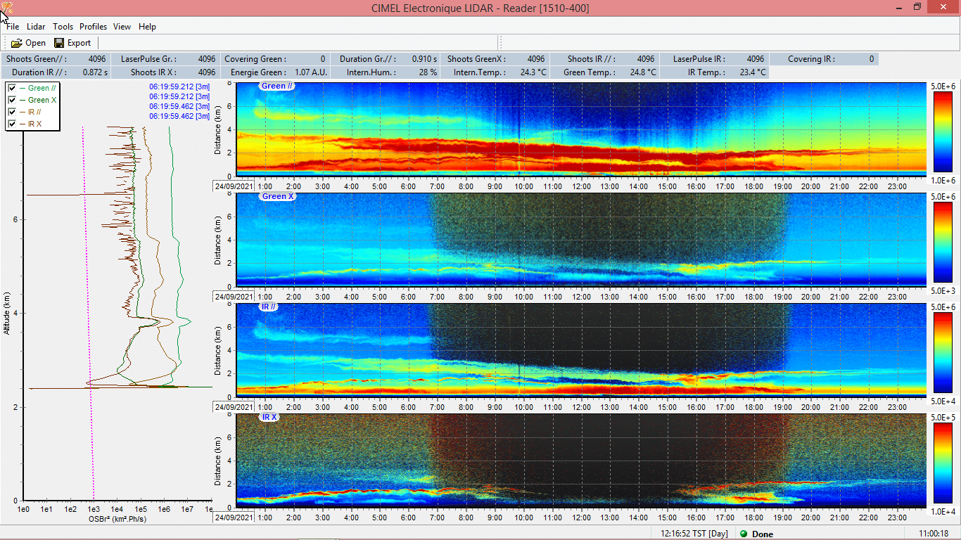
CIMEL AAMS – Automatic Aerosol Monitoring Solution allows the study of the transportation of pollution, dust, smoke and all the aerosols related to atmospheric composition. For instance, optical characterization of dust and smoke particles are made thanks to the 2 wavelengths CE376 – Compact LiDAR. In addition, the instrument has depolarization capability, which is a relevant information for aerosols typing.
By using state-of-the-art solutions and collaborating with the Laboratoire d’Optique Atmosphérique (LOA – University of Lille/CNRS), the CAO provides high quality, long-term observations of key atmospheric pollutants relevant to air quality and climate change, and thus, brings value to the Cyprus Institute in different sectors such as Research, Innovation and Education. This collaboration is developing for many years in the frame of aerosol monitoring (AERONET), radiative flux monitoring and more recently with automatic Lidar/photometer synergy, in the frame of ACTRIS. Moreover, the cooperation between LOA and CAO, in the frame of AQABA campaign, allowed the first operation of the prototype shipborne version of CE318T.
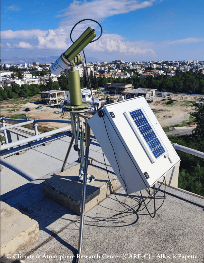
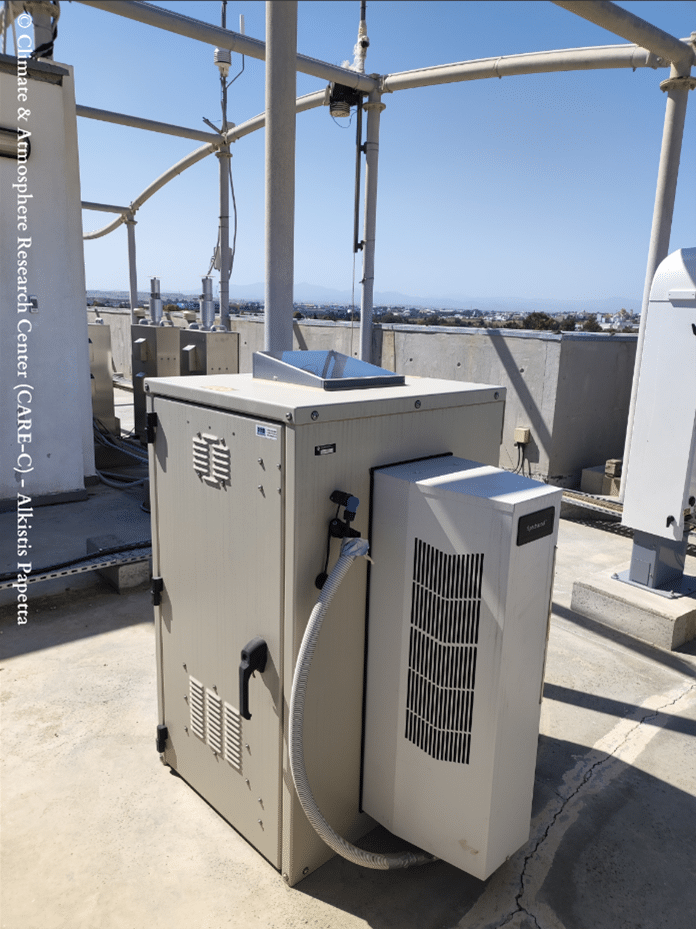
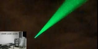
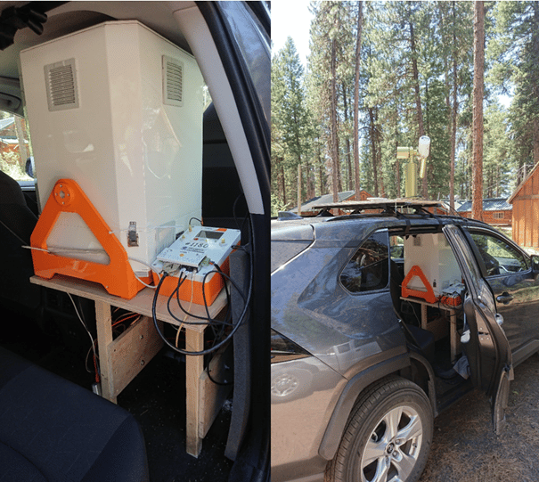
Figure 2 : CE376 – Micro LiDAR at Nicosia station.