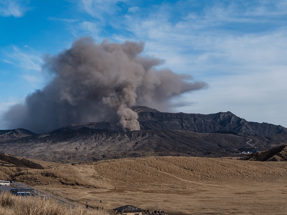
Volcano eruption of Mount Aso in Japan – A peak of AOD due to volcanic ashes
Keywords : Photometer, Aerosols Optical Depth, Atmosphere, volcanic eruption, Ashes.
17th November 2021
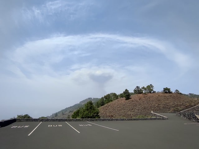
The volcano of Mount Aso located in the south of the Japanese archipelago on the island of Kyushu erupted this Wednesday, October 20, releasing volcanic ashes up to 3,5 kilometers in the atmosphere during the strongest eruption time.
The volcano had not been active since 2016, local authorities are advising residents to remain vigilant of volcanic ashes and gases on the leeward side of the Nakadake crater. As a matter of fact, the gas and projectiles created a cloud that is denser than the surrounding air and which is an extremely hot ash plume due to the turbulence between the flow and the overlying air.
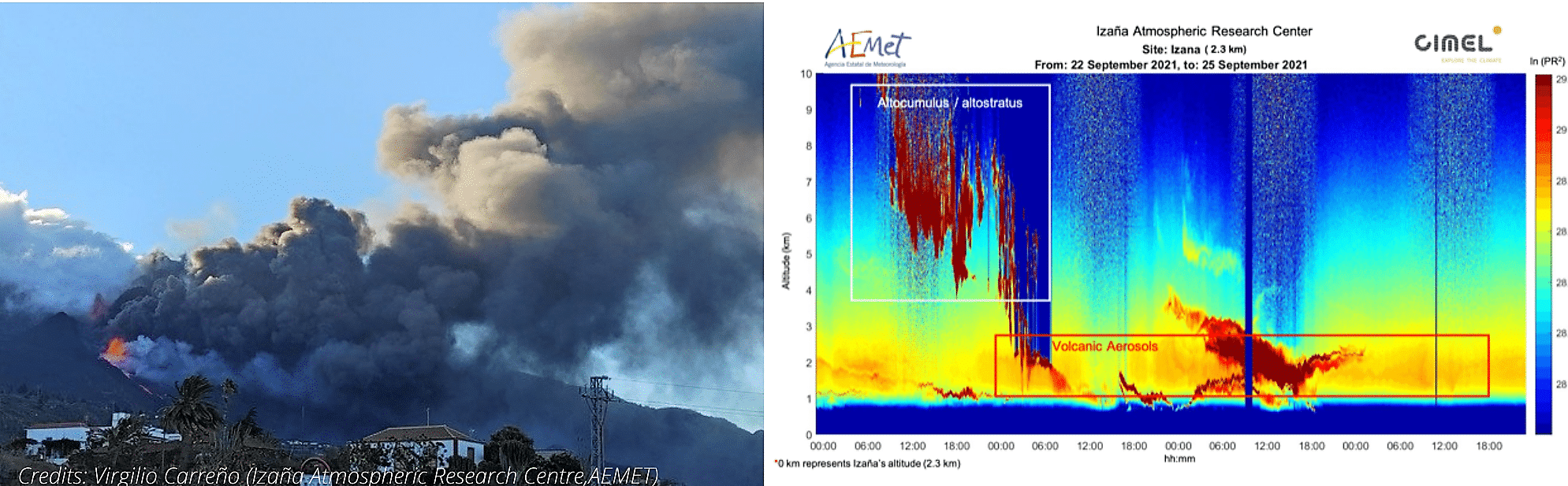
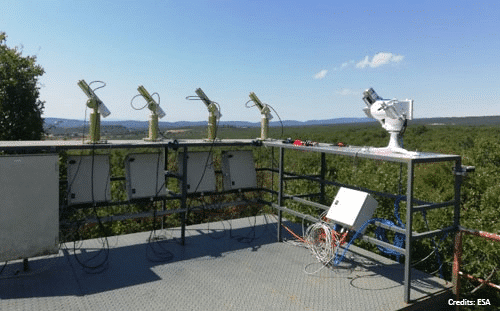
One of the Cimel CE318-T photometer is currently providing atmospheric aerosols measurements near the volcano eruption. Indeed, the NASA AERONET site based on the offshore platform of Ariake observation tower located in Ariake Sea in Japan, is about 5 kilometers from the coast of Saga city in Ariake Sea.
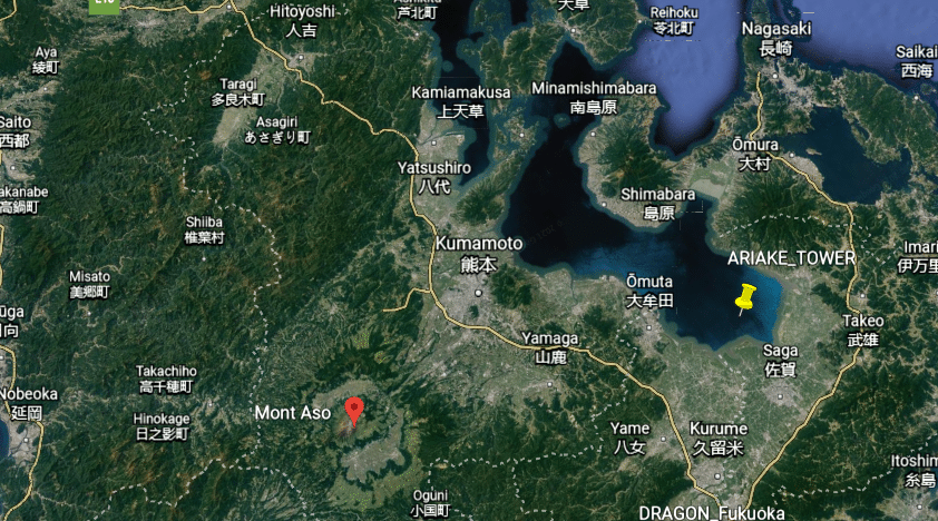
Figure 1: Google Earth satellite image showing the position of the NASA AERONET Ariake Tower site in relation to the Mount Aso volcano in Kyushu Island (Japan).
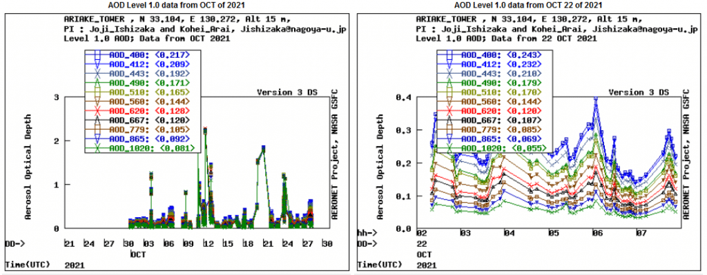
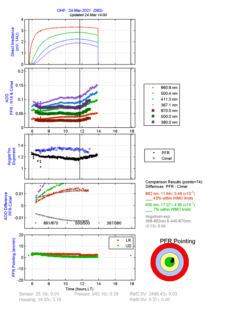
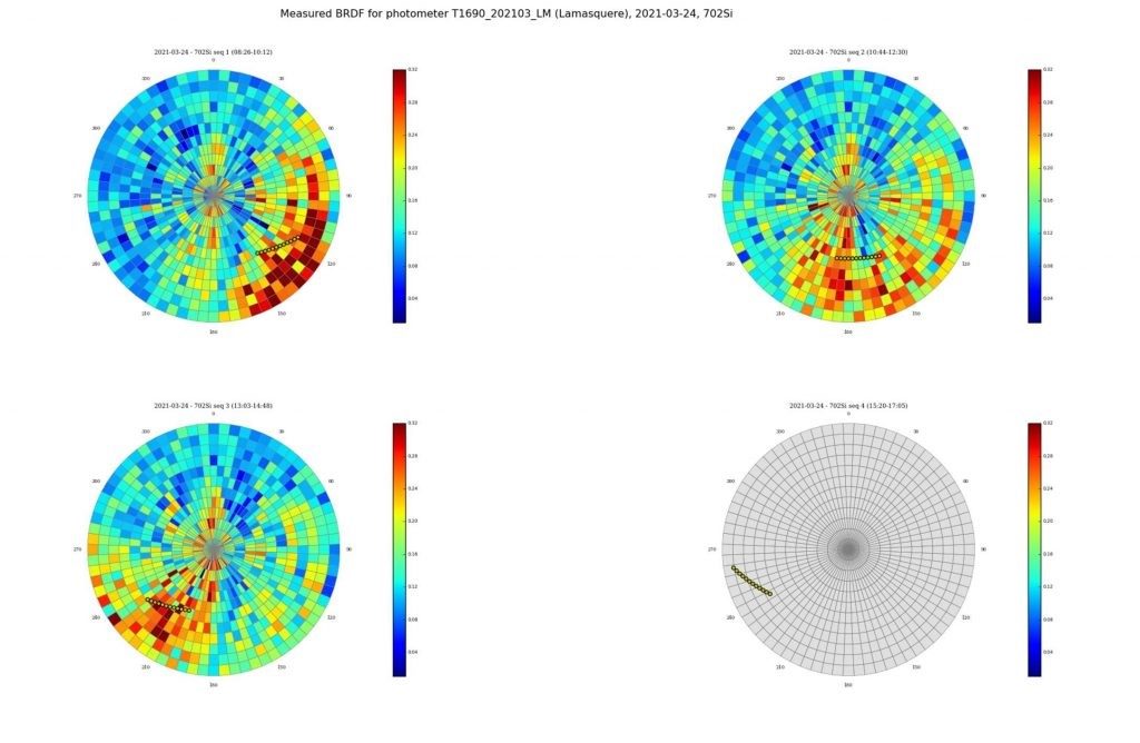
Figure 2: Data provided by the Cimel photometer in the Ariake Tower operated by Saga University, depicting Aerosols Optical Depth in the atmosphere.
We have collected data recorded by the Cimel CE318 photometer which measures the Aerosols Optical Depth (AOD) in the atmosphere. We note a peak of the AOD on October 21, a day after the volcanic eruption.
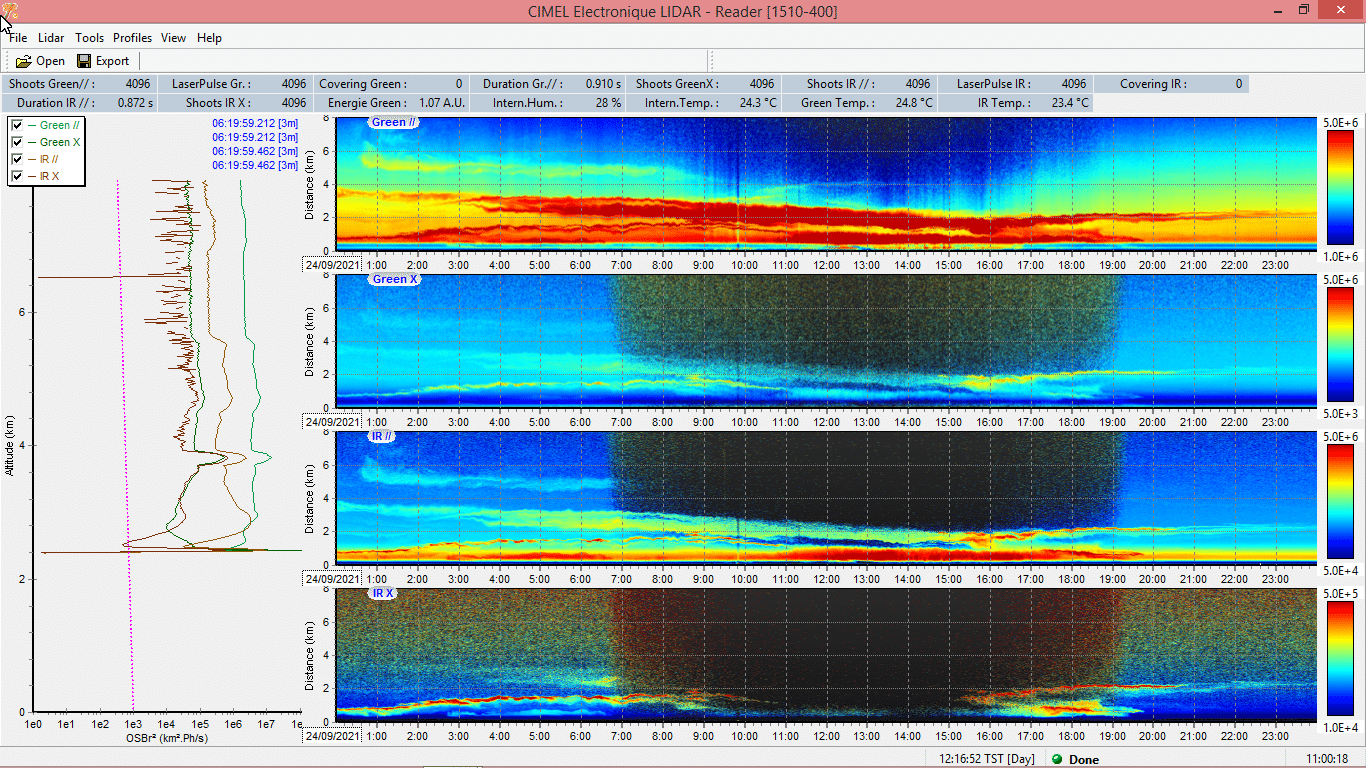
With the addition of Cimel CE376 LiDAR, it would be possible to obtain more high added value parameters such as the characterization, location and the extinction and backscatter profile of mass concentration of this kind of ash aerosols in the atmosphere.
See more on our AAMS solution which consists in the synergy between our LiDARs and our photometers.