CE376 LiDAR at Izaña (AEMET)

The CE376 LiDAR at Izaña (AEMET)

High above the clouds in the Canary Islands, scientists at the Izaña Observatory (AEMET) are using the CE376 LiDAR to explore the vertical structure of the atmosphere with unprecedented detail. This advanced instrument allows the aerosol science team to monitor aerosols moving across the Atlantic Ocean, providing critical insights into climate, air quality, and weather processes.

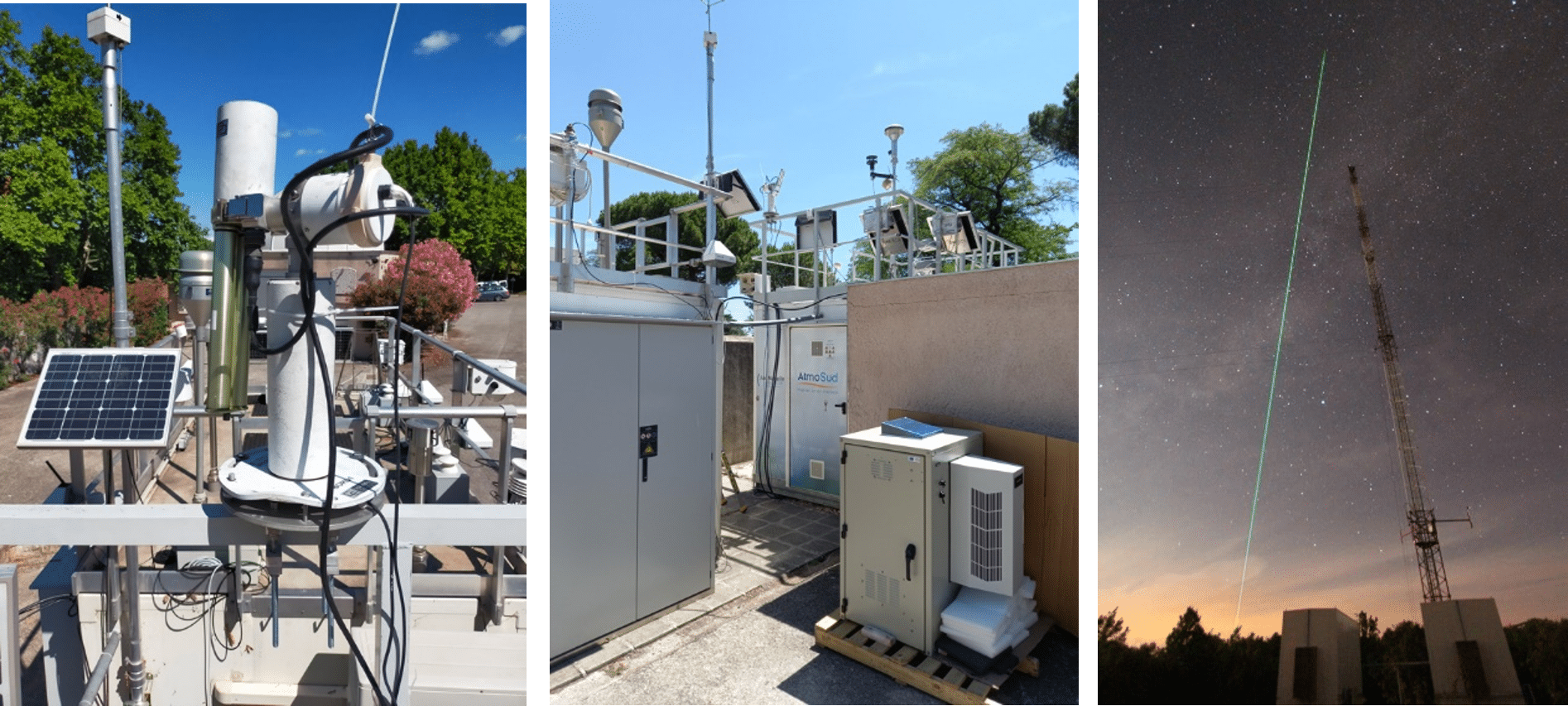
The CE376 is a compact dual-wavelength depolarization elastic lidar (532 and 808 nm). Its continuous monitoring capability makes it particularly valuable for atmospheric research. By analyzing data from both channels, the instrument provides detailed information on aerosol properties, allowing our team to capture the vertical distribution and dynamics of aerosols with unmatched precision.

Every day, the CE376 monitors Saharan dust events as they sweep across the Atlantic, revealing how mineral particles interact with clouds and affect radiation. Over time, it has also recorded comprehensive data on various aerosol types, including volcanic sulfate aerosols from the Cumbre Vieja eruption in September 2021, the devastating wildfire event on the island in August 2023, as well as long-range transported, aged wildfire plumes originating from Canadian wildfires during the late spring seasons. These observations have highlighted clear differences in particle size, shape, and optical properties, demonstrating the CE376’s suitability for continuous monitoring and characterization of both the temporal and vertical evolution of atmospheric aerosols.

Fig 1. MODIS VIS channel satellite image showing the Saharan dust over the Canary Islands on 20 August 2020.

Looking ahead, our team is continuously advancing the integration of CE376 lidar data together with sun photometer and in-situ measurements, while appliying sophisticated retrieval techniques such as GRASP (Generalized Retrieval of Aerosol and Surface Properties). This ongoing collaborative synergy is contributing to a more comprehensive understanding of aerosol optical properties and their effects on radiative forcing and regional climate.

More than just an instrument, the CE376 serves as a window into the atmosphere, revealing processes invisible to the naked eye but essential for science, society, and our understanding of a changing climate.

Fig 2. Saharan Air layer reaching the Izaña Observatory (AEMET). Courtesy of Conchy Bayo (AEMET)
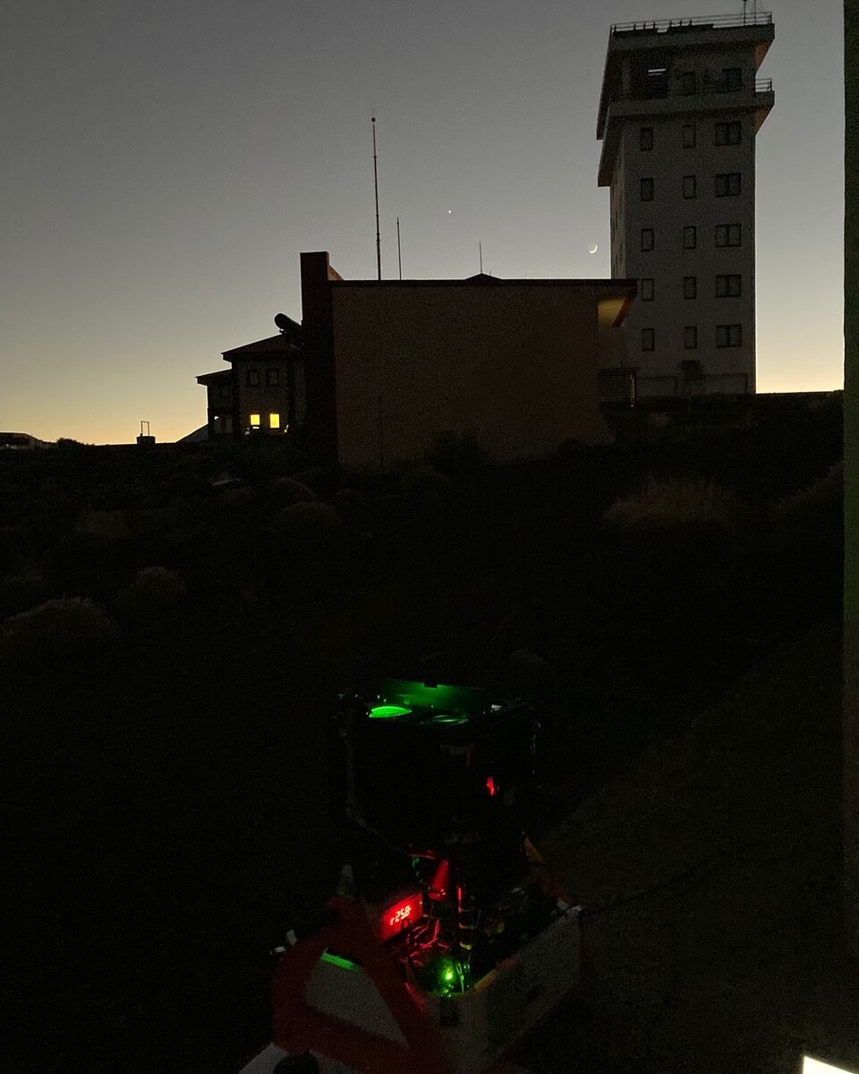
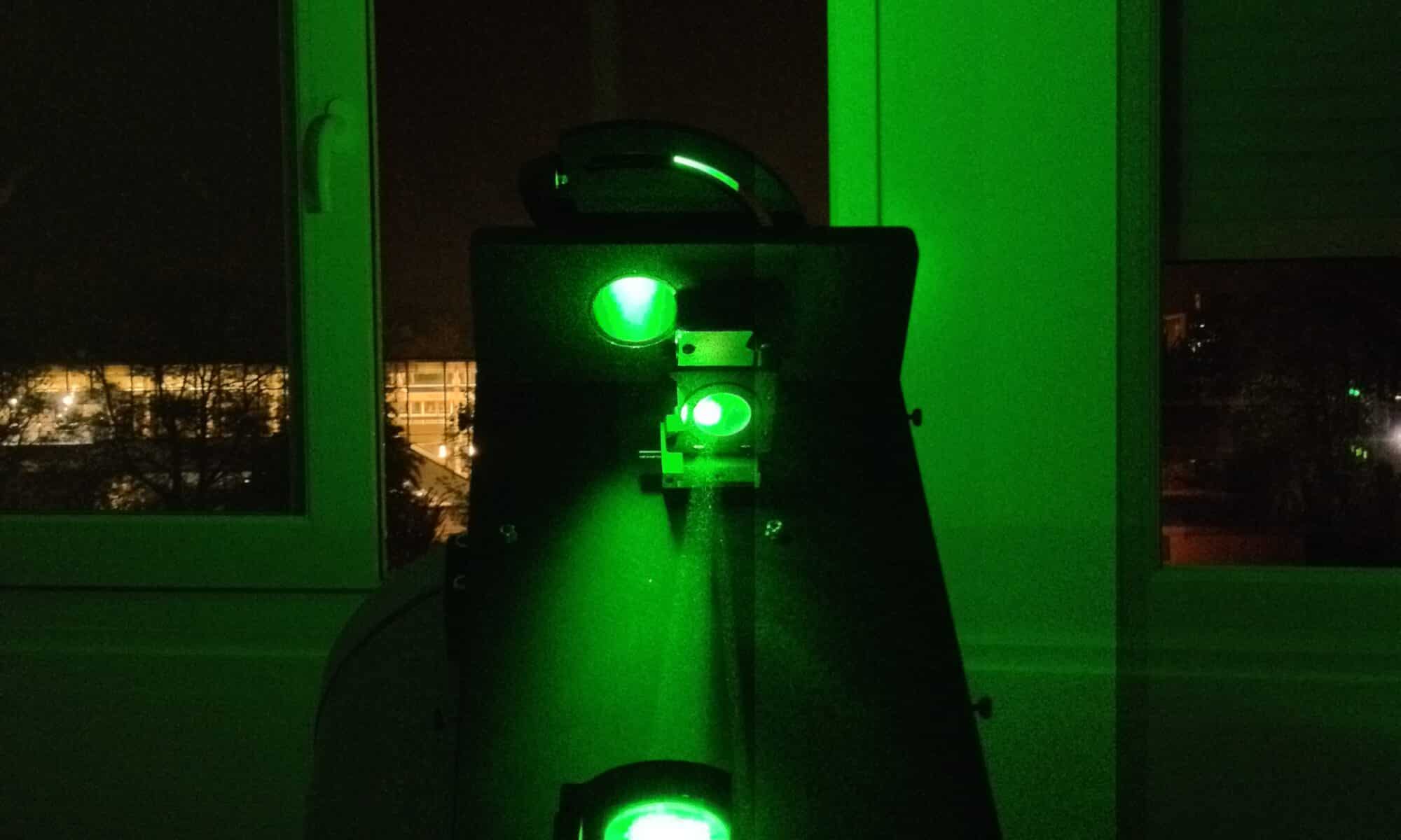
Fig3. CE376 Lidar at Izaña Observatory (AEMET)

NOAA-NASA MD campaign

NASA and NOAA pioneered a shipborne photometer campaign across the Atlantic

In 2023, NASA and NOAA launched a groundbreaking Atlantic campaign, placing an automated, AERONET-compatible sun photometer aboard a research vessel for the first time. The goal was simple but ambitious: collect high-quality aerosol optical depth (AOD) data over ocean regions, long neglected by traditional land-based monitoring networks. By measuring directly from the sea, scientists could fill a critical observational gap and strengthen satellite validation where fixed stations are sparse.

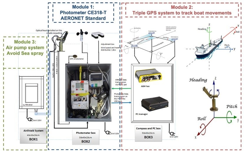
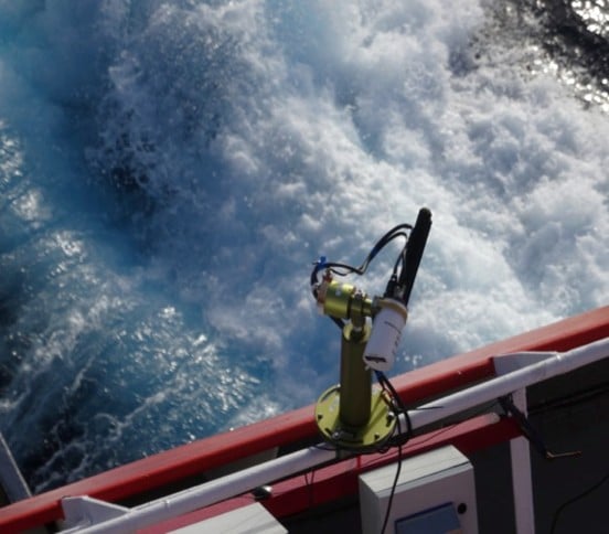
The instrument, a CIMEL CE318‑T, was specially adapted for shipborne deployment. Engineers stabilized it against vessel motion, added protective enclosures to withstand sea spray, and updated the firmware to maintain accurate sun-tracking and sky radiance measurements. Calibrations were aligned with AERONET protocols, ensuring the data matched the rigorous standards of land-based sites.

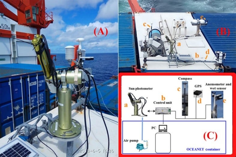
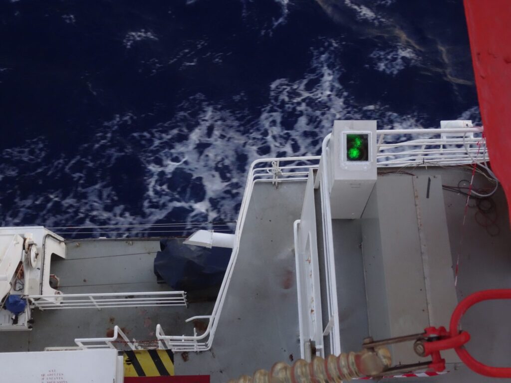
Adapted CIMEL CE 318‑T photometer installed on the vessel, stabilized against motion and protected from spray

Voyage across the Atlantic

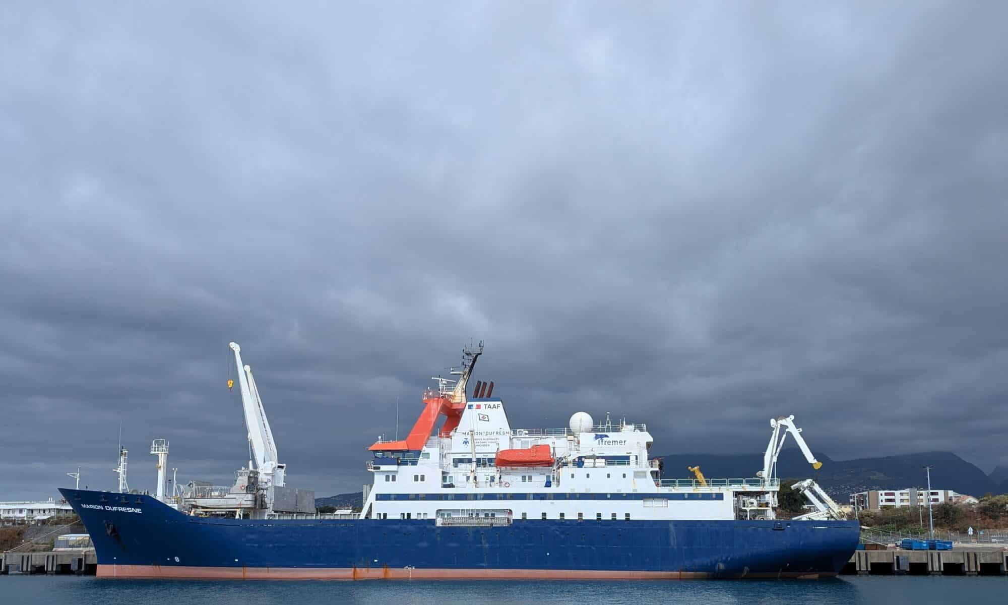
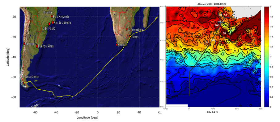
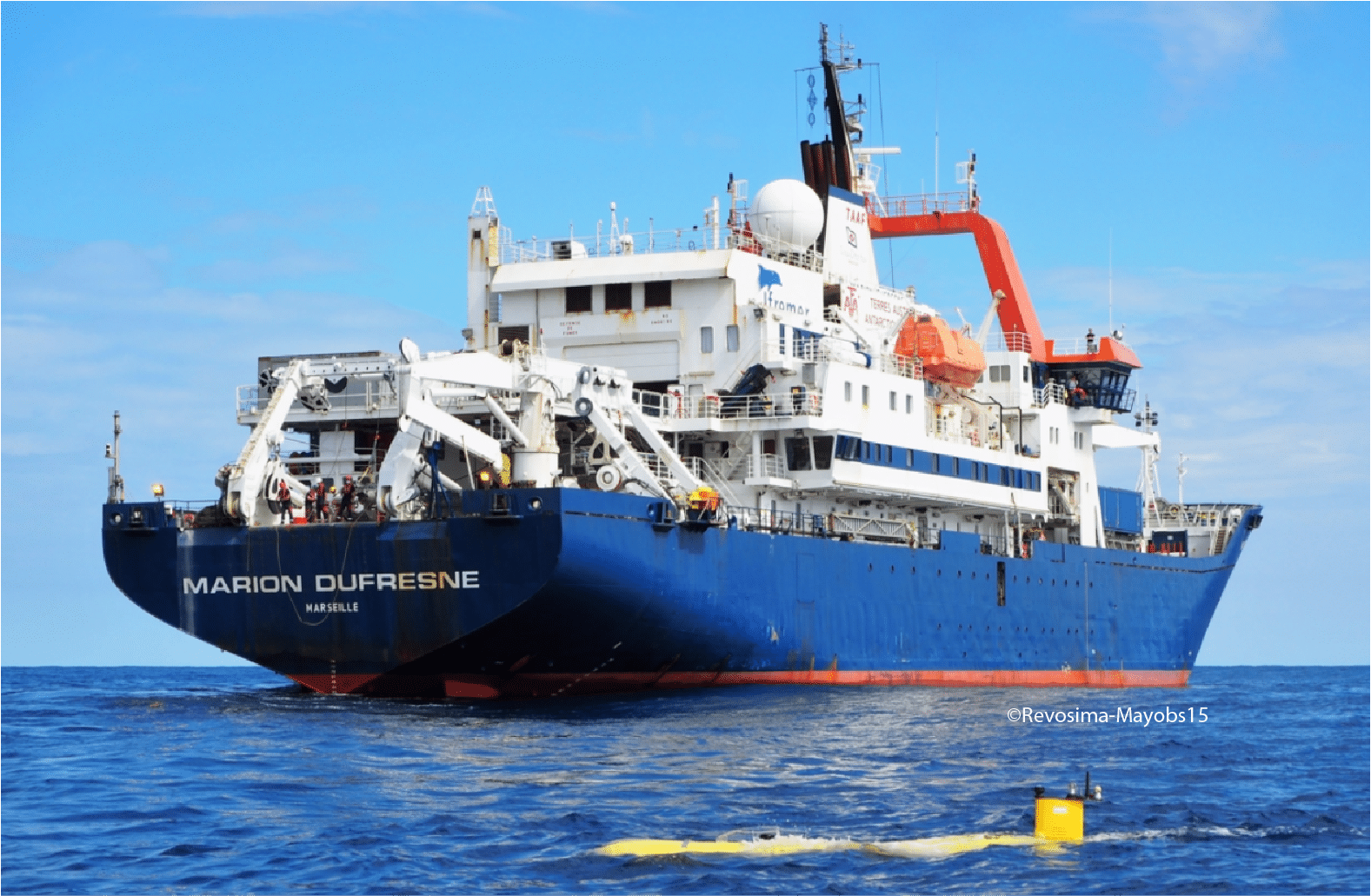
Aboard the RV Marion Dufresne, the photometer captured aerosol characteristics along a route stretching from the tropical Atlantic, across the Intertropical Convergence Zone (ITCZ), and into the mid-latitudes. The ship crossed the ITCZ three times, recording interactions between Saharan dust, marine aerosols, and cloud systems. Over the three-year period, the dataset revealed patterns of episodic dust transport, background sea-spray, and long-range aerosol variability.

The campaign was conducted in close collaboration with the LOA through the AGORA-Lab, which ensured data quality control, calibration traceability, and scientific analysis in coordination with NASA’s AERONET team.

RV Marion Dufresne cruise track across the Atlantic, showing key aerosol sampling regions.

Key insights include:

  • Shipborne AOD retrievals were on par with established AERONET sites, confirming data quality.
  • The measurements provide essential reference points for satellite sensors like PACE and support improved aerosol transport modeling.

Bridging the gap in ocean observations

Oceanic aerosol measurements are scarce but essential for accurate climate modeling and satellite validation. By deploying high-precision, automated photometers on ships, NASA and NOAA created a bridge between sparse ground stations and satellite footprints. This approach allows for continuous monitoring, capturing both episodic events like dust storms and consistent background conditions.

The campaign also sets a template for future maritime aerosol monitoring. Plans include deploying similar instruments on additional vessels, extending geographic coverage, and integrating vertical profiling systems or unmanned aerial platforms. Data are archived in standardized formats and made publicly available, ensuring the scientific community can leverage the measurements for satellite match-ups, climate model validation, and process studies.

By venturing directly into the Atlantic, NASA and NOAA have opened a new chapter in aerosol observation. This initiative not only fills a critical gap in global monitoring but also enhances our understanding of aerosol-cloud-climate interactions in remote ocean regions.

References

  1. Torres, B. et al. 2025. Adaptation of the CIMEL‑318T to shipborne use: 3 years of automated AERONET-compatible aerosol measurements on board the research vessel Marion Dufresne. Atmos. Meas. Tech., 18, 4809‑4838. DOI:10.5194/amt‑18‑4809‑2025.
  2. Torres, B. 2024. Three years of aerosol measurements using an automated photometer on the first long-term AERONET ship site. LOA/Apolo Univ. Lille.
  3. AERONET / Maritime Aerosol Network (MAN) website.
  4. PACE Technical Report Series Vol 11. 2023. PACE Science Data Product Validation Plan. NASA.

TRANSAMA campaign

TRANSAMA Campaign: Exploring aerosols across the oceans

In April–May 2023, the French research vessel Marion Dufresne II set sail from La Réunion Island toward Barbados on a unique mission: the TRANSAMA campaign (Transit to AMARYLLIS-AMAGAS). As part of the MAP-IO program (Marion Dufresne Atmospheric Program–Indian Ocean), this expedition aimed to deepen our understanding of aerosols — tiny particles suspended in the atmosphere – and their behavior over the open ocean.

Aerosols, whether transported from distant continents or generated locally, play a critical role in cloud formation, sunlight reflection, and climate dynamics. Yet, their behavior over the oceans remains poorly documented due to the logistical challenges of conducting continuous measurements at sea. TRANSAMA was designed to fill this gap by deploying state-of-the-art instrumentation capable of capturing both column-integrated and vertically resolved aerosol data in a fully autonomous, shipborne environment.

To meet this challenge, CIMEL collaborated closely with the Laboratoire d’Optique Atmosphérique (LOA) through their joint research structure, AGORA-Lab, which coordinated and supported all the instrumental installations aboard the ship.

Two CIMEL instruments formed the backbone of this observational campaign. The CE318-T Sun/Sky-Lunar photometer, set up permanently on board the ship since 2021, continuously recorded aerosol optical depth and particle size distribution during daylight hours, while the micro-LiDAR scanned the vertical structure of the atmosphere, revealing the layering of aerosols and their interactions with clouds.

Installed on the deck and carefully adapted for marine conditions, these instruments worked in harmony, providing a detailed picture of the atmosphere above the Atlantic.

Spatio-temporal variability of aerosol properties during the TRANSAMA campaign (21 April–15 May 2023) aboard the RV Marion Dufresne II. Measurements were conducted along the route from La Réunion Island to Barbados. (a) 3D variation of NRB at 532 nm from lidar measurements overlaid on a true-color image of the covered regions. (b) AOD at 440 nm and (c) EAE at 440/870 nm derived from photometer observations, displayed on topographic maps. Photometer data include L1 and L1.5 solar and lunar observations. Red345 pins mark the ports at Le Port (La Réunion), Recife (Brazil), and Bridgetown (Barbados).
Each observation contributed to a growing dataset that bridges the gap between local measurements and global atmospheric models.

Following the success of the 2023 campaign, the set up of a new CE376 lidar aboard Marion Dufresne in the framework of the OBS4CLIM project is scheduled for late October 2025. Once the lidar will be set up on board the vessel, it will record regular mobile measurements during the ship’s rotations from La Réunion island to the French Southern and Antarctic Lands (TAAF). These next voyages will further extend the temporal coverage of aerosol observations and help scientists understand the seasonal variations and long-range transport processes over the Indian and Atlantic Oceans.

Key publications

NASA-ARSET

NASA-ARSET reveals how AERONET contributes to air quality and climate applications

Ground-based networks such as AERONET play a crucial role in atmospheric science and air quality monitoring. During its latest NASA ARSET training titled “Atmospheric Composition Ground Networks Supporting Air Quality,” AERONET was showcased as a global benchmark in providing high-quality aerosol optical data for researchers, air quality managers, and decision-makers.

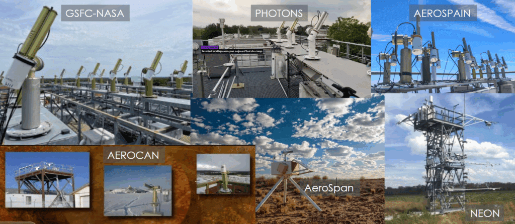
CIMEL CE318-T photometer enables fully autonomous, standardized, and long-term aerosol monitoring across diverse environments—from megacities to deserts and polar regions. With over 600 stations in 80+ countries, AERONET has become a global reference in satellite validation and atmospheric composition studies.

The ARSET training session reveals:

  • How ground-based observations complement satellite missions
  • The role of AERONET in policy-relevant applications
  • The importance of consistent, open-access data

You can access the training here: NASA ARSET Program

Key benefits of joining NASA-AERONET:

  1. Global data integration: As part of AERONET, CE318-T data integrates into a global network, allowing users to compare and access high-quality, standardized aerosol data worldwide, enhancing research with broader data context.
  2. Real-time data accessibility: AERONET provides near real-time data processing and availability on its online platform, allowing end-users to access and analyze current aerosol measurements efficiently.
  3. High-quality data: CE318-T photometers within AERONET are regularly calibrated at NASA’s calibration facilities, ensuring consistent, reliable, and high-quality data that meet strict scientific standards.
  4. Comprehensive aerosol data products: AERONET processes raw CE318-T measurements to deliver aerosol properties like aerosol optical depth (AOD), particle size distribution, and water vapor content, providing users with valuable insights without needing to process the raw data manually.
  5. Research collaboration opportunities: By participating in AERONET, end-users gain access to a collaborative network of scientists and research institutions globally, fostering opportunities for joint research projects and data sharing.
  6. Data validation for satellite missions: AERONET data is widely used to validate satellite aerosol measurements, allowing end-users to contribute to and benefit from satellite-derived aerosol research and applications in atmospheric studies.
  7. Recognition and credibility: Being part of AERONET enhances the credibility of the data collected, as the network is globally recognized in atmospheric sciences, potentially increasing the impact and visibility of users’ research.
Network of Networks – Calibration Centers/Sites
AERONET network – Calibration Centers/Sites

New CE710 Raman LiDAR

Pioneering Aerosol Remote Sensing: LOA and CIMEL’s Journey with the CE710 LiDAR for ACTRIS

Keywords: LiDAR, Aerosols, monitoring, remote sensing, ACTRIS, Raman.

The Laboratoire d’Optique Atmosphérique (LOA) at the University of Lille, in collaboration with CIMEL, focuses on studying clouds, aerosols, gases, and their interactions with radiation, utilizing advanced remote sensing instrumentation for experiments, observations, and modeling. LOA brings its expertise to ACTRIS as the Quality Assurance and Control Lead, playing a crucial role in maintaining precise and reliable photometric aerosol measurements.

Since 1991, LOA and CIMEL have collaborated to advance and refine photometry techniques for measuring aerosols and water vapor. This collaboration was at the origin of the NASA AERONET planetary network, built with the CIMEL sun/sky/lunar photometers for over three decades. In 2005, building on this success, they extended their cooperation to include aerosol LiDAR technologies. Finally, in 2020, LOA and CIMEL established a joint research laboratory, AGORA-Lab, to develop advanced remote sensing technologies, including Lidars and photometers, and to combine them for cutting-edge performance.

LiDARs provide high-resolution vertical profiles of aerosols and clouds, while photometers offer column-integrated aerosol optical properties. By combining these measurements, calibration, quality control and retrievals are enhanced, leading to better quantification and characterization of aerosols and higher-level data products.

Since 2012, CIMEL and LOA have collaborated on developing the CE710 LiDAR, a high-power, multi-spectral Mie-Raman-Fluorescence LiDAR, spearheading significant advancements in aerosol measurement capabilities. The first version, called LILAS, was set up on the ATOLL platform (Atmospheric Observatory of Lille) and has been part of ACTRIS since 2015.

LOA and CIMEL continuously advance the industrialization and validation of the CE710 LiDAR range, making it a cost-efficient, modular solution that is ACTRIS-ready, meaning it meets all current and future guidelines. This cutting-edge technology provides innovative features that enhance measurement accuracy, operational efficiency, and adaptability to evolving scientific needs.

  • Multi-wavelength emission: 355, 532 and 1064 nm.
  • Up to 15 detection channels: to profile a wide range of atmospheric parameters, including aerosol backscatter, depolarization, fluorescence, water vapor, trace gases, and temperature.
  • Advanced laser technology: Uses diode or flash-lamp pumped Nd:YAG lasers with energy per pulse up to 200 mJ at 355 nm and repetition rate up to 200 Hz.
  • Depolarization capability: Measures linear depolarization ratios at multiple wavelengths to distinguish between spherical and non-spherical particles.
  • Fluorescence detection: Provides additional vertically resolved information to improve aerosol typing.
  • Customizable configurations: The modular design allows adaptation to initial and evolving research objectives.
  • Robust and transportable design: Facilitates installation, inside or outside with optional thermal enclosure.
  • Data Processing: Includes AUSTRAL software for real-time visualization and interpretation of measurement data.
  • Enhanced data quality: The CE710 meets all the requirements of the stringent ACTRIS Quality Assurance guidelines, that ensure high measurement precision and reliability and are a prerequisite for data certification by ACTRIS.
  • Comprehensive aerosol profiling: The multi-channel design allows detailed characterization of aerosol physical and chemical properties, providing valuable inputs for atmospheric models.
  • Integrated calibration tools: The built-in remote control and calibration functions enable operators to consistently perform standardized quality control operations over time.
  • Advanced analysis capabilities: The AUSTRAL software offers real-time data processing and visualization, enabling quick assessment of atmospheric conditions and facilitating advanced research and collaborative projects.
  • Future-Proof Design: The modular architecture supports future upgrades, allowing the system to adapt to evolving scientific requirements and technological advancements.

GAWPFR WMO reference

New AOD tracking technique by ESA with AERONET and the GAWPFR WMO reference

Keywords : Aerosols, Atmosphere, Sun/Sky/Lunar photometer, Meteorology

The World Meteorological Organization (WMO) has recognised the Word Optical Depth Research and Calibration Center (WORCC) as the primary reference center for Aerosol Optical Depth measurements. The WORCC is a section within the World Radiation Center at the Physikalisch-Meteorologisches Observatorium Davos (PMOD/WRC), located in Davos, Switzerland.

With its new QA4EO project, European Space Agency (ESA) wishes to obtain homogeneous results between the various passive monitoring networks of passive remote sensing of aerosol optical properties, presents in Davos and in France at the Observatoire de Haute Provence (OHP).

Consequently, a precision filter radiometer (PFR) travelling standard was installed at the European calibration site of AERONET to supply continuous traceability of aerosol optical depth measurements to the World reference maintained at Davos through a PFR Triad.

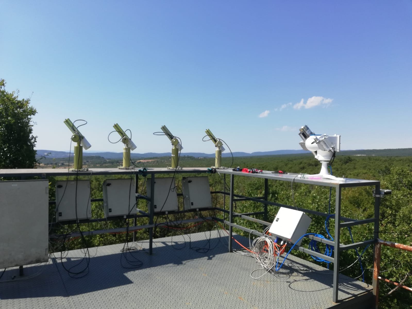
The precision filter radiometer was installed in July 2020 at the Observatoire de Haute Provence (OHP) on a solar tracker provided by the Laboratoire d’Observation Atmosphérique (LOA) next to our 4 sun photometers (CE318-T).

OHP’s platform, with four CIMEL Sun/Sky/Lunar photometers CE318-T and the PFR traveling (at the right of the picture).

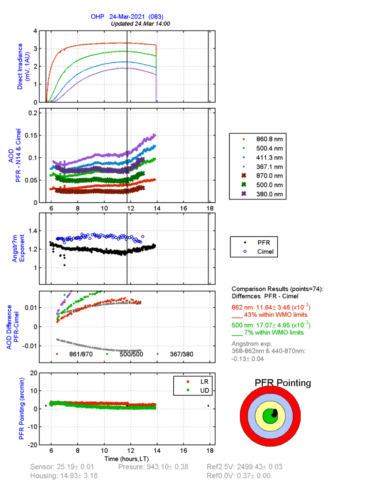
The measurements of spectral solar irradiance during clear sky periods are used to retrieve AOD from our photometers with AERONET calibration and the PFR.

You can follow the comparison between these two instruments in real time on this web page. This real-time analysis allows for continuous monitoring and quality control of the measurements provided by these two devices.

Real-time monitoring of the measurement analysis of the two instruments on 24 March 2021 – Source: https://www.pmodwrc.ch/en/world-radiation-center-2/worcc/gaw-pfr/ohp/

After 6 months of comparison (August 2020 to January 2021) between the two networks, results have been very promising with an Aerosol Optical Depth difference of less than 0.01, corresponding perfectly to the WMO criteria for AOD traceability for 3 of its 4 channels. This shows that the results provided by CIMEL CE318-T photometers are in line with the WMO expectations and that CIMEL photometers may be used as an instrument of reference for other research projects.

Other projects are in parallel with this one such as the 19ENV04 project funded by EURAMET and the European Commission to extend the traceability of international unit systems through the characterization and calibration of our Sun/Sky/Lunar photometers from these networks (See more information here).

This collaboration between research institutes and the European metrology community will establish a consistent framework providing calibrations of our Sun/Sky/Lunar photometers with traceability to the SI as well as comprehensive uncertainty budgets that will be a necessary part of the data provided to the users and actors of these networks.

References:
Kazadzis, S., Kouremeti, N., Nyeki, S., Gröbner, J., and Wehrli, C.: The World Optical Depth Research and Calibration Center (WORCC) quality assurance and quality control of GAW-PFR AOD measurements, Geosci. Instrum. Method. Data Syst., 7, 39-53, https://doi.org/10.5194/gi-7-39-2018, 2018.

MAP-IO campaign

Ship-borne CE318-T photometer aboard the Marion Dufresne in the frame of the MAP-IO.

January 11th – March 8th2021

Since the beginning of January 2021, one of our CE318-T photometers is permanently embarked on the Marion Dufresne as part of the MAP-IO (Marion Dufresne Atmospheric Program – Indian Ocean) research programme.

The objective of a permanent installation of our photometer on the Marion Dufresne is to allow the measurement of atmospheric aerosols from mobile platforms, and to extend and automate the coverage of the AERONET network.

CE318-T CIMEL photometer aboard the Marion Dufresne (Credits : LACY/University of la Réunion)

In future campaigns, our photometer will be used mainly in the Southern Hemisphere and the Indian Ocean to measure the aerosol optical depth (AOD). The new campaign that has just started is the result of preparatory campaigns like OCEANET and SEA2CLOUD, during which the system has been tested, improved and validated.

Below, the preliminary results of the campaign obtained thanks to satellite data transmitted to the LOA/CNRS to measure spectral AOD, water vapour content, Ångström exponent, and sky radiance for AERONET.

Map of the first daytime recorded AOD (level 1.5) between 13 and 31 January 2021 (Source: Luc Blarel at LOA/CNRS/U. Lille).

Objectives

  • To monitor long-term atmospheric changes in the Indian and Austral oceans regions which are very poorly documented (IR ACTRIS and ICOS).
  • To calibrate and validation data from satellites.
  • To understand better the ocean-atmosphere exchanges and regional pollution by improving and adapting and adapting the parametizations used in numerical weather and climate predition models over the Indian and the Austral oceans.

If you want to know more about this campaign click here !

Key words: Aerosols, Atmosphere, sun/sky/lunar photometer, Meteorology

ROSAS – CESBIO

CESBIO_ROSAS

ROSAS – A new BRDF photometer installed in Lamasquère by CESBIO

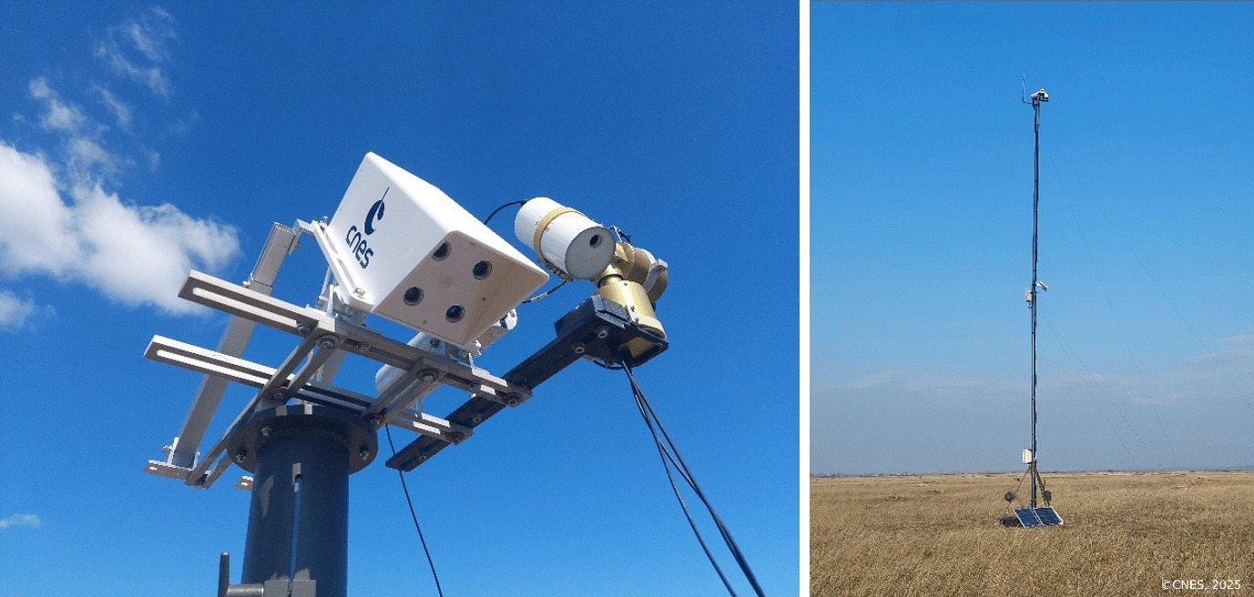
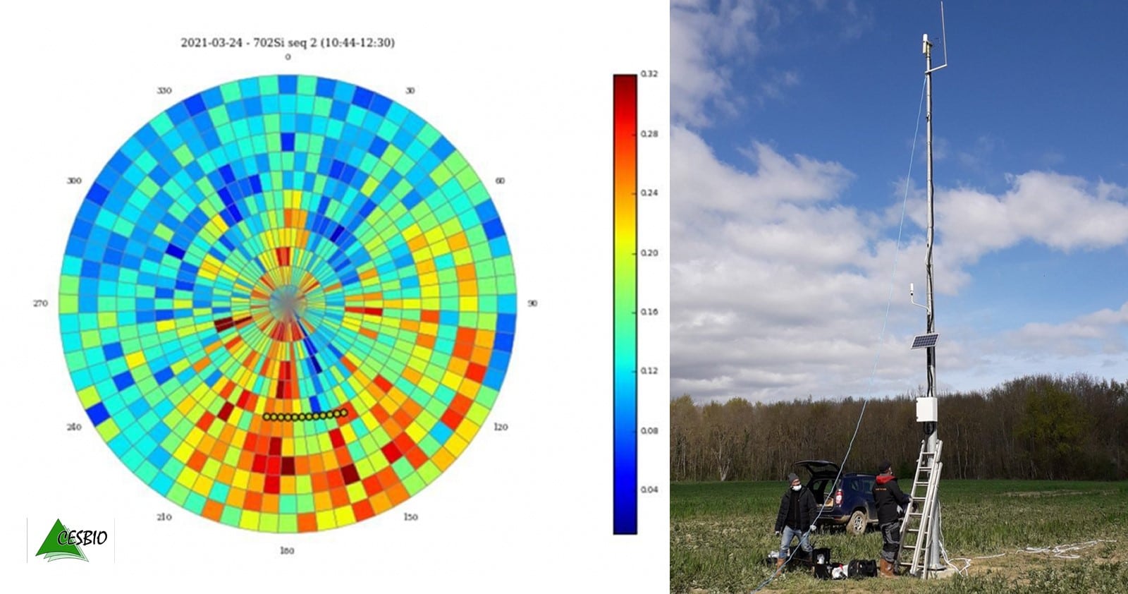
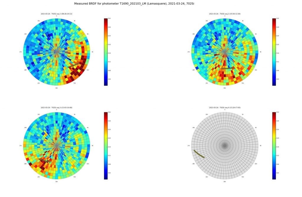
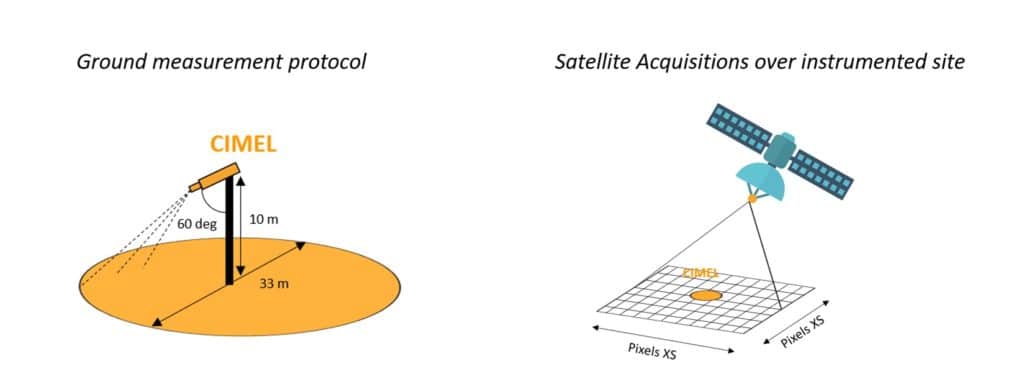
The Lamasquère site (France) is now equipped with a CIMEL 12 filters photometer (CE318-TU12) which measures direct and diffuse irradiation, and the directional reflectance of the surface (BRDF).

This system, installed in March 2021, is called RObotic Station for Atmosphere and Surface (ROSAS) and operates mounted on top of a 10 m high mast in a field on the agricultural area of Lamothe farm in Lamasquère (France). The CESBIO ROSAS station is thus the 3rd site of this type worldwide after the CNES station in La Crau (France) and the CNES/ESA station in Gobabeb (Namibia), and the first to characterize an agricultural vegetated surface, with seasonal and inter-annual variations of the cover.

The spatial and temporal heterogeneity of the surface of this new site makes it more suitable for the validation of surface reflectance (after atmospheric correction), than for the absolute calibration of satellite sensors, as it is the case for La Crau and Gobabeb. When the Lamasquère field crops become very green and dense, the surfaces are dark and the atmospheric correction errors have a strong impact on the reflectance estimates, and when the crops are mature or the plot is bare ground, the adjacency effects due to the nearby forest become strong. Such in situ measurements are thus of primary interest to CESBIO, CNES and the broader scientific community.

The data are automatically transmitted to CESBIO and CNES every hour via the mobile phone network (GPRS), and processed periodically to derive the filtered bi-directional reflectance distribution function (BRDF).

Here below, you can find the first BRDF measurements acquired a few days after the validation of the station:

Polar diagrams of surface reflectances measured by the ROSAS station in Lamasquère. The 0° azimut corresponds to observations towards the South. The top left image was taken in the morning, the top right around noon, bottom left in the afternoon, and bottom right later on after the arrival of clouds. The yellow dots indicate the position of the sun . The radius of the graph corresponds to the zenith angle, and the other dimension is the azimuth with regard to the North.

Keywords: CIMEL, photometer, ROSAS, CNES, AERONET, CESBIO, BRDF

More information on : https://lnkd.in/dhh7KXN

The plume of the Icelandic volcano Bardarbunga pollutes the air in the Nord – Pas de Calais

The plume of the Icelandic volcano Bardarbunga pollutes the air in the Nord – Pas de Calais

At the end of September 2014, the Nord – Pas de Calais region suffered an episode of heavy air pollution due to the eruption of the Icelandic volcano Bardarbunga, which has already been going on for more than a month.

The analysis of observations of the volcanic plume, obtained from the ground, thanks to CIMEL photometers and LiDAR, and by satellite, by a team of researchers, engineers and technicians from the Laboratoire d’optique atmosphérique (LOA, CNRS / Université Lille 1) in collaboration with the association for monitoring air quality atmo Nord – Pas de Calais, allowed them to describe the journey, from Iceland, of the volcanic plume and its arrival in the lowest layers of the French atmosphere.

BSC Dust Daily Forecast – AAMS platform

CIMEL AAMS SENEGAL

BSC Dust Daily Forecast – AAMS platform

Aerosol particles are important and highly variable components of the terrestrial atmosphere, and they affect both air quality and climate. In order to evaluate their multiple impacts, the most important requirement is to precisely measure their characteristics.

Remote sensing technologies such as lidar (light detection and ranging) and sun/sky photometers are powerful tools for determining aerosol optical and microphysical properties. In our work, we applied several methods to joint or separate lidar and sun/sky-photometer data to retrieve aerosol properties. The Raman technique and inversion with regularization use only lidar data. The LIRIC (LIdar-Radiometer Inversion Code) and recently developed GARRLiC (Generalized Aerosol Retrieval from Radiometer and Lidar Combined data) inversion methods use joint lidar and sun/sky-photometer data.

Link to the article: click here