Stratéole-2 Becool: micro-LiDARs span the globe aboard hot-air balloons up to 22km high in the stratosphere.
Keywords: Aerosols, LiDARs, monitoring, Earth observation, remote sensing, stratosphere, troposphere.
October 16th 2023
On the night of Wednesday, August 22, 2018, the CIMEL’s micro-LiDAR flew for the first time in a stratospheric balloon for the validation of the project, from Timmins Air Force Base, in Ontario (Canada).
Stratéole-2 is a program of observation of the dynamics of the atmosphere in the intertropical zone developed in partnership between CNRS and CNES. The LATMOS (Atmosphere, environment and space observations laboratory) through its joint laboratory with CIMEL: CIEL), the LMD (Dynamic Meteorology Laboratory), and the CSA (Canadian Spatial Agency) are also collaborating on this project.
This Stratéole-2 project called BECOOL (BalloonbornE Cirrus and convective overshOOt Lidar) mainly consists in placing CIMEL’s micro-LiDARs in stratospheric hot-air balloons and flying them around the world. The onboard aerosols micro-LiDARs emit lasers downwards, contrary to the initial use (the shots are normally done from the ground towards the atmosphere).
The project Stratéole-2 represents several challenges as CIMEL had to develop, in collaboration with the LATMOS a micro-LiDAR prototype that must correspond to the following standards:
- Weighting less than 7 kg
- Consuming less than 10 W
- Resisting harsh temperature conditions
Indeed, CIMEL’s LiDARs are well known for their robustness and energetic Self-reliance which allows low maintenance: practical when the LiDARs are up to 20km in the stratosphere!
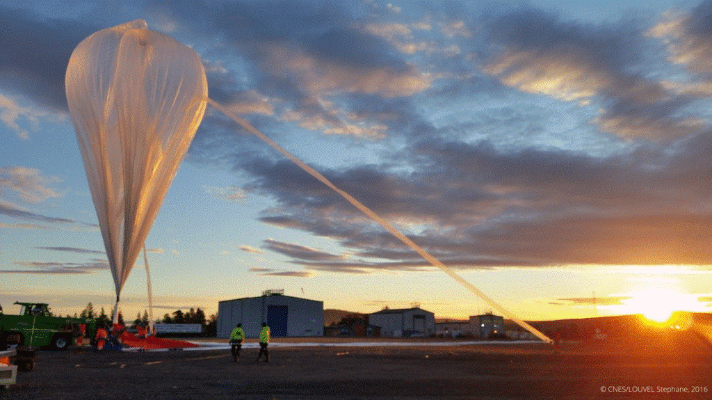
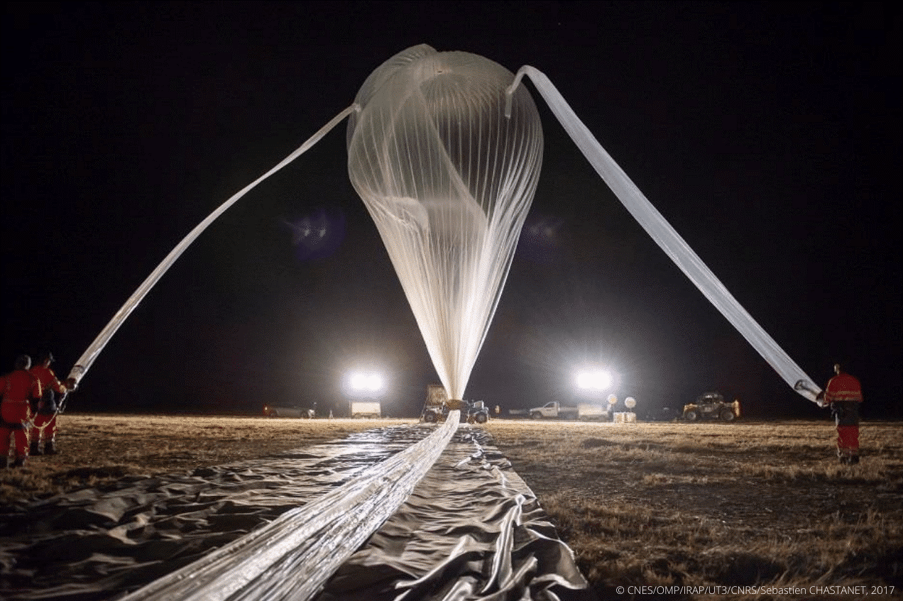
Figure 1: Preparation of a stratospheric balloon before the takeoff
The program uses stratospheric pressurized balloons filled with helium 11 to 13 meters in diameter. During 3 to 4 months, they are carried by the winds all around the tropical belt and are propelled up to 20 kilometers in the atmosphere. Some can travel across 80,000 kilometers around the world (Figure 2).
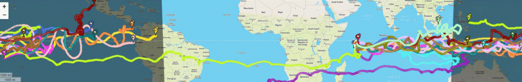
Figure 2: Stratéole-2 Long-duration balloon flights across the tropics to study atmospheric dynamics and composition / https://webstr2.ipsl.polytechnique.fr/#/
The project includes a total of three measurement campaigns realized between 2018 and 2025. Contrary to the previous one which served as a validation (and in which 2 micro-LiDARs were released), the second campaign was for scientific purposes. It started in mid-October 2021 and ended in April 2022, 3 micro-LiDAR balloons were released into the atmosphere from the Seychelles (Mahé). They collected valuable information which will then be analyzed for the study of atmospheric phenomena and their role in the climate. The third campaign is planned for 2025, with a further 4 micro-LiDAR balloons that will be released.
The objectives are to try to clarify some of the grey areas that hinder our detailed understanding of the atmosphere and its role in the Earth’s climate. BECOOL allows scientists to study atmospheric dynamics and composition such as convection or the dynamic coupling between the troposphere and the stratosphere. Exchanges and air movements between these two atmospheric layers are important and influence the whole planet.
However, the tropical region is difficult to access. Consequently, the classical methods of observation (by satellites, by plane, …) are not enough. This is why using balloons is strategic: they are the only ones able to observe these phenomena in real time and very closely to the atmosphere.
“It is a completely original mode of sampling, which is not obtained otherwise and allows results of unequaled finesse” (A. Hertzog).
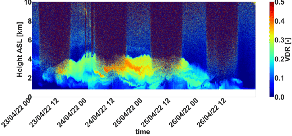
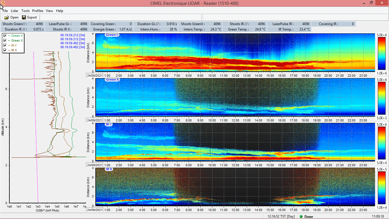
Below is a quicklook from a Stratéole-2 micro-LiDAR taken from a balloon.
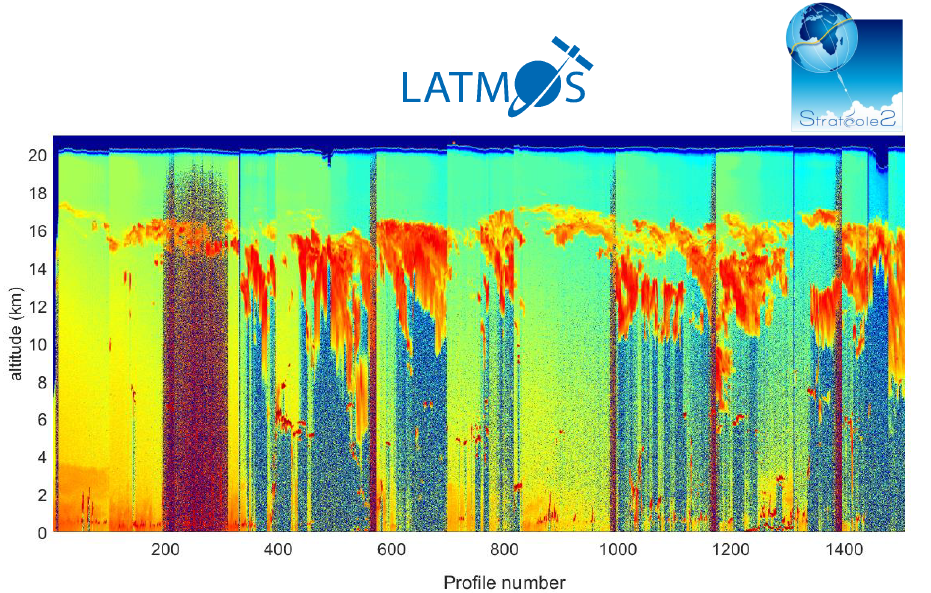
Figure 3: Quicklook LATMOS-Stratéole 2018
Bibliography:
E. J. Jensen et al, Bull. AMS, 129-143 (2017), M. McGill et al., Appl. Opt., (41) 3725-3734 (2002), J. S. Haase et al., Geophys. Res.L., 39, (2012), P. Zhu et al., Geos. Inst. Meth. and Data Systems, 89-98, (2015) J.-E. Kim et al, Geophys. Res. L. (43), 5895-5901 (2016), S. Davis et al., J.Geophys Res, 115 (2010) S. Solomon et al., Science (327), 1219-1223 (2010) V. Mariage et al., Optics Express 25 (4), A73-A84 (2017) ,G. Di Donfrancesco et al., Appl. Opt. (45) 5701-5708 (2006) https://doi.org/10.1051/epjconf/202023707003
François Ravetta, Vincent Mariage, Emmanuel Brousse, Eric d’Almeida, Frédéric Ferreira, et al. BeCOOL: A Balloon-Borne Microlidar System Designed for Cirrus and Convective Overshoot Monitoring. EPJ Web of Conferences, EDP Sciences, 2020, The 29th International Laser Radar Conference (ILRC 29), 237, 07003 (2p.). ff10.1051/epjconf/202023707003ff. ffinsu-02896973f
https://presse.cnes.fr/sites/default/files/drupal/202110/default/cp099-2021_-_strateole-2.pdf
https://videotheque.cnes.fr/index.php?urlaction=doc&id_doc=37302&rang=1&id_panier=#


.jpg)