Presidential mission in Brazil

Presidential mission in brazil (25-28 march 2024)

French President Emmanuel Macron Leads CIMEL and Various French Companies in Brazil for Economic Diplomacy and Green Transition Innovation

Keywords: Aerosols, monitoring, remote sensing, green transition, innovation.

Once again CIMEL had the honor to be part of the French delegation accompanying the French president Emmanuel MACRON this time in Brazil in São Paulo from 25th to 28th March 2024.

Organized by MEDEF International and Business France, this delegation of over 80 French companies was embarking on a journey to Brazil, aimed at fostering stronger economic ties between the two countries.

Through a comprehensive agenda created around multiple business possibilities, heavy discussions have been conducted between French companies and other stakeholders. CIMEL, in particular, has actively participated in meetings with significant entities such as the Brazilian Space Agency (INPE), the University of São Paulo, the Institute of Advanced Studies (IPEN), as well as ministers and responsible for finance, cities, energy, and environment.

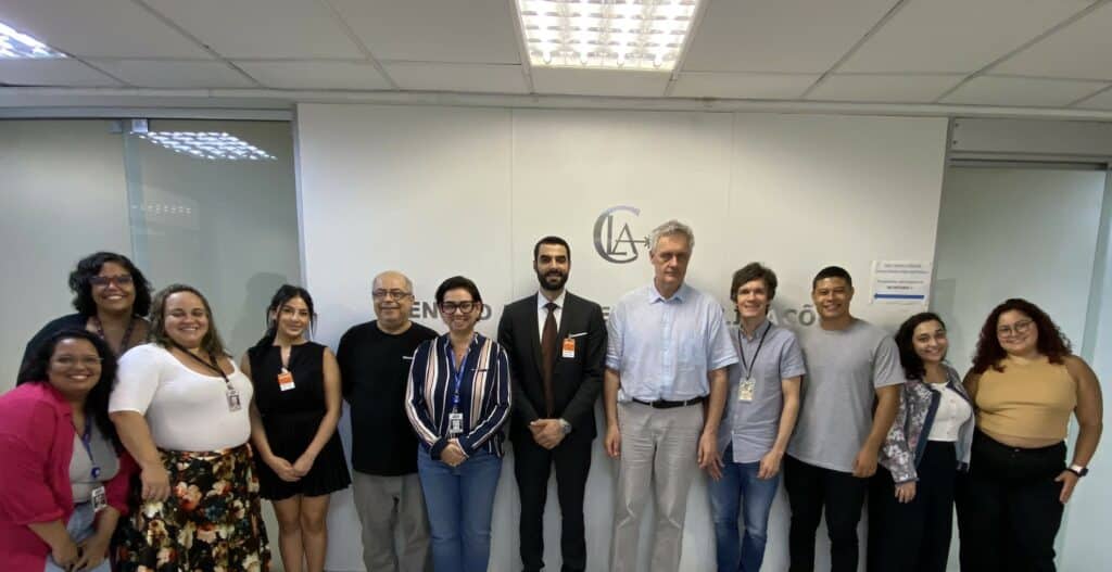
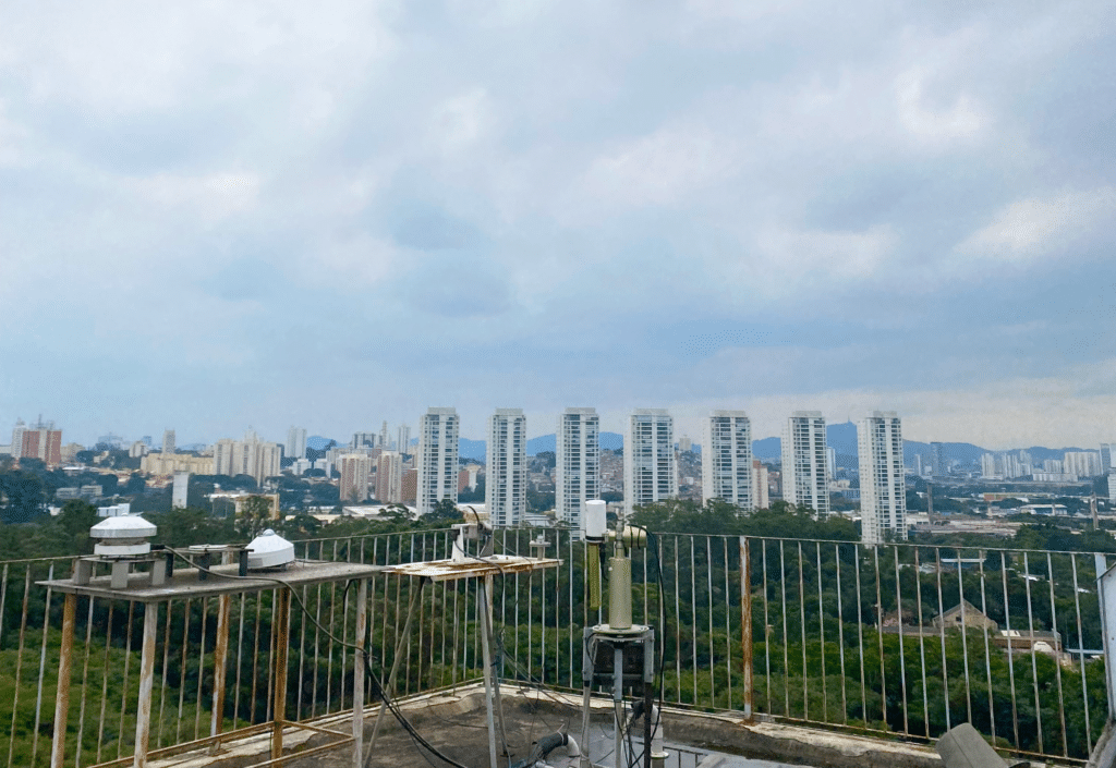
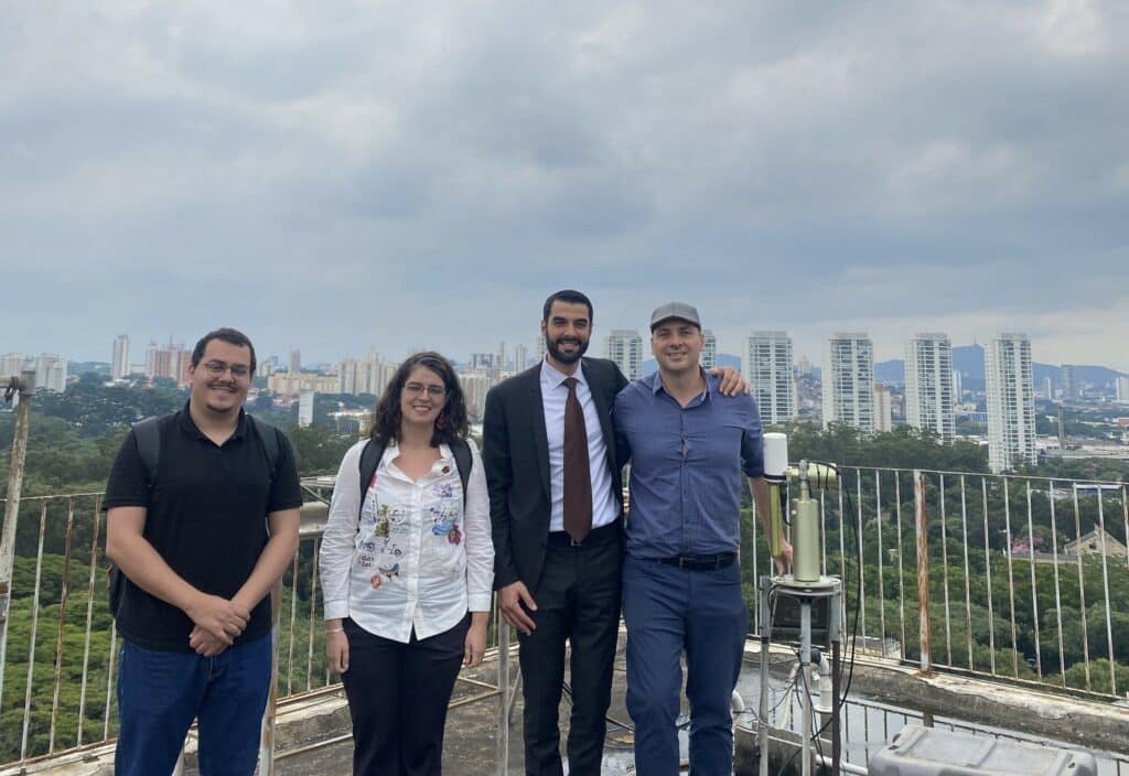
Encounter with the Remote Sensing experts from the University of São Paulo.

It was particularly interesting for CIMEL to meet these scientific entities in sectors such as space research, advanced technology, and energy, as these areas align closely with CIMEL’s expertise and potential for collaboration and innovation.

The most popular event of the visit is the Franco-Brazil Business Forum addressing energy transition, which involves President Macron and Geraldo Alckmin – the Vice-President of Brazil. The Forum discussed the initiatives of how the investments will change color into “green” for both governments and revealed plans for sustainable development.

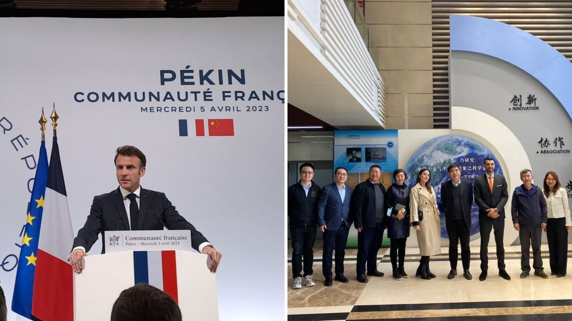
CIMEL meeting the French President during the Business Forum.

The presence of Laurent Saint-Martin, Director General of Business France, brought a decisive vision of the strengths of France with its delegation.

As CIMEL continues to forge ahead in its quest for international expansion, this business trip served as a demonstration of its commitment to innovation, collaboration, and global leadership in the sector of atmospheric and environmental monitoring.

Special thanks to the Business France Team!

Emmanuel Macron Laurent Saint-Martin Michelle Portugal Adriana Braga Nasser Elmamoune Roberta Derquiashian Juliette Petit Berenice Pereira Estrela

SDS 2024 Conference – NEOM City

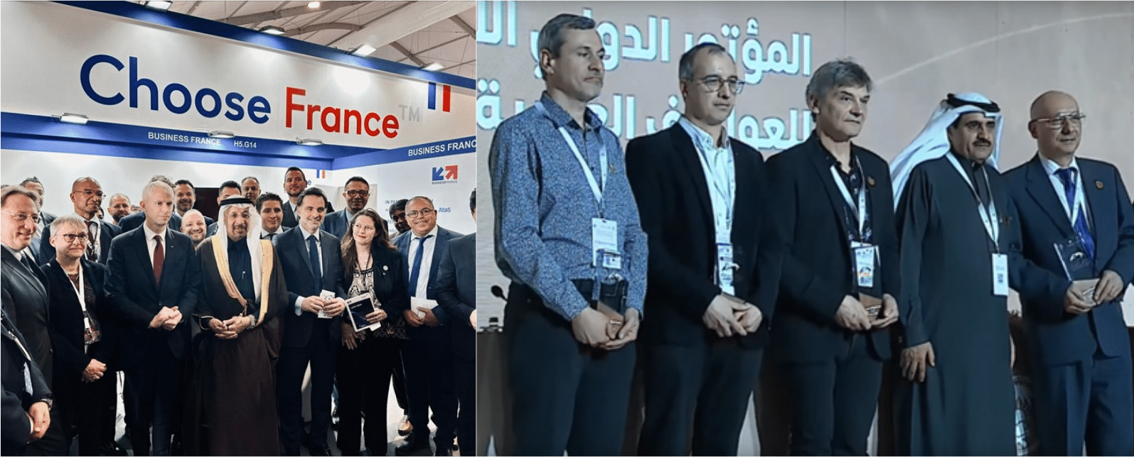
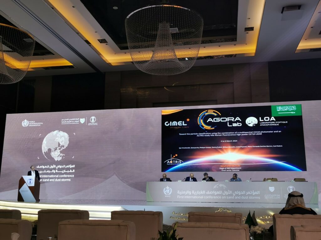
Photos at the First International Conference on Sand and Dust Storms

CIMEL shares its expertise in sand and dust monitoring at the SDS Conference and NEOM City, Riyadh – Saudi Arabia

Keywords: Aerosols, LiDARs, photometers, monitoring, remote sensing, stratosphere, troposphere.

🇫🇷 🇸🇦  | Exciting times for 120 French companies as Business France, led by Franck Riester and in collaboration with the Secretariat General for Investment and the Movement of French International Enterprises, ventures into Saudi Arabia.

Saudi Arabia is undergoing a significant metamorphosis, offering unparalleled opportunities for French companies of all sizes across various sectors. CIMEL is actively contributing to this innovative transformation.

NEOM City, a groundbreaking project, stands as a symbol of Saudi Arabia’s ambition for the future. This futuristic city, focusing on innovation and sustainability, presents immense possibilities for collaboration and investment. CIMEL, recognizing its potential, is actively engaged in discussions and presentations to showcase its expertise in contributing to NEOM’s environmental purposes.

Furthermore, last week marked the beginning of the 1st International Conference on Sand and Dust Storms, hosted by the National Center for Meteorology in #KSA, with CIMEL’s involvement. Follow the three days of lectures at https://youtu.be/rVHzYSVog_U, where CIMEL played a key role in sharing insights and ongoing activities related to #SDS within WMO and the United Nations.

An inspiring week, where CIMEL’s dual commitment to economic transformation and environmental responsibility takes center stage.

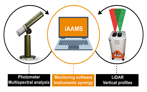
CIMEL was able to explain how our cutting-edge technology enhances aerosols remote sensing capabilities. The synergy between our aerosol photometers and LiDARs, integrated into the iAAMS software, allows for comprehensive data analysis and visualization of aerosols (characterization, location, concentration…). The incorporation of the GRASP algorithm refines aerosol characterization and better concentration profiles, proving invaluable in monitoring sand and dust storms. This technological advancement highlights a collective commitment to economic transformation and environmental responsibility, positioning CIMEL as a key player in a sustainable future.

#CIMEL #GlobalPartnership #RemoteSensing #AerosolMonitoring #Duststorms #EnvironmentalAwareness #NCM #NEOM #SaudiVision2030 #France2030

Presidential mission in Sweden

Emmanuel Macron in sweden stockholm

CIMEL accompanies the French president MACRON during his mission in Sweden.

Keywords: Aerosols, LiDARs, monitoring, remote sensing, stratosphere, troposphere.

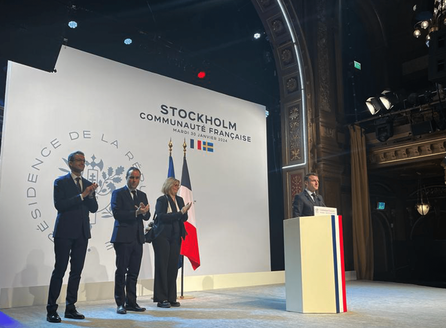
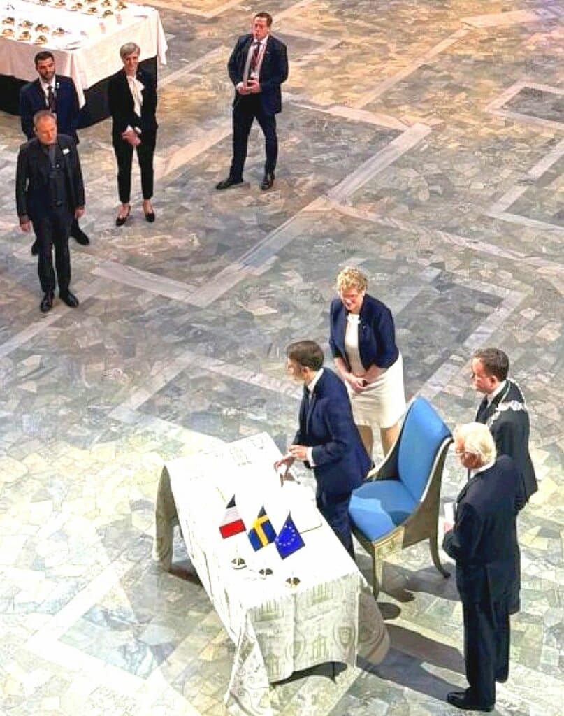
At the invitation of King Carl XVI Gustaf, the French President Emmanuel MACRON, went on a diplomatic state visit in Sweden (Stockholm, Lund and Malmö), organized in collaboration with Business France and Business Sweden from January 29th to 31st 2024.

He was accompanied by his wife, Brigitte Macron, ministers of the French government such as Minister of Research Sylvie RETAILLEAU, along representatives of the French Parliament, public authorities, and cultural organizations.

CIMEL is proud to have been part of the French delegation of 12 companies that joined this mission to strengthen relations between France and the Swedish market.

This mission aims to enhance more collaboration on innovation concerning the space industry and ecological transition, where Cimel is fully involved.

In this aspect, our Sales and Marketing Director, Idris SANHAJ, had the opportunity to present CIMEL’s cutting-edge remote sensing solutions for aerosol monitoring through business meetings with Lund University (Erik SWIETLICKI – Director of ACTRIS SWEDEN), the CEC – Center for Environment and Climate science (Tobias BIERMANN) and Stockholm University (Radovan KREJCI – Head of Atmospheric science unit – ACTRIS member).

Credits: pictures taken by Business Sweden.

Logo Lund University - CEC
Logo Stockholm University
Logo ACTRIS Sweden
Logo CNES
Logo CNRS

CIMEL could demonstrate how our solutions help address challenges related to satellite data validation, air quality and climate change by providing valuable insights and new data. Our objectives are to develop aerosols monitoring networks across Europe, especially through ACTRIS and to bring a strong added value to the air quality application.

A Business Forum organized by Business Sweden took place in Stockholm under the high patronage of King Carl XVI Gustaf. Around 200 Swedish and French business representatives were present for the occasion, with the heads of state and ministers from Sweden and France. Crown Princess Victoria and Prince Daniel graced the delegation with their presence.

It was a pleasure to attend with the presence of some strategic partners and collaborators to discuss current and future projects like CNES (Philippe BAPTISTE), CNRS (Antoine PETIT) and AIRBUS (Guillaume FAURY).

Cimel through our Sales and Marketing Director, Idris SANHAJ was able to talk to the French President Emmanuel MACRON about an innovative project that is set to be implemented soon. This will highlight the national strategic technological innovation combined with the recent scientific progress.

By combining climate modeling, through in-situ sensors, our ground remote sensing and satellite data, we allow more accurate air quality forecasting and so decision-making for public health and environmental management.

To summarize, our participation in this mission in Sweden has been immensely fruitful.

We had the privilege of engaging with numerous partners, fostering meaningful connections, and presenting our innovative solutions.

We are grateful for the visibility provided by this mission, which has undoubtedly contributed to expanding our presence in the global market and advancing our mission to address critical environmental challenges through cutting-edge and made-in-France solutions.

🙏 We extend our gratitude to Business France Pascal CAGNI, Business Sweden Jan LARSSON, #teamfranceexport Michelle PORTUGAL, Félicia KURWITZ and Mélanie GAUDIN for coordinating this successful business trip.

Our range of solutions:

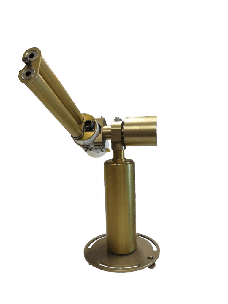
CIMEL CE318 photometer
Cimel CE318
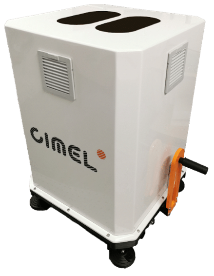
CIMEL CE376 LiDAR
Cimel CE376
CIMEL AAMS
Cimel AAMS
CIMEL Quicklook AAMS
Quicklook AAMS

References Sweden AERONET

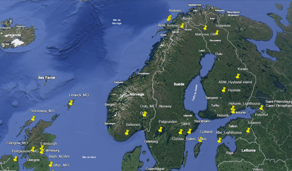
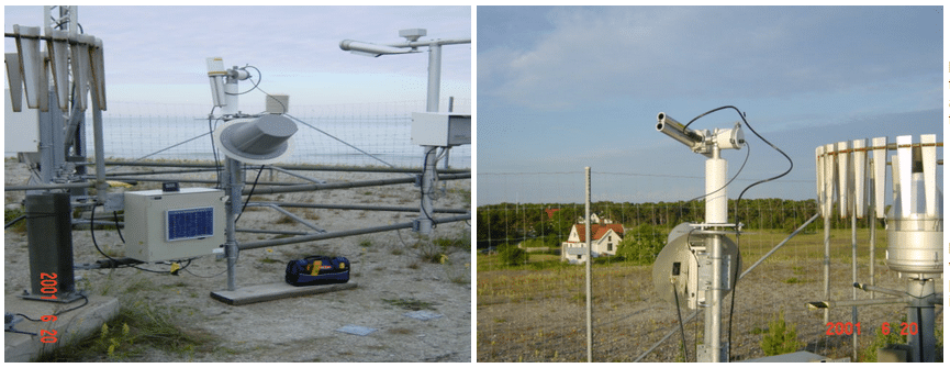
Map AERONET sites Sweden
Map of AERONET sites in Sweden in 2024.
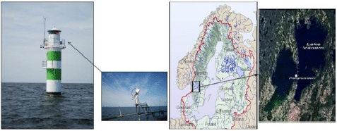
Palgrunden site AERONET
Palgrunden site managed by European Space Agency, Swedish National Space Board and Stockholm University, for Ocean CAL/VAL application.
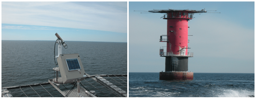
Gustav Dalen Tower site AERONET
Gustav_Dalen_Tower site managed by Joint Research Centre of the European Commission.
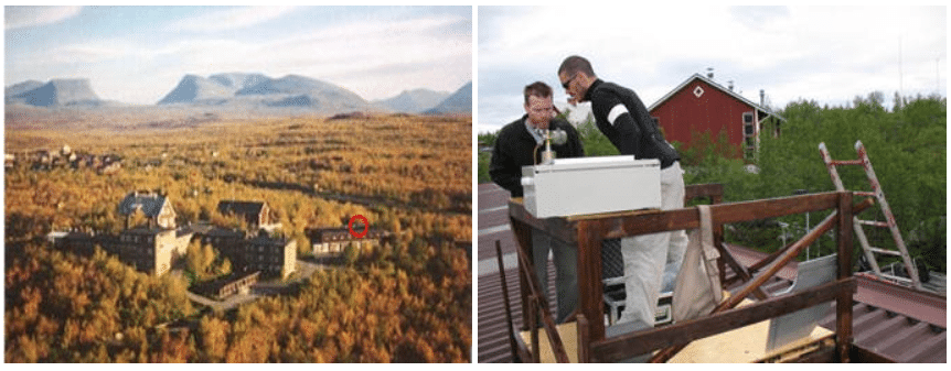
Abisko site AERONET
Abisko site managed by University College London, Department of Geography.
Gotland site AERONET
Gotland site managed by Swedish Meteorological and Hydrological Institute.
SMHI site AERONET
SMHI site managed by Swedish Meteorological and Hydrological Institute.

BECOOL Project

becool balloon

Stratéole-2 Becool: micro-LiDARs span the globe aboard hot-air balloons up to 22km high in the stratosphere.

Keywords: Aerosols, LiDARs, monitoring, Earth observation, remote sensing, stratosphere, troposphere.

October 16th 2023

On the night of Wednesday, August 22, 2018, the CIMEL’s micro-LiDAR flew for the first time in a stratospheric balloon for the validation of the project, from Timmins Air Force Base, in Ontario (Canada).

Stratéole-2 is a program of observation of the dynamics of the atmosphere in the intertropical zone developed in partnership between CNRS and CNES. The LATMOS (Atmosphere, environment and space observations laboratory) through its joint laboratory with CIMEL: CIEL), the LMD (Dynamic Meteorology Laboratory), and the CSA (Canadian Spatial Agency) are also collaborating on this project. 

This Stratéole-2 project called BECOOL (BalloonbornE Cirrus and convective overshOOt Lidar) mainly consists in placing CIMEL’s micro-LiDARs in stratospheric hot-air balloons and flying them around the world. The onboard aerosols micro-LiDARs emit lasers downwards, contrary to the initial use (the shots are normally done from the ground towards the atmosphere).

The project Stratéole-2 represents several challenges as CIMEL had to develop, in collaboration with the LATMOS a micro-LiDAR prototype that must correspond to the following standards:

  • Weighting less than 7 kg
  • Consuming less than 10 W
  • Resisting harsh temperature conditions

Indeed, CIMEL’s LiDARs are well known for their robustness and energetic Self-reliance which allows low maintenance: practical when the LiDARs are up to 20km in the stratosphere!

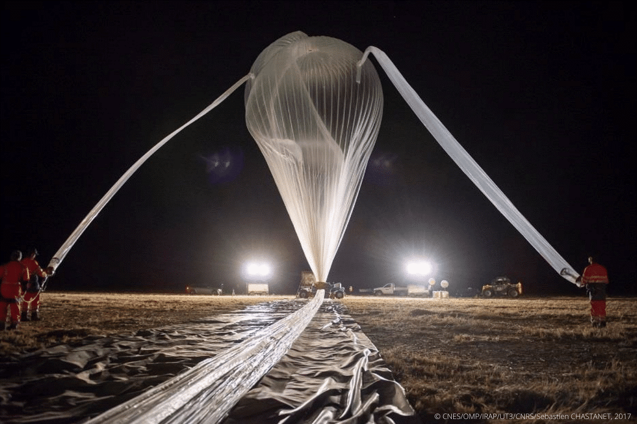
Figure 1: Preparation of a stratospheric balloon before the takeoff

The program uses stratospheric pressurized balloons filled with helium 11 to 13 meters in diameter. During 3 to 4 months, they are carried by the winds all around the tropical belt and are propelled up to 20 kilometers in the atmosphere. Some can travel across 80,000 kilometers around the world (Figure 2).

Figure 2: Stratéole-2 Long-duration balloon flights across the tropics to study atmospheric dynamics and composition / https://webstr2.ipsl.polytechnique.fr/#/
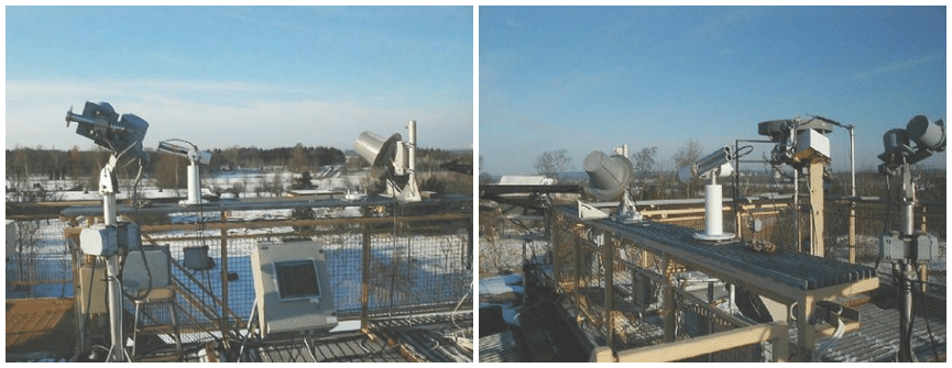
The project includes a total of three measurement campaigns realized between 2018 and 2025. Contrary to the previous one which served as a validation (and in which 2 micro-LiDARs were released), the second campaign was for scientific purposes. It started in mid-October 2021 and ended in April 2022, 3 micro-LiDAR balloons were released into the atmosphere from the Seychelles (Mahé). They collected valuable information which will then be analyzed for the study of atmospheric phenomena and their role in the climate. The third campaign is planned for 2025, with a further 4 micro-LiDAR balloons that will be released.

The objectives are to try to clarify some of the grey areas that hinder our detailed understanding of the atmosphere and its role in the Earth’s climate. BECOOL allows scientists to study atmospheric dynamics and composition such as convection or the dynamic coupling between the troposphere and the stratosphere. Exchanges and air movements between these two atmospheric layers are important and influence the whole planet.

However, the tropical region is difficult to access. Consequently, the classical methods of observation (by satellites, by plane, …) are not enough. This is why using balloons is strategic: they are the only ones able to observe these phenomena in real time and very closely to the atmosphere.

“It is a completely original mode of sampling, which is not obtained otherwise and allows results of unequaled finesse” (A. Hertzog).

Below is a quicklook from a Stratéole-2 micro-LiDAR taken from a balloon.

Figure 3: Quicklook LATMOS-Stratéole 2018

Bibliography:

E. J. Jensen et al, Bull. AMS, 129-143 (2017), M. McGill et al., Appl. Opt., (41) 3725-3734 (2002), J. S. Haase et al., Geophys. Res.L., 39, (2012), P. Zhu et al., Geos. Inst. Meth. and Data Systems, 89-98, (2015) J.-E. Kim et al, Geophys. Res. L. (43), 5895-5901 (2016), S. Davis et al., J.Geophys Res, 115 (2010) S. Solomon et al., Science (327), 1219-1223 (2010) V. Mariage et al., Optics Express 25 (4), A73-A84 (2017) ,G. Di Donfrancesco et al., Appl. Opt. (45) 5701-5708 (2006)  https://doi.org/10.1051/epjconf/202023707003

François Ravetta, Vincent Mariage, Emmanuel Brousse, Eric d’Almeida, Frédéric Ferreira, et al. BeCOOL: A Balloon-Borne Microlidar System Designed for Cirrus and Convective Overshoot Monitoring. EPJ Web of Conferences, EDP Sciences, 2020, The 29th International Laser Radar Conference (ILRC 29), 237, 07003 (2p.). ff10.1051/epjconf/202023707003ff. ffinsu-02896973f

https://www.ecmwf.int/sites/default/files/elibrary/2016/16866-strateole-2-long-duration-stratospheric-balloons-providing-wind-information.pdf

https://presse.cnes.fr/sites/default/files/drupal/202110/default/cp099-2021_-_strateole-2.pdf

https://videotheque.cnes.fr/index.php?urlaction=doc&id_doc=37302&rang=1&id_panier=#

AAMS Cyprus Institute

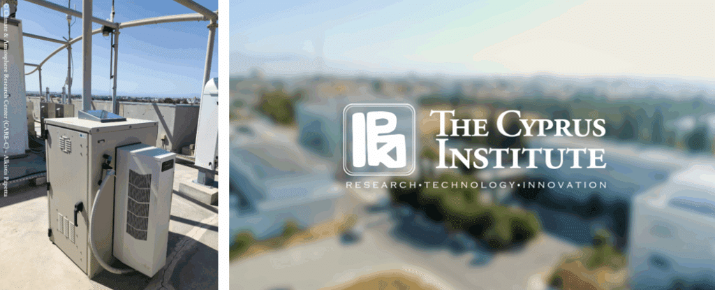
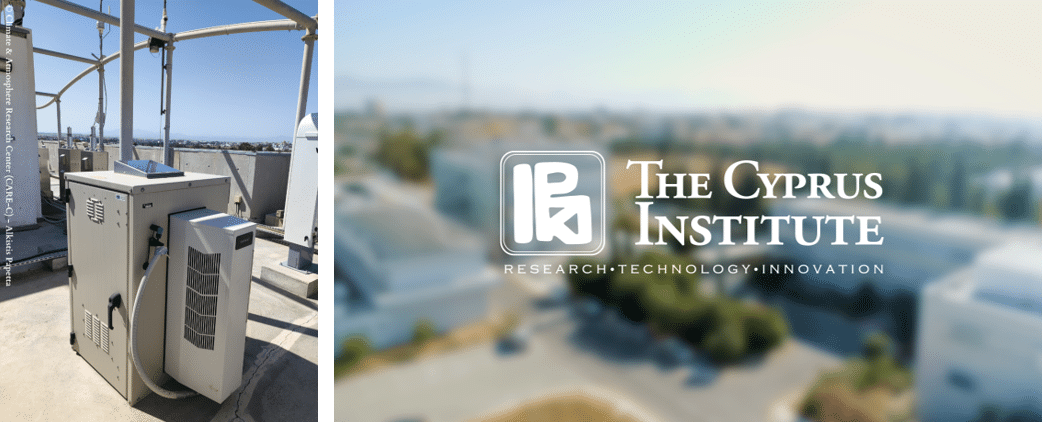
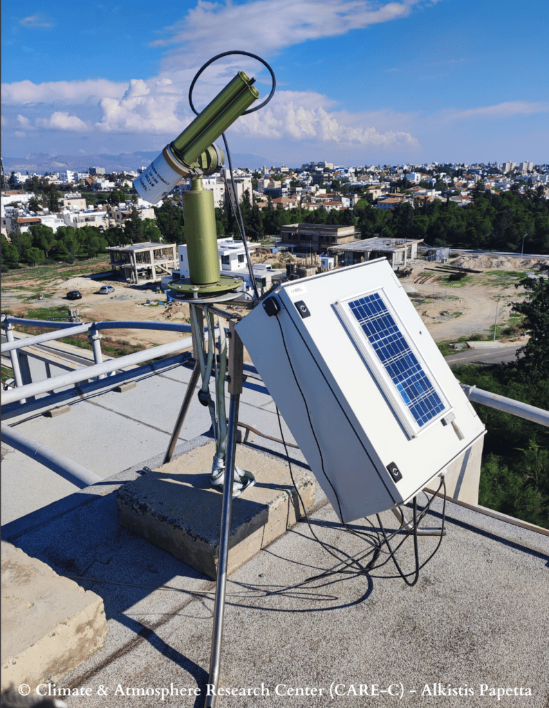
The Climate and Atmosphere Research Center (CARE-C) of The Cyprus Institute using AAMS solution for atmospheric observation.

Keywords : Aerosols, Monitoring, Earth observation, Remote sensing, Wavelength, LiDAR, Photometer, AAMS, CARE-C.

The Cyprus Institute is non-profit research and educational institution with a strong scientific and technological orientation.

The Institute is divided into four research centers:

  • Energy, Environment and Water Research Center (EEWRC)
  • Science and Technology in Archeology and Culture Research Center (STARC)
  • Computation-based Science and Technology Research Center (caSToRC)
  • Climate & Atmosphere Research Center (CARE-C)

The Climate and Atmosphere Research Center (CARE-C) was founded at the Cyprus Institute in January 2020. It is a regional European Center of Excellence for Climate and Atmosphere Research, based in Cyprus, for the Eastern Mediterranean and Middle East (EMME) region. The aim of the center is to lead some researches about urgent climate change and air pollution challenges such as greenhouse gases, the water cycle, extreme weather, atmospheric dust and their impacts.

Therefore, the center owns a remote sensing group composed by a network of ground-based instruments located at three Cyprus Atmosphere Observatory (CAO) stations: Nicosia, Agia Marina Xyliatou and Troodos. Among these instruments, three CE318-T – Sun Sky Lunar Multispectral Photometers and a CE376 – Compact LiDAR.

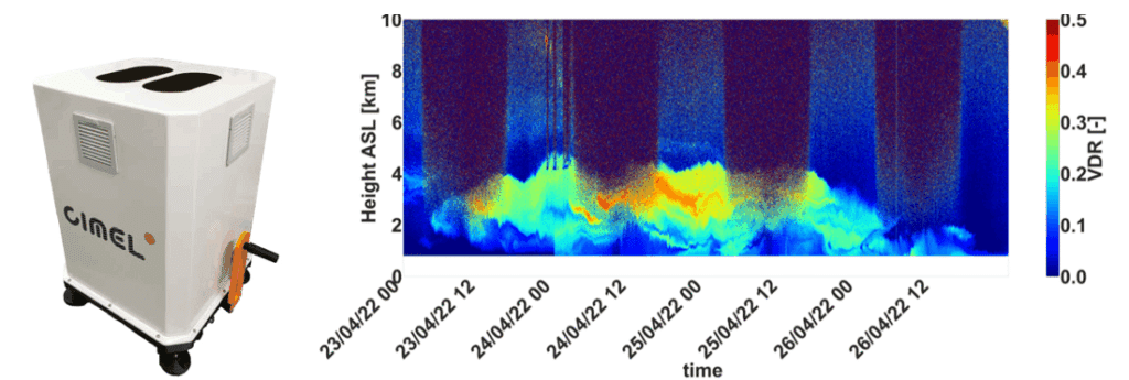
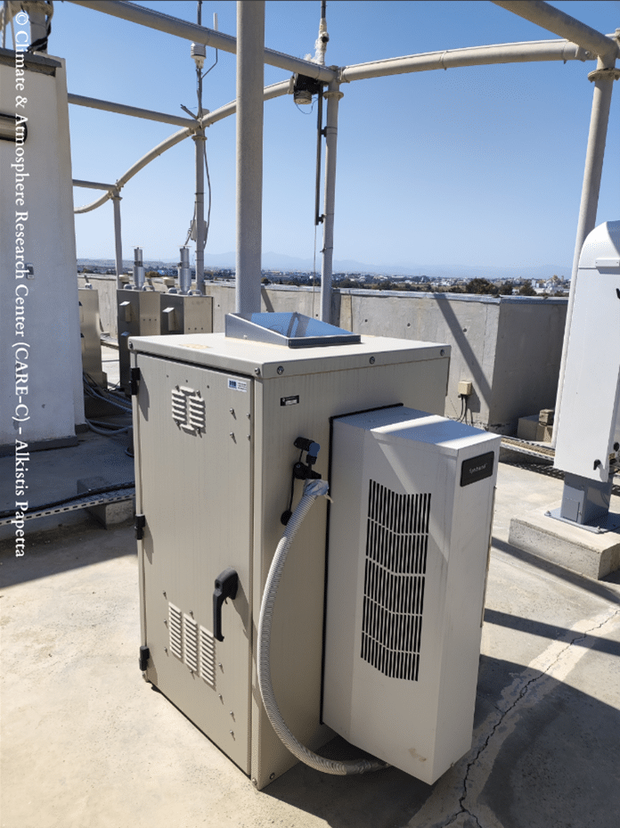
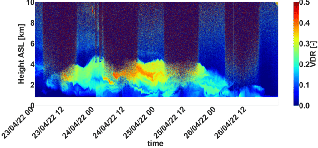
CIMEL AAMS – Automatic Aerosol Monitoring Solution allows the study of the transportation of pollution, dust, smoke and all the aerosols related to atmospheric composition. For instance, optical characterization of dust and smoke particles are made thanks to the 2 wavelengths CE376 – Compact LiDAR. In addition, the instrument has depolarization capability, which is a relevant information for aerosols typing.

By using state-of-the-art solutions and collaborating with the Laboratoire d’Optique Atmosphérique (LOA – University of Lille/CNRS), the CAO provides high quality, long-term observations of key atmospheric pollutants relevant to air quality and climate change, and thus, brings value to the Cyprus Institute in different sectors such as Research, Innovation and Education. This collaboration is developing for many years in the frame of aerosol monitoring (AERONET), radiative flux monitoring and more recently with automatic Lidar/photometer synergy, in the frame of ACTRIS. Moreover, the cooperation between LOA and CAO, in the frame of AQABA campaign, allowed the first operation of the prototype shipborne version of CE318T.

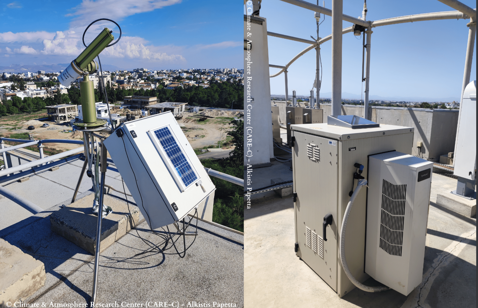
Figure 1 : CE318-T – Sun Sky Lunar Multispectral photometer at Nicosia station.

Figure 2 : CE376 – Micro LiDAR at Nicosia station.
Figure 3 : Quicklook of the volume depolarization ratio during a dust event in Cyprus.

SORBETTO Winter School

SOlar Radiation Based Established Techniques for aTmospheric Observations (SORBETTO) Winter school.

Keywords : Aerosols, Monitoring, Earth observation, Remote sensing, Wavelength, LiDAR, Photometer, Radiation, Atmosphere, CAL/VAL, SORBETTO.

February 14th 2023

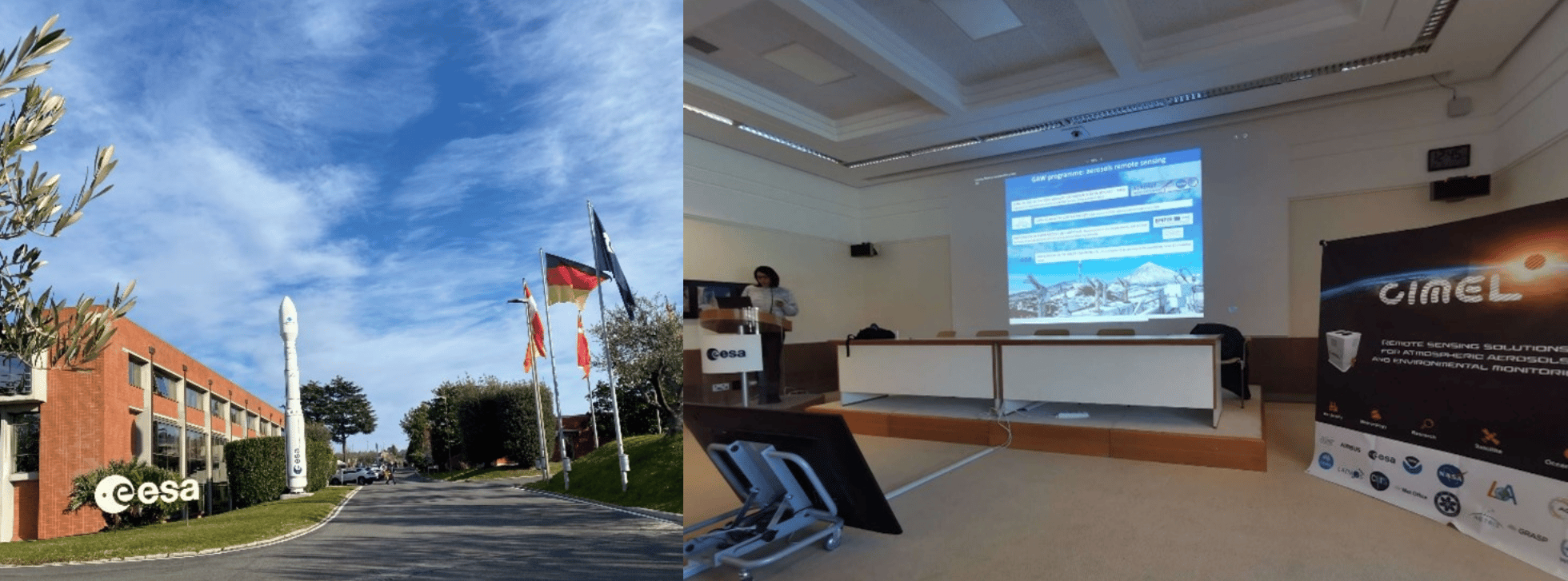
SOlar Radiation Based Established Techniques for aTmospheric Observations (SORBETTO) Winter school took place from February 6th to 10th at ESA-ESRIN (European Space Research Institute), in Frascati, Italy and was organized in collaboration with Sapienza University (Roma) and CNR-ISAC (National Research Council – Institute of Atmospheric Sciences and Climate).

SORBETTO is an important training event for young researchers collaborating within the international aerosol’s scientific community (gas and aerosol observations for climatological, meteorological, local and global air pollution studies, remote sensing and in-situ measurements, calibration of satellite measurements…).

Ground-based instruments deployed in Networks such as AERONET are key players to perform high quality observations that contribute to the Validation and Calibration (CAL/VAL) of satellite missions. Instruments such as Sun Sky Lunar Photometers or LiDARs allow to check that information derived from satellite sensors is comparable to ground measurements and thus, to validate their accuracy.


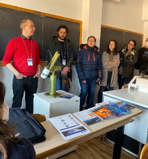
CIMEL Team operating an instrumental demonstration of CE318-T Sun Sky Lunar Photometer at University of Sapienza, 9th 2023.

The instrument show held on Thursday 9th at Sapienza University was the opportunity for students to attend a presentation of various solutions such as CIMEL CE318-T Sun Sky Lunar Photometer, exclusive instrument of NASA Aerosol Network AERONET.

It was a pleasure for CIMEL to attend the event with our great and exclusive Italian Business Partner XEarPro Srl. With 20 years of experience in the field of environmental monitoring, XEarpro Srl contributes in the development of applications and solutions to safeguard the environment around us. We collaborate closely to meet the needs of the Italian scientific community in term of aerosols remote sensing instruments. 

Méteo France

METEO-FRANCE network of CIMEL’s instruments

Keywords : Aerosols, LiDARs, monitoring, Earth observation, remote sensing, CAL/VAL, atmosphere, air quality, photometers, aviation, volcanos survey, volcanic ashes, atmospheric monitoring

July 06th 2022

Météo-France is a public administrative institution, the official meteorological and climatological service in France. As such, it exercises the State’s responsibilities in terms of meteorological safety. The institution is also in charge of managing and modernizing an observation network of the atmosphere, the surface ocean and the snow cover in France and overseas.

The institution is also present on an international level as it contributes to the programs and activities of the World Meteorological Organization (WMO) which sets standards that meet the shared needs of its Member States.

Météo-France’s research department, the Centre national de recherches météorologiques (CNRM), is a joint research unit with the CNRS. Météo-France is also a joint supervisor of the Laboratoire de l’Atmosphère et des CYclones (LaCy), the Service des Avions Français Instrumentés pour la Recherche et l’Environnement (SAFIRE), and the Observatoire Midi-Pyrénées (OMP).

Météo-France core missions are linked to the needs related to the protection of people and property: weather forecasting, knowledge of the climate and its evolution, physics and dynamics of the atmosphere and interactions between men, the climate and the atmosphere…

The knowledge of weather conditions is of huge importance for the aviation industry for example. Landing, taking off and even flying safely depends on weather conditions. The perfect example of this huge importance is the eruption of the volcano Eyjafjallajökull which occurred in April 2010. The Icelandic volcano released a thick ash of smoke which disrupted European air traffic, causing five days of complete interruption of traffic: the largest closure of airspace decreed in Europe, not without financial consequences as it led to considerable losses.

Indeed, volcanic ash which tends to settle in the atmosphere is dangerous as it can be sucked into the plane’s engines, then, melt, and finally clog the jet engines. It can cause air plane accidents.

Hence the importance of using state-of-the-art remote sensing measuring instruments to determine for instance the localization, the characterization and the concentration of aerosols in the atmosphere. For this purpose, Météo-France works in collaboration with the LOA (Laboratoire d’Optique Atmosphérique) to manage and maintain a network of efficient solutions and link several instruments such as LiDARs and CIMEL photometers (ready-to-use by AERONET) for more accurate data and considerably reduced uncertainties.

To this end, CIMEL works in close collaboration with Météo-France and ensures to provide quality and constantly improved instruments to meet the urgent needs in terms of security.

Actually, CIMEL also provides instrument synergies between Photometers and LiDARs through a unique monitoring software iAAMS, dedicated to the aerosols study and analysis. The obtained parameters are the characterization of aerosol types, the extinction and backscatter profile of mass concentration. Cimel’s AAMS is able to automatically locate, identify and quantify aerosols, layer by layer, day and night.

US-WILDFIRES

US west coast forests are more and more in the grip of Wildfires.

Keywords : Aerosols, LiDARs, MicroLiDARs, Monitoring, Earth observation, Remote sensing, Wildfire, Smoke, Ash, Fires, Climate Change, Global Warming, Atmospheric Monitoring, Mobile Solutions, Air Quality

June 28th 2022

According to a recent UN report, forest fires will continue to increase by the end of the century. It is especially the case on the west coast of the United States, which is one of the countries most affected by this phenomenon. Whether they are natural or human-caused, these fires are devastating on a large scale.

The global warming makes the conditions more favorable to the start of fires and their proliferation. The climate change is worsening the impacts by prolonging the fire seasons.

California is the most wildfire-prone state in the United States. In 2021, over 9000 wildfires burned in the Southwestern state ravishing nearly 2.23 million acres.

Fires are a danger to life on the planet: smoke inhalation, soil degradation and water pollution, destruction of the habitats of many species… Not to mention the aggravation of global warming due to the destruction of forests, crucial to absorb the carbon that we emit.

Therefore, on summer 2019, NASA initiated FIREX-AQ mission so as to investigate on fire and smoke from wildfire using several measurement instruments across the world, and especially in the US.

NASA uses satellites combined with airborne and ground-based instruments to decipher the impact of wildfires.

The emissions of ash clouds resulting from the fire can be transported thousands of miles and can have an impact on air quality for example as they are responsible for a large fraction of the US PM2.5 emissions. Due to its microscopic size, PM2.5 is easily inhaled and has the potential to travel deep into our respiratory tracts, it can also remain airborne for long periods.

To date, wildfire outputs are still poorly represented in emission inventories.

The overarching objectives of FIREX-AQ are to:

  • Provide measurements of trace gas and aerosol emissions for wildfires and prescribed fires in great detail
  • Relate them to fuel and fire conditions at the point of emission
  • Characterize the conditions relating to plume rise
  • Follow plumes downwind to understand chemical transformation and air quality impacts
  • Assess the efficacy of satellite detections for estimating the emissions from sampled fires

For this purpose, CIMEL provided CE376 micro-LiDARs as well as its network of CE318-T photometers through AERONET. These solutions allowed detailed measurements of aerosols emitted from wildfires and agricultural fires to address science topics and evaluate impacts on local and regional air quality, and how satellite data can be used to estimate emissions more accurately.


Figure 1: CE376 micro-LiDAR and CE318-T photometers embarked on a car for FIREX-AQ mobile measurements campaign in Western US (2019).

Indeed, the synergy of the photometer with the mobile CE376 LiDAR allows profiling the extinction at 2 wavelengths (532, 808 nm) and of the Angstrom Exponent (AE). AE vertical profile and the depolarization capabilities of the CE376 allow identifying the aerosol type (fine/coarse). Below are some results from the FIREX-AQ 2019 mission:


Figure 2: Mapping of smoke vertical and spatial dispersion thanks to mobile LIDAR and photometer measurements by Dr. Ioana POPOVICI.   

Figure 3:  Mapping and modelization from FIREX-AQ campaign in Western US (2019) by LiDAR CE376.


FIREX-AQ experience proved that we are able to embark compact remote sensing instruments and install them quickly on site to access harsh environments and get close to fire sources, which has not been done before. Actually, it is the first time a LIDAR reaches that close to fire sources in a mountainous region.

Bibliography:

https://www.agora-lab.fr/_files/ugd/376d34_4116704968934963a6aea9b5719f2824.pdf

https://ui.adsabs.harvard.edu/abs/2020AGUFMA191…09G/abstract

https://ui.adsabs.harvard.edu/abs/2019AGUFM.A23R3049H/abstract

https://ui.adsabs.harvard.edu/abs/2020AGUFMA191…09G

Citation:

Giles, D. M. and Holben, B. and Eck, T. F. and Slutsker, I. and LaRosa, A. D. and Sorokin, M. G. and Smirnov, A. and Sinyuk, A. and Schafer, J. and Kraft, J. and Scully, A. and Goloub, P. and Podvin, T. and Blarel, L. and Proniewski, L. and Popovici, I. and Dubois, G. and Lapionak, A., (2020), Ground-based Remote Sensing of the Williams Flats Fire Using Mobile AERONET DRAGON Measurements and Retrievals during FIREX-AQ, 2020, AGU Fall Meeting Abstracts.


AEROCAN ARCTIC PHOTOMETERS

Pearl and Opal CE318-T photometers recording AOD and measurements in Canada’s high Arctic for AEROCAN.

Keywords : Aerosols, photometer, monitoring, Earth observation, remote sensing, CAL/VAL, Arctic.

March 23rd 2022

The Canadian Arctic is probably one of the best areas to conduct climatological studies, especially on global warming given the purity of the atmosphere in this zone, especially due to the absence of anthropological pollution.

Nevertheless, this rather hostile land, due to its temperatures, can make the difficulties of recording measurements very real. Consequently, there is a lack of measurements in the Arctic, hence the need to install platforms with robust and reliable measuring instruments.

Some of those platforms, especially PEARL and OPAL, have a particular emphasis on the Arctic because Canada has a significant portion of its territory in the Arctic.

The Polar Environmental Atmospheric Research Lab (PEARL) and the zerO altitude Polar Atmosphere Laboratory (OPAL) which is part of PEARL, is operated by the CAnadian Network for the Detection of Atmospheric Change (CANDAC) which is a member of AEROCAN. Formed in 2005, PEARL constitutes a network of universities and government researchers dedicated to studying the changing atmosphere over Canada.

The first task of PEARL was to renew and operate the existing laboratory at Eureka in Nunavut, which was created to contribute to the world-wide effort to intensively study the Arctic region through AEROCAN.

The AEROCAN photometer network is run as a joint collaboration between the Université de Sherbrooke and the Meteorological Service of Canada (MSC). It is a full-fledged sub-network of the much larger AERONET network of Cimel photometers and benefits from all the services that AERONET offers.

Objectives:

  • Understanding atmospheric change over Canada
  • Integration of measurements taken from space, aircraft, balloons and the ground
  • Provision of quality-controlled research datasets to researchers
  • Linkage with international networks for data exchange and supranational planning

In addition, PEARL undertakes measurements that are simultaneous with those made by various satellite instruments. These “validation” measurements are extremely effective because of the location of PEARL and OPAL, and they further enhance the science return of the research as they use state-of-the-art technology solutions like the CE318-T Photometer.

PEARL is located at Eureka, Nunavut (80N, 86W) on Ellesmere Island in Canada’s high Arctic, 450 km north of Grise Fiord, the most northerly permanent settlement. This photometer site is 1,100 km from the North Pole. OPAL is located about 12 km southeast of the PEARL ridge lab which is at an elevation of 610 m. This dual placement was designed to study the layer between the two sites as well as provide an element of redundancy for the AOD measurements.

Figure 1: Location of PEARL and OPAL photometer sites (upper pictures : 2007 CANDAC/Ovidiu Pancrati, bottom picture: Norm O-Neill, Université de Sherbrooke)
Figure 2: PEARL CE318 Photometer pointing to the sun for a measurement scenario
Figure 3: Latest measurements from Opal (above) and Pearl (bottom) photometers depicting AOD (Aerosol Optical Depth). Credits: NASA AERONET: https://aeronet.gsfc.nasa.gov/

Results:


A multi-year AOD and effective radius climatology for the high Arctic showed a number of consistent features using the Cimel CE318-T Photometer:
• Spring to summer decrease of fine-mode AOD (probably attributable to biomass burning and/or anthropogenic pollution)
• Significant correlation of fine mode AOD with CO (Carbon monoxide) concentration which indicates a predominance of biomass burning aerosols throughout the entire year
• West to East decrease in AOD on a pan-Arctic scale
Another study (Antuña-Marrero et al., 2022) has been conducted for water vapor research.
It shows that it is feasible to use Cimel CE318-T Photometer AERONET observations in the Arctic for water vapor research, considering the robust quantification of its dry bias that has been established.
As a matter of fact, AERONET imposes standardization of instruments, calibration, processing and distribution that Cimel is the exclusive provider. Its IWV (Integrated Water Vapor) observations are an ideal standard dataset to re-calibrate or homogenize the rest of the instrumental IWV observations to a predefined absolute standard dataset.

References:

  • Antuña-Marrero, Juan Carlos & Román, Roberto & Cachorro, Victoria & Mateos, David & Toledano, Carlos & Calle, Abel & Antuña Sánchez, Juan Carlos & Vaquero-Martínez, Javier & Antón, Manuel & Baraja, Ángel. (2022). Integrated water vapor over the Arctic: Comparison between radiosondes and sun photometer observations. Atmospheric Research. 270. 106059. 10.1016/j.atmosres.2022.106059.
  • AboEl‐Fetouh, Y., O’Neill, N. T., Ranjbar, K., Hesaraki, S., Abboud, I., & Sobolewski, P. S. (2020). Climatological‐scale analysis of intensive and semi‐intensive aerosol parameters derived from AERONET retrievals over the Arctic. Journal of Geophysical Research: Atmospheres, 125, e2019JD031569. https://doi.org/10.1029/2019JD031569
  • Mölders, N. and Friberg, M. (2020) Using MAN and Coastal AERONET Measurements to Assess the Suitability of MODIS C6.1 Aerosol Optical Depth for Monitoring Changes from Increased Arctic Shipping. Open Journal of Air Pollution, 9, 77-104.
    https://doi.org/10.4236/ojap.2020.94006

PLATFORM EUREKA

Eureka offshore oil platform provides continuous aerosols data recorded by CE318-TV12-OC (SeaPRISM) for NASA AERONET.

Keywords : Aerosols, photometer, water radiance, monitoring, ocean properties, ocean color, Earth observation, remote sensing, CAL/VAL, SeaPRISM.

February 9th 2022

Since 2002, more than 31 OC measurement sites have been integrated on the NASA AERONET OCEAN COLOR network through offshore fixed platforms and coastal platforms all around the world. Thanks to numerous collaborations between environmental sciences and energy industries such as discussed below, the number of Ocean Color measurement sites keeps growing.

In collaboration with University of Southern California (USC), the SeaPRISM site at the oil rig platform Eureka was installed in the Los Angeles Harbor and was initially operational in April 2011. CE318-TV12-OC (SeaPRISM) photometers  are part of the AERONET network of automated instruments designed to make automated measurements of aerosols around the world.

The SeaPRISM instrument has been modified to also view the ocean surface and measure ocean color remote sensing reflectance as well as the aerosol measurements. Data is currently flowing to NASA AERONET as well as NRL-SSC (The Naval Research Laboratory detachment at  Stennis Space Center (SSC), Mississippi) and Oregon State University (OSU) for matchups. Data has been collected routinely since June 2012 to date.

Continuity of the ocean color products between ocean color satellites is required for climate studies, as well as to enhance the operational products used in ecological monitoring and forecasting, such as accurately monitoring ocean water quality and determining changes along our coastlines. In addition, inter-satellite product comparisons are essential for data continuity into the future.

The JPSS (Joint Polar Satellite System) calibration and validation team has developed an infrastructure to evaluate VIIRS (Visible Infrared Imaging Radiometer Suite) Ocean Environmental Data Records (EDRs): routinely nLw(λ) and chlorophyll are evaluated against existing satellites data measurements. Ocean color products are based on nLw( λ) from which specific products of chlorophyll, backscattering coefficients, absorption coefficients, and diffuse attenuation coefficients  are computed.

Therefore the accurate radiometric retrieval of the nLw( λ) is considered essential for the production of any ocean color product. A web-based with the VIIRS data matching the satellite data from Platform Eureka SeaPRISM was created in order to provide reliable data. The CE-318 of the oil platform Eureka helps to validate the satellite data provided by VIIRS on the JPSS.


Here are some results performed recently by the CE318-TV12-OC (SeaPRISM) located at Platform Eureka depicting the Normalized Water-Leaving Radiance.

Figure 1: Measurements performed at AERONET-OC Eureka oil platform, California – Normalized Water-Leaving Radiance [Lw]N.
Figure 2: CE318-TV12-OC (SeaPRISM) on site Eureka oil platform, California (USA).

Bibliography:

Curtiss O. Davis, Nicholas Tufillaro, Jasmine Nahorniak, Burton Jones, and Robert Arnone “Evaluating VIIRS ocean color products for west coast and Hawaiian waters”, Proc. SPIE 8724, Ocean Sensing and Monitoring V, 87240J (3 June 2013); https://doi.org/10.1117/12.2016177

http://businessdocbox.com/Business_Software/112273525-Establishing-a-seaprism-site-on-the-west-coast-of-the-united-states.html

https://www.spiedigitallibrary.org/conference-proceedings-of-spie/8724/1/Evaluating-VIIRS-ocean-color-products-for-west-coast-and-Hawaiian/10.1117/12.2016177.short?SSO=1

https://earthdata.nasa.gov/earth-observation-data/near-real-time/download-nrt-data/viirs-nrt