New joint laboratory “AGORA-LAB”
Keywords : Aerosols, Photometer, LiDAR, AGORA-LAB, Atmosphere
On 18 May 2021, the CNRS published its innovation letter highlighting the joint laboratory between Cimel and the LOA (Laboratoire d’optique atmosphérique) called « AGORA-LAB »
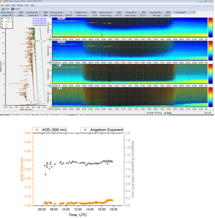
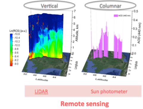
This joint laboratory will allow the development of a multi-year research programme with the main objective of further improving photometric and LiDAR technics for aerosol characterization, providing synergies between instruments, and developing autonomous mobile measurement systems such as the Mobile Aerosol Monitoring Solutions (M-AAMS) for air quality and climate science to obtain aerosol measurements as below:
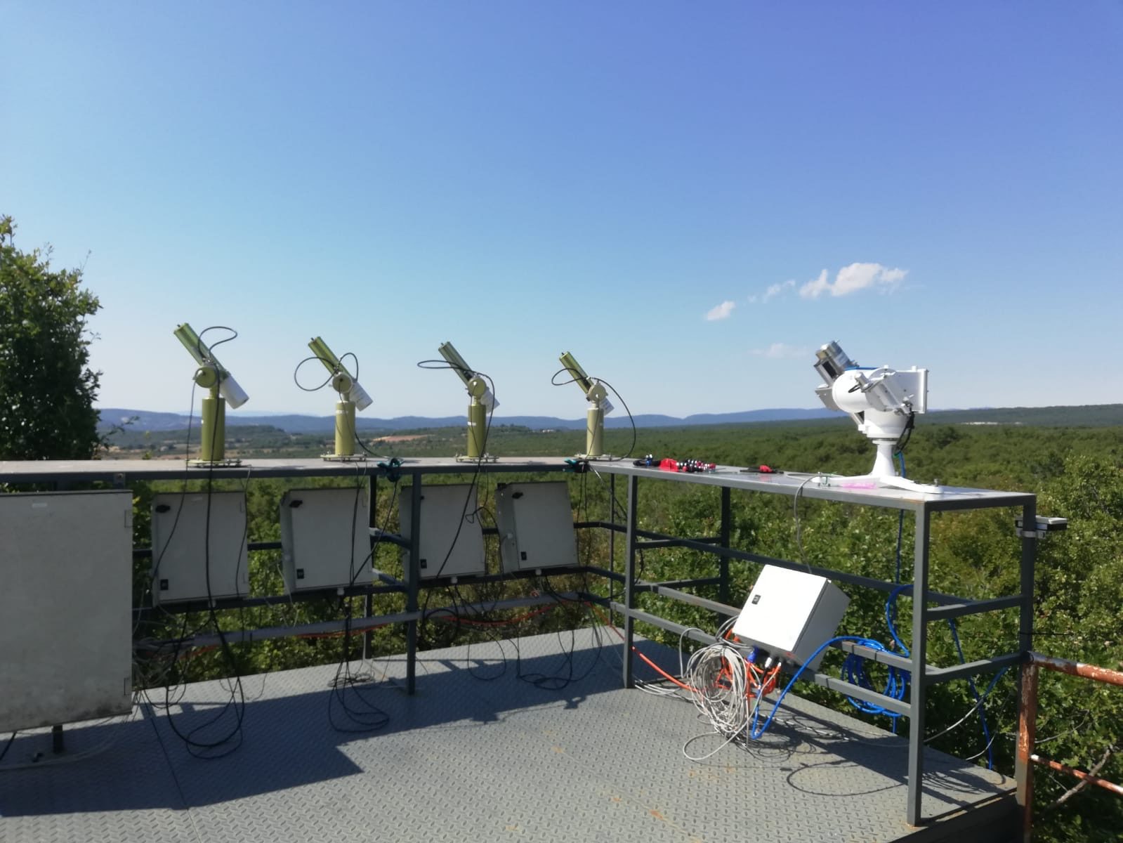
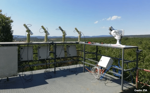
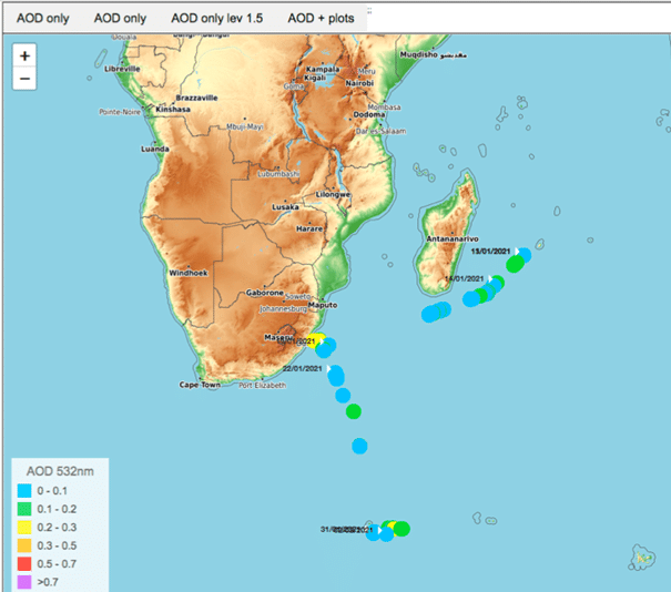
Some campaigns have already been deployed, such as MAP-IO campaign with the installation of a Cimel photometer on board of the Marion Dufresne ship, to carry out measurements during the trip, whilst automatically processing data.
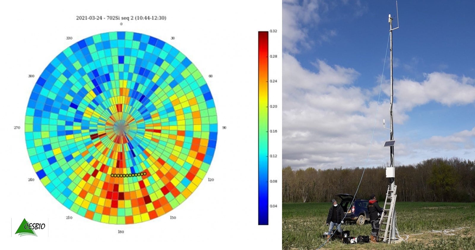
Other mobile platforms in the joint laboratory program will be installed on airplanes like for the SAFIRE project, but also on trains, as part of the Equipex Obs4Clim, to measure different types of aerosols.
The LOA studies the various components of the atmosphere, mainly clouds, aerosols and certain gases, which thus play a major role in the Earth’s energy balance. The laboratory has internationally recognized expertise in remote sensing, covering a wide spectral range from the ultraviolet and solar domains to thermal infrared and millimeter waves. The LOA will be the spokesperson for the joint laboratory AGORA-LAB to deploy the projects planned by the two entities.
As for CIMEL, we will contribute to AGORA-LAB by putting forwards its assets, namely:
- Our design and model-making laboratory.
- Our characterization and functional tests in electronics.
- New means of optical and mechanical design and prototyping.
- A laboratory for adjustment and testing of lidar in our factory.
Click here to read the full CNRS innovation letter.
- Philippe Goloub / Researcher at the Laboratory of Atmospheric Optics / philippe.goloub@univ-lille1.fr
- Stephane Victori / Scientific Director, Cimel / s-victori@cimel.fr