Urban air quality monitoring at ATMOSUD super sites
CIMEL instruments supporting urban air quality and atmospheric process studies across ATMOSUD and OHP reference sites
ATMOSUD operates a network of long-term atmospheric reference sites in Southern France dedicated to air quality and greenhouse gas studies. These super sites combine in situ measurements, remote sensing observations and modelling tools to better understand pollutant dispersion, atmospheric mixing and emission reduction scenarios at the metropolitan scale.
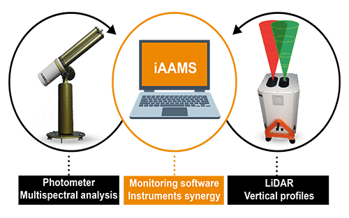
Within this framework, CIMEL Automatic Aerosol Monitoring Solutions (AAMS) play a key role by providing continuous, high-quality observations of both the vertical and column-integrated structure of the atmosphere.
Marseille–Longchamp: an urban reference site for air quality applications
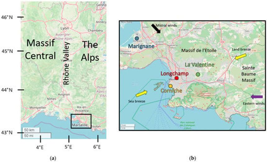
The Marseille–Longchamp site, located in the city centre, is a flagship ATMOSUD urban reference observatory. It captures air quality conditions in a dense urban environment strongly influenced by local emissions, complex meteorology and coastal effects.
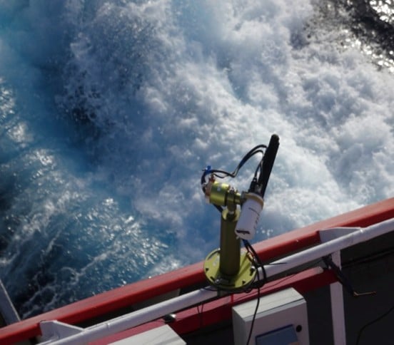
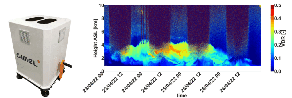
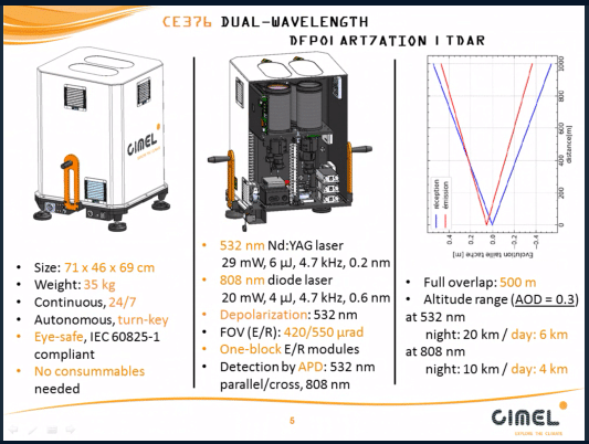
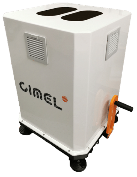
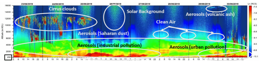
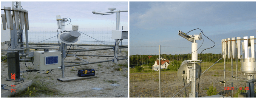
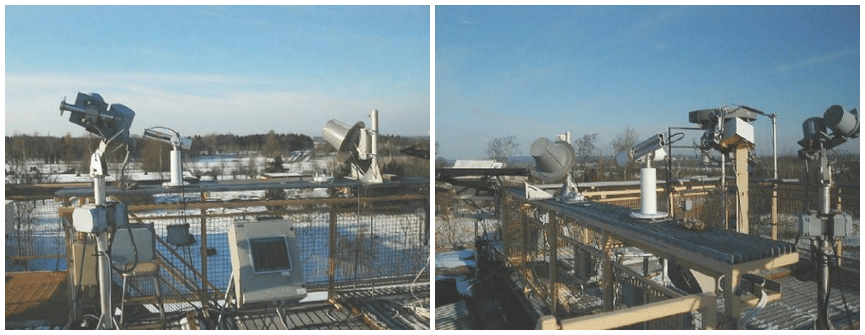
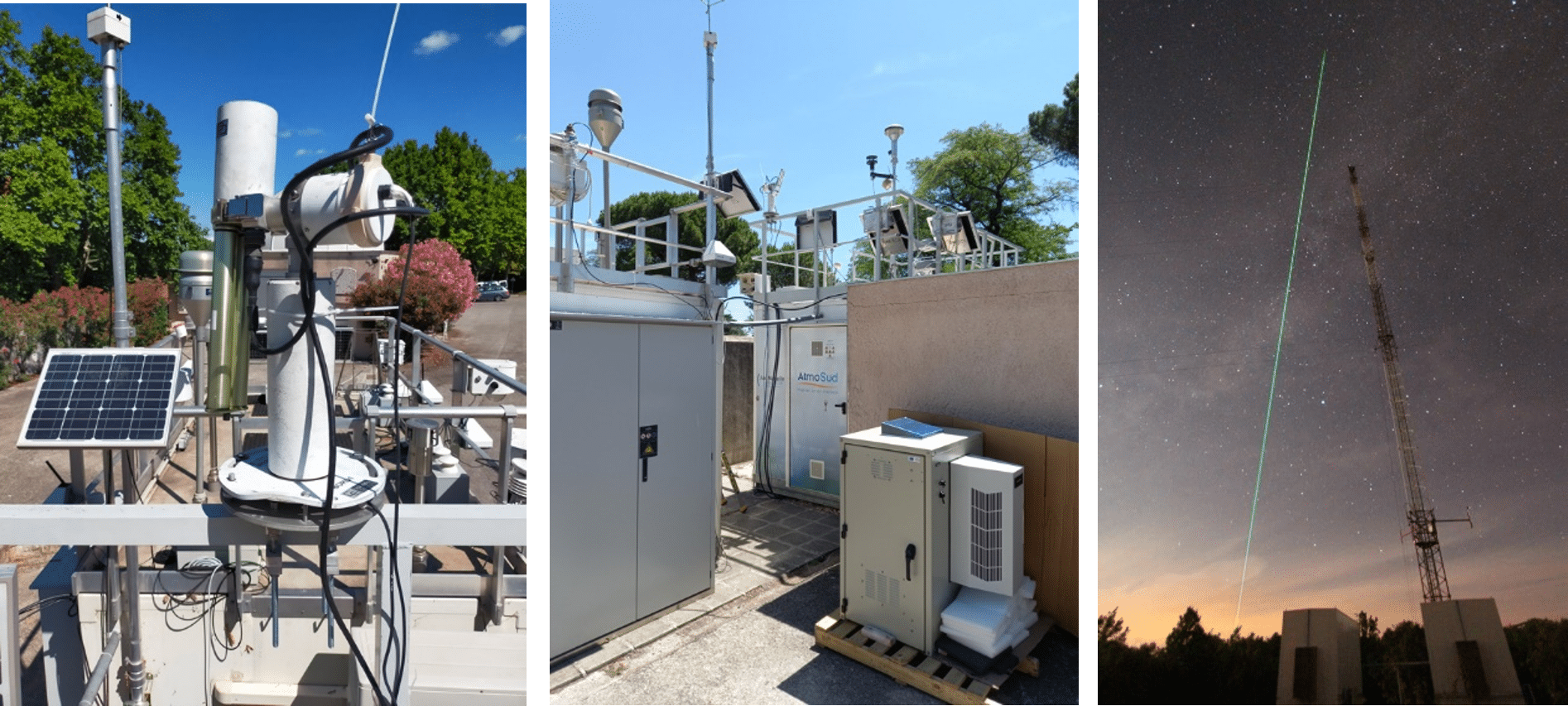
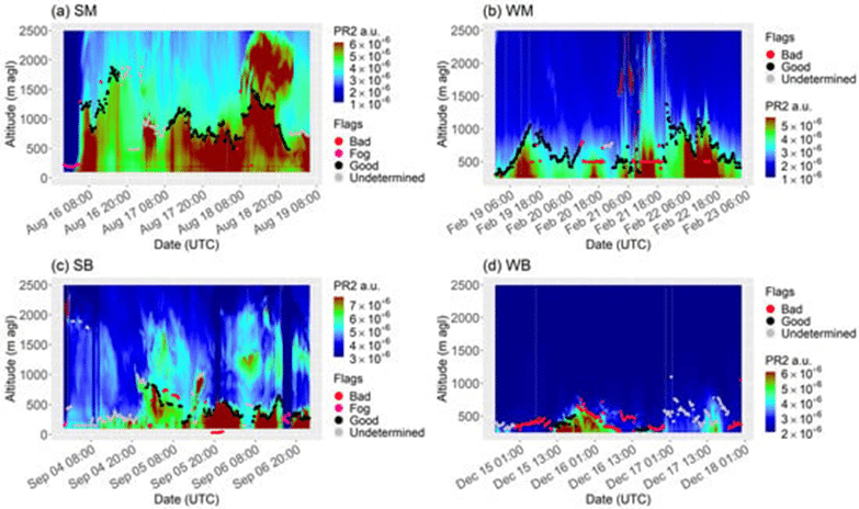
A CIMEL CE376 aerosol LiDAR is deployed on the rooftop of the site to continuously monitor atmospheric vertical structure, with a particular focus on atmospheric boundary layer height (ABLH). This parameter is a key driver of pollutant dilution and accumulation in cities. LiDAR observations reveal strong contrasts between wind regimes, such as mistral conditions inducing intense turbulence and deeper mixing layers, and sea–land breeze situations associated with shallow boundary layers and pollutant buildup. These LiDAR-derived mixing height observations provide essential physical context for the interpretation of in situ air quality measurements, strengthening the operational and scientific value of the Marseille–Longchamp site.
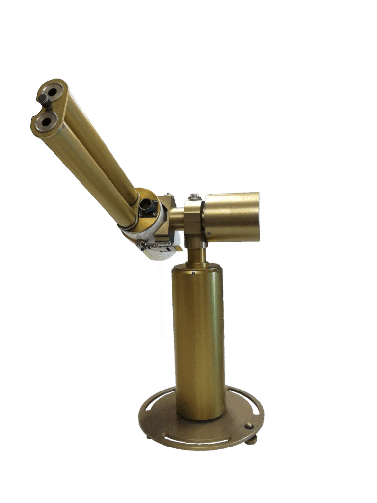
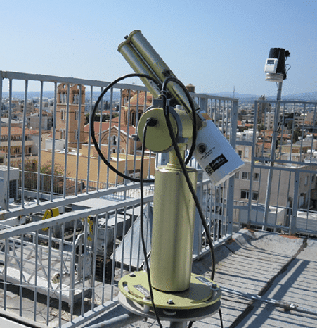
Complementing the LiDAR, a CIMEL CE318 sun photometer provides long-term measurements of aerosol optical properties, contributing to the characterization of the atmospheric column above the urban area.
Complementary sites: urban, coastal and rural altitude observations
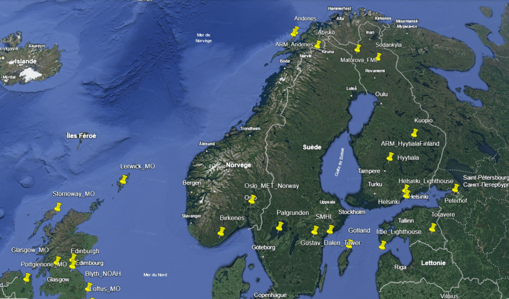
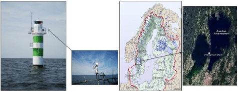
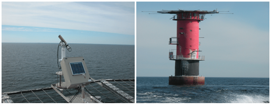
Beyond Marseille–Longchamp, ATMOSUD and its scientific partners operate complementary reference sites covering contrasted environments, including coastal and industrial areas and the Observatoire de Haute-Provence (OHP), a rural high-altitude site representative of background atmospheric conditions.
The OHP site plays a central role in regional atmospheric studies by documenting free-tropospheric conditions, long-range transport and baseline aerosol and gas concentrations. The scientific collaboration between ATMOSUD and OHP enables a consistent interpretation of observations across environments, from urban emission-dominated areas to rural background conditions.
Across this network, CIMEL instruments ensure observational continuity, allowing comparisons between sites and supporting studies of local versus regional contributions to air quality and greenhouse gas signals.
From observations to applications
Data collected at ATMOSUD and OHP super sites feed a wide range of applications, including:
- interpretation of urban air quality measurements,
- analysis of pollutant accumulation and dilution regimes,
- support to atmospheric modelling,
- evaluation of metropolitan-scale emission reduction scenarios.
By integrating CE376 LiDAR vertical profiling and CE318 photometer column observations within operational reference sites, CIMEL’s AAMS contributes directly to advancing air quality monitoring and atmospheric process understanding in complex urban and regional environments.
Bibliography
- Xueref-Remy, I., Riandet, A., Bellon, C., Khaykin, S., Blanc, P.-E., Gomez, F., Armengaud, A., Gille, G., Popovici, I., Pascal, N., Podvin, T., and Goloub, P.: Continuous monitoring of atmospheric aerosols by LIDAR remote sensing technics in the south-east of France at the Observatoire de Haute Provence and Marseille Longchamp sites in the framework of ACTRIS-France and of the ANR COoL-AMmetropolis project., EGU General Assembly 2022, Vienna, Austria, 23–27 May 2022, EGU22-3126, https://doi.org/10.5194/egusphere-egu22-3126, 2022.
- Riandet, A., Xueref-Remy, I., Popovici, I., Lelandais, L., Armengaud, A., & Goloub, P. (2023). Diurnal and Seasonal Variability of the Atmospheric Boundary-Layer Height in Marseille (France) for Mistral and Sea/Land Breeze Conditions. Remote Sensing, 15(5), 1185. https://doi.org/10.3390/rs15051185