La Palma eruption (Canary Islands) – volcanic plumes tracking by our LiDARs
Keywords : LiDARs, Aerosols, Atmosphere, La Palma, Cumbre Vieja volcano, CE376.
6th October 2021
The Cumbre Vieja volcano on La Palma in the Canary Islands erupted on 19th September for the first time since 1971 resulting in large lava flows and evacuations.
Due to the volcanic eruption, nearly 10 000 tons of sulfur dioxide are released in the atmosphere every day. The risks generated are acid rain and deterioration of air quality which can lead to respiratory problems.
In a few words, this phenomenon is due to the fact that the lava of the volcano which reaches 1000°C meets the sea water which is at around 20°C. Therefore, the sodium chloride contained in the sea breaks down the water into oxygen and hydrogen. However, when hydrogen meets chlorine, they turn into hydrochloric acid which is an extremely dangerous gas.
There are many consequences such as the impact on the air quality which directly concerns the surrounding populations who breathe a toxic smoke harmful for their health.
Air traffic is also strongly impacted as all the flights departing from the island have been cancelled. These disturbances are also due to the lack of instruments measuring aerosols (such as LiDARs) to accurately identify the location of the volcanic ash as well as its characteristics and concentration.
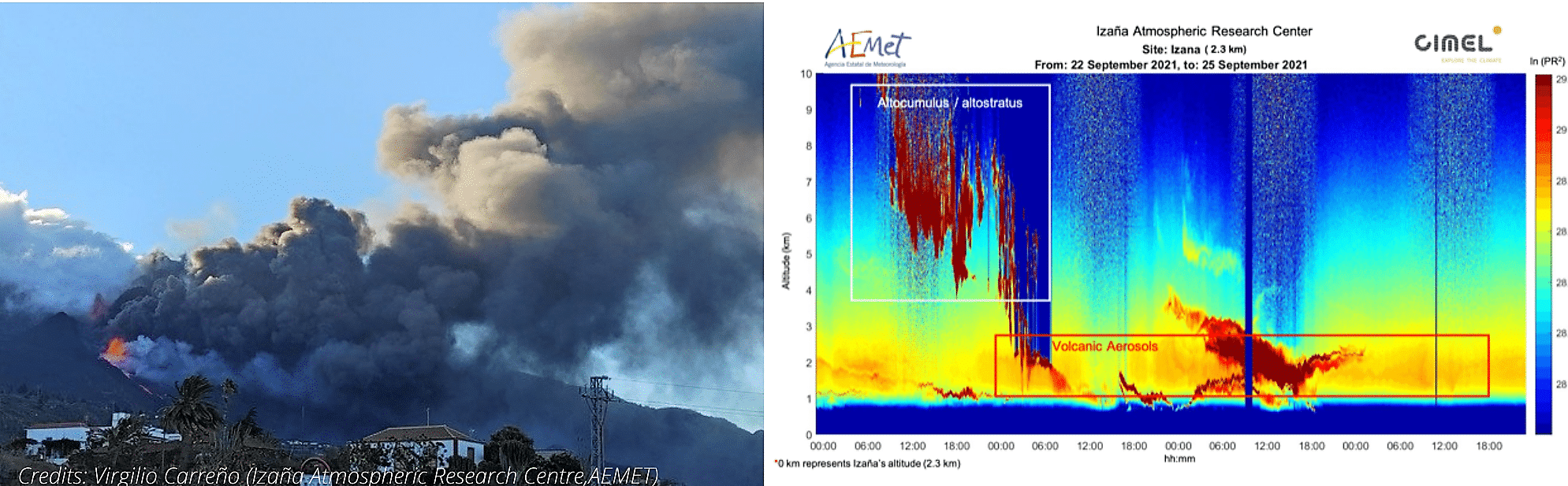
Our CE376 LiDARs in AEMET (Izaña) is tracking plumes of the volcanic ash from the volcanic eruption on La Palma and here are some results to illustrate it.
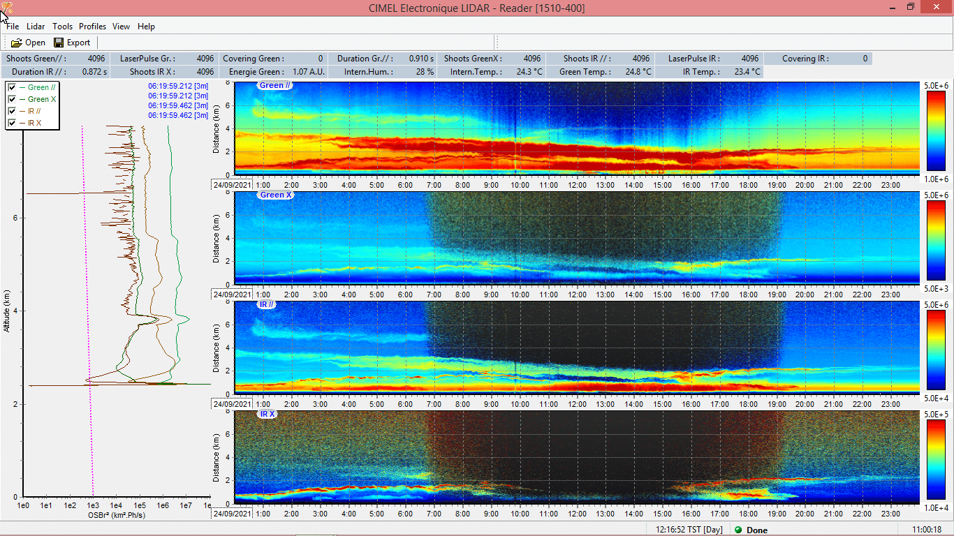
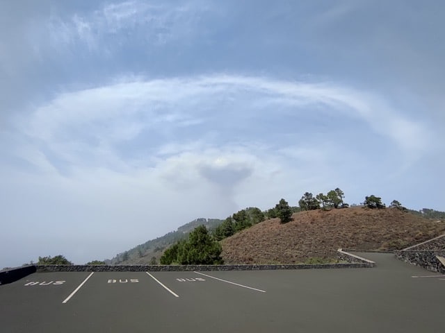
The volcano is propelling air into the atmosphere which meets a thermal inversion – a reversal of the normal behavior of temperature in the troposphere where a layer of hot air sits above a layer of cooler air.