COBIACC campaign

COBIACC campaign

Is the rural atmosphere better than elsewhere?

For the entire month of July in Caillouël-Crépigny (France), scientists from the University of Lille and ATMO Hauts-de-France will analyze particles in the air and their impact on health in rural areas.

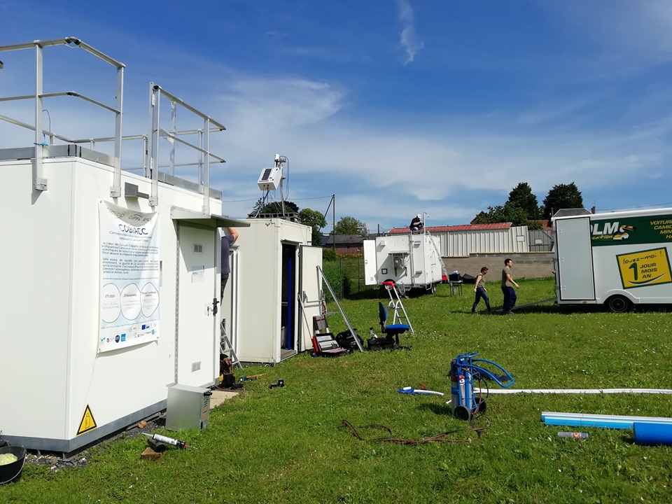
Since 28 June, more than twenty air pollution measuring devices deployed over 100 m² in the commune of Caillouël-Crépigny (02) may answer this question.

Objectives: To understand the formation and the composition of particles and their precursors in the air in a rural environment during the summer period.

The sensors collect dust from the countryside and nearby dust from forests, roads, buildings and industries in the distance.

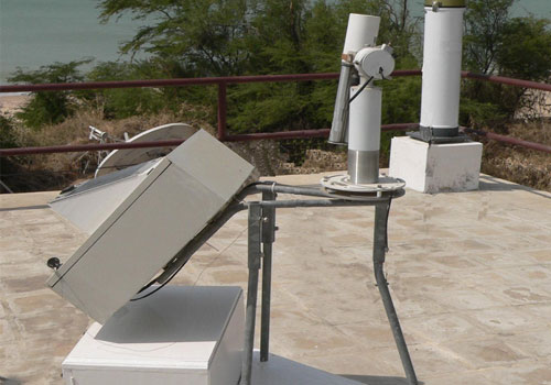
The facility consists of four containers installed on 100 m² in the village square of Caillouël-Crépigny. They accommodate twenty-two observation instruments including our Cimel Sun Sky Lunar CE318-T photometer as well as our CE376 micro-LiDAR. These instruments, unique in France, measure the impact of climate change on air quality, biodiversity and health. Thirty researchers take turns night and day to study the chemical modifications of particles during periods of high heat.

This campaign was named COBIACC for Campagne d’OBservation Intensive des Aérosols et précurseurs à Caillouël-Crépigny. It is the result of a partnership between Labex CaPPA, a laboratory of excellence in Lille, CPER Climibio, an environmental project involving 16 laboratories in the Hauts-de-France and Atmo Hauts-de-France, the regional air quality observatory.

Laboratories involved:

ILRC29 – International Laser Radar Conference (Hefei – China)

ILRC29 – International Laser Radar Conference (Hefei – China)

June, 24-28 2019

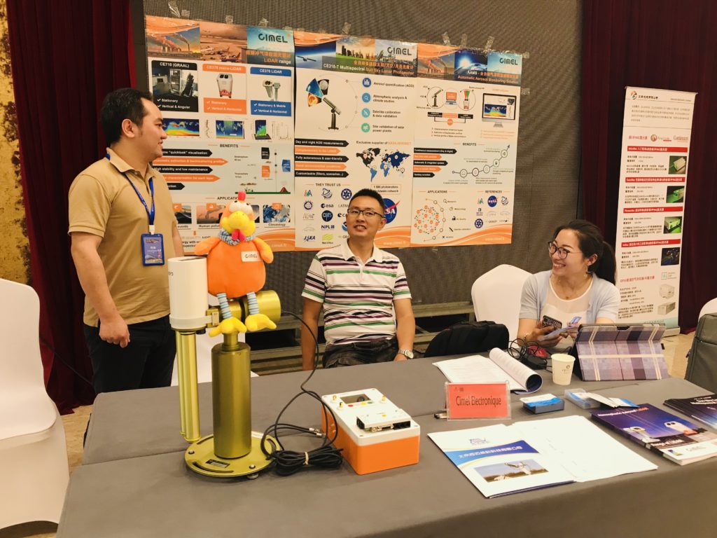
After 50 years, for the first time, the 29th ILRC came to China! ILRC is held biennially under the oversight of the ICLAS, of the International Radiation Commission (IRC). The 29th ILRC was co-hosted by six institutes/universities in China and supported by the Chinese Academy of Sciences and Hefei municipal government. It is also persistently supported by the National Aeronautics and Space Administration (NASA), the European Space Agency (ESA), and many international/national partners and enterprises.

During the 29th ILRC, the new lidar technologies and techniques for profiling the aerosol and clouds, trace gases, water vapor, temperature, turbulence and 3D-wind were explored. The application of lidar networking and space-borne lidars were  investigated. Emphasis was given to weather forecasting, environmental and climate change investigations combined with multiple instruments and platforms. The lidar technologies extended to ocean, land surface and biological applications were also present.

The 29th ILRC was an excellent opportunity to share and exchange ideas. We would like to thank everyone who came at Cimel’s booth and poster presentation during ILRC29. We were pleased to welcome you all!

NASA AERONET

NASA AERONET

Aerosols, these tiny particles of the lower atmosphere, are one important component of atmosphere affecting climate (radiative effects, water cycle) and air quality.

For characterizing and monitoring aerosols, water wapor and clouds, LOA and Cimel, in collaboration with NASA’s GSFC, developed the robotic solar photometer for the AERONET network in the early 1990s. The meeting between CNRS and NASA researchers and the industrial company Cimel led to the definition of an automatic, robust, autonomous solar photometer that transmits its data by radio, providing AOD and particle size in real time. In 1998, the French component (PHOTONS) was awarded the INSU Observation Service label.

Cimel is NASA – AERONET’s exclusive supplier of automatic Sun Sky Lunar photometers (CIMEL CE318-T) operating in near real time and providing aerosol optical and columnar microphysical properties.

GPS reset

GPS reset

A GPS reset initially scheduled for April 6 has been postponed to November 2, 2019. We will update the software shortly so that your instruments are not affected by this modification. Stay tuned!

A 10-year characterization of the Saharan Air Layer lidar ratio in the subtropical North Atlantic

A 10-year characterization of the Saharan Air Layer lidar ratio in the subtropical North Atlantic

May 10, 2019

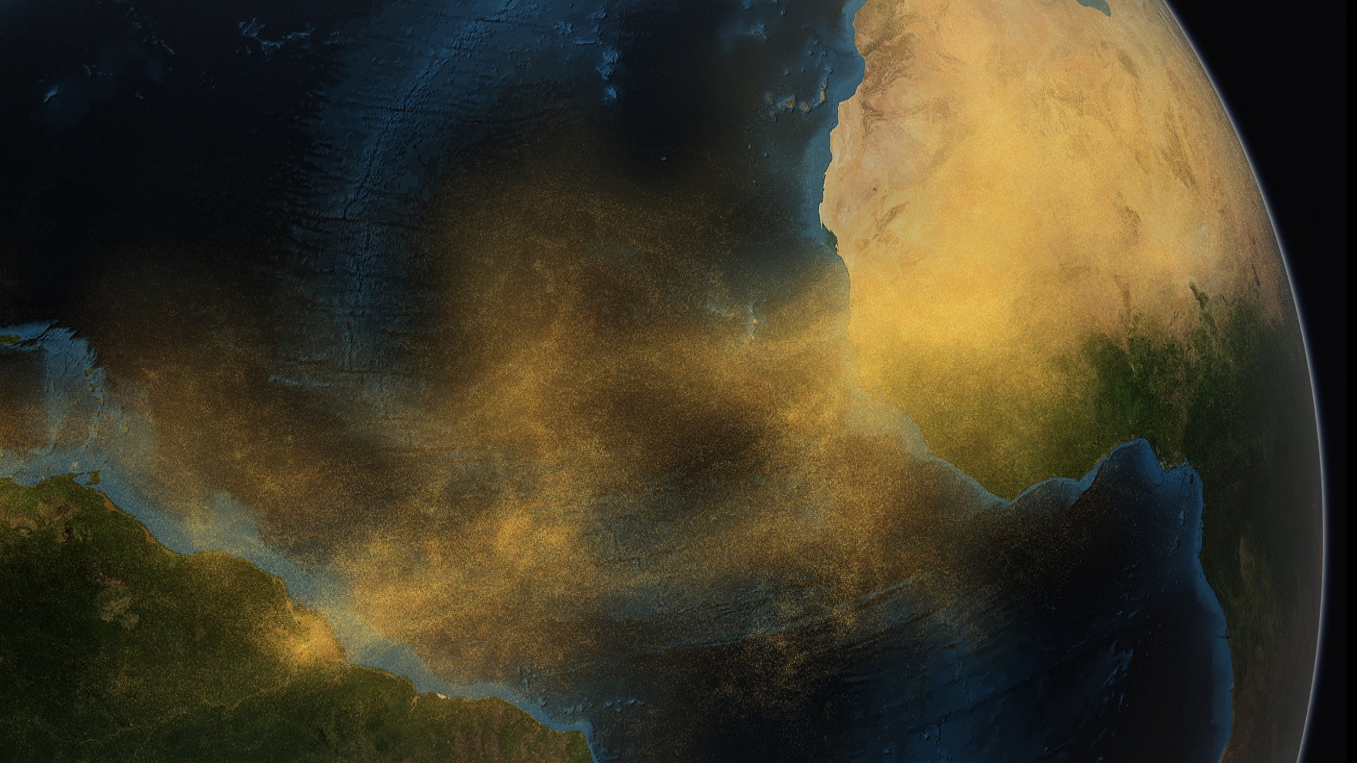
Particle extinction-to-backscatter ratio (lidar ratio) is a key parameter for a correct interpretation of elastic lidar measurements. Of particular importance is the determination of the lidar ratio of the Saharan Air Layer mineral dust transported into the free troposphere over the North Atlantic region. The location of the two sun photometer stations managed by the Izaña Atmospheric Research Centre (IARC) on the island of Tenerife and a decade of available micropulse lidar (MPL) data allow us to determine the lidar ratio under almost pure-dust conditions. This result can be considered representative of the Saharan dust transported westward over the North Atlantic in the subtropical belt.

Three different methods have been used to calculate the lidar ratio in this work: (1) using the inversion of sky radiance measurements from a sun–sky photometer installed at the Izaña Observatory (2373 m a.s.l.) under free-troposphere conditions; (2) the one-layer method, a joint determination using a micropulse lidar sited at the Santa Cruz de Tenerife sea-level station and photometric information considering one layer of aerosol characterized by a single lidar ratio; and (3) the two-layer method, a joint determination using the micropulse lidar and photometric information considering two layers of aerosol with two different lidar ratios. The one-layer method only uses data from a co-located photometer at Santa Cruz de Tenerife, while the two-layer conceptual approach incorporates photometric information at two heights from the observatories of Izaña and Santa Cruz de Tenerife. The almost pure-dust lidar ratio retrieval from the sun–sky photometer and from the two-layer method give similar results, with lidar ratios at 523 nm of 49 ± 6 and 50 ± 11 sr. These values obtained from a decade of data records are coincident with other studies in the literature reporting campaigns in the subtropical North Atlantic region. This result shows that the two-layer method is an improved conceptual approach compared to the single-layer approach, which matches the real lower-troposphere structure well. The two-layer method is able to retrieve reliable lidar ratios and therefore aerosol extinction profiles despite the inherent limitations of the elastic lidar technique.

We found a lack of correlation between lidar ratio and Ångström exponent (α), which indicates that the dust lidar ratio can be considered independent of dust size distribution in this region. This finding suggests that dust is, under most atmospheric conditions, the predominant aerosol in the North Atlantic free troposphere, which is in agreement with previous studies conducted at the Izaña Observatory.

Citation: Berjón, A., Barreto, A., Hernández, Y., Yela, M., Toledano, C., and Cuevas, E.: A 10-year characterization of the Saharan Air Layer lidar ratio in the subtropical North Atlantic, Atmos. Chem. Phys., 19, 6331-6349, https://doi.org/10.5194/acp-19-6331-2019, 2019.

READ THE ARTICLE

Photo credits: NASA-GSFC

Come and visit us at ISTP Toulouse

Come and visit us at ISTP Toulouse

Cimel is exhibiting at ISTP, the 11th edition of the International Symposium on Tropospheric Profiling in Toulouse, on 20-24 May 2019.

Come and visit our booth to discover our innovative Remote Sensing Solutions!

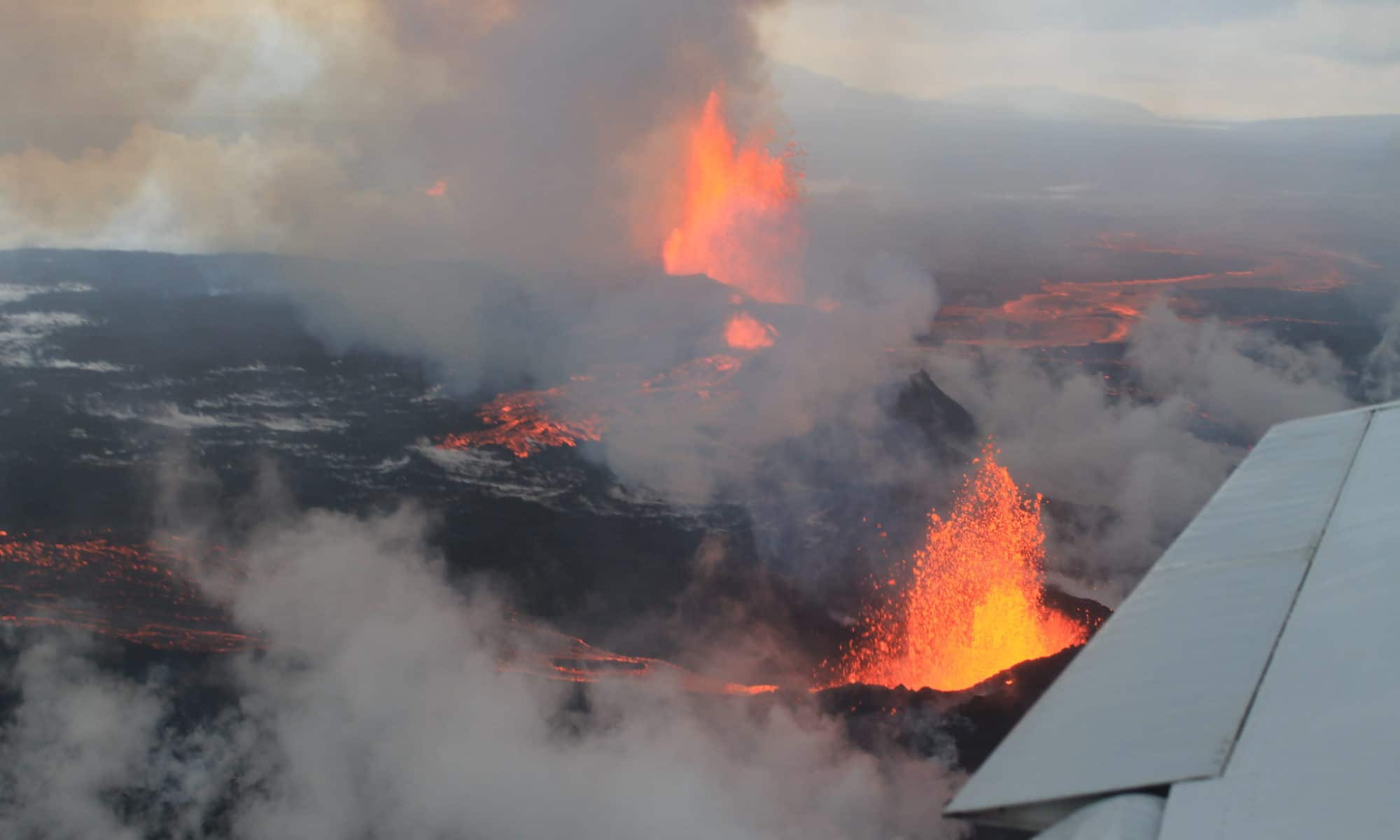
The plume of the Icelandic volcano Bardarbunga pollutes the air in the Nord – Pas de Calais

The plume of the Icelandic volcano Bardarbunga pollutes the air in the Nord – Pas de Calais

At the end of September 2014, the Nord – Pas de Calais region suffered an episode of heavy air pollution due to the eruption of the Icelandic volcano Bardarbunga, which has already been going on for more than a month.

The analysis of observations of the volcanic plume, obtained from the ground, thanks to CIMEL photometers and LiDAR, and by satellite, by a team of researchers, engineers and technicians from the Laboratoire d’optique atmosphérique (LOA, CNRS / Université Lille 1) in collaboration with the association for monitoring air quality atmo Nord – Pas de Calais, allowed them to describe the journey, from Iceland, of the volcanic plume and its arrival in the lowest layers of the French atmosphere.

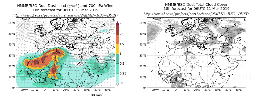
BSC Dust Daily Forecast – AAMS platform

CIMEL AAMS SENEGAL

BSC Dust Daily Forecast – AAMS platform

Aerosol particles are important and highly variable components of the terrestrial atmosphere, and they affect both air quality and climate. In order to evaluate their multiple impacts, the most important requirement is to precisely measure their characteristics.

Remote sensing technologies such as lidar (light detection and ranging) and sun/sky photometers are powerful tools for determining aerosol optical and microphysical properties. In our work, we applied several methods to joint or separate lidar and sun/sky-photometer data to retrieve aerosol properties. The Raman technique and inversion with regularization use only lidar data. The LIRIC (LIdar-Radiometer Inversion Code) and recently developed GARRLiC (Generalized Aerosol Retrieval from Radiometer and Lidar Combined data) inversion methods use joint lidar and sun/sky-photometer data.

Link to the article: click here

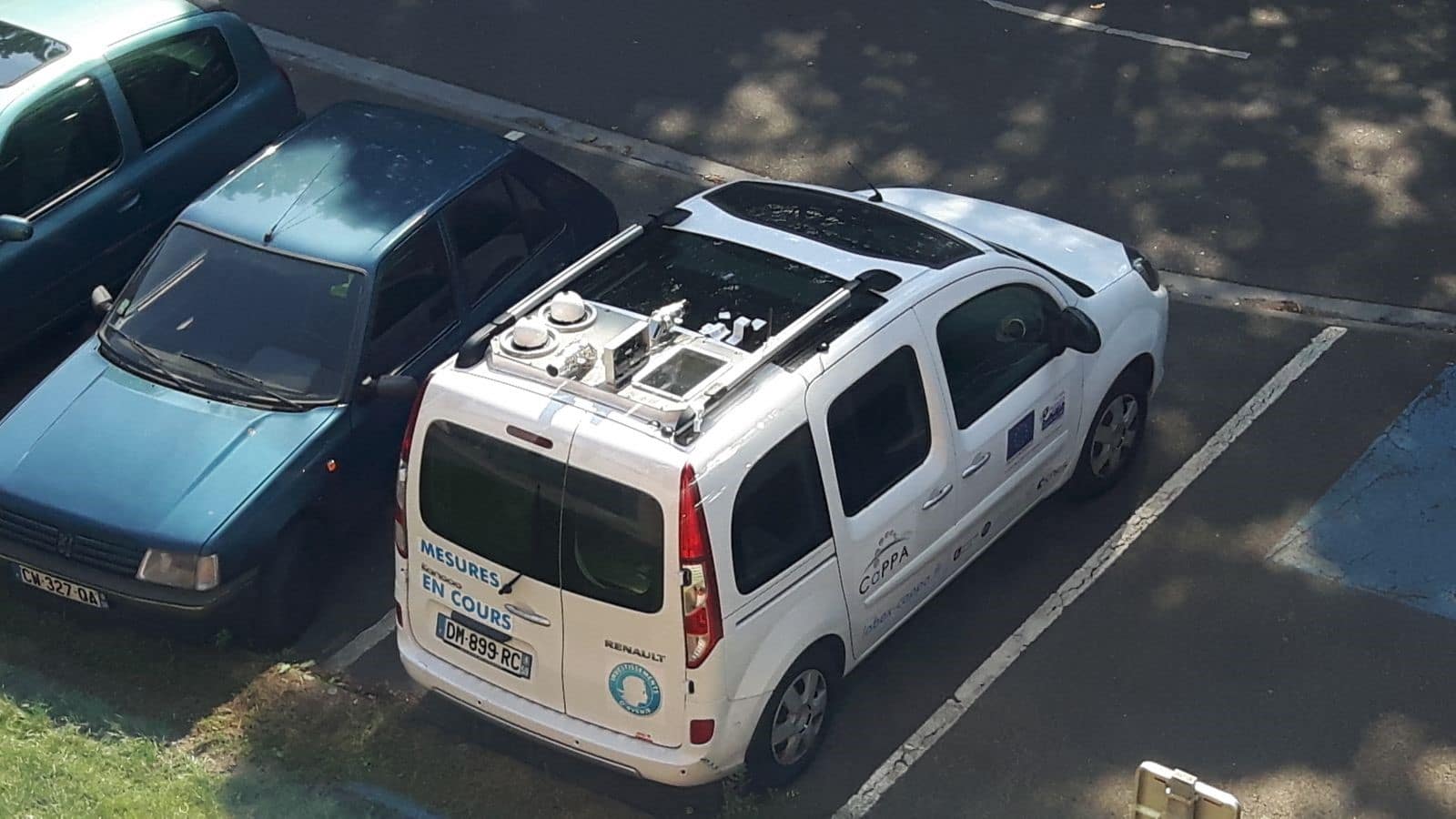
Mobile Automatic Aerosol Monitoring Solution project (M-AAMS)

Mobile Automatic Aerosol Monitoring Solution project (M-AAMS)

Mobile Automatic Aerosol Monitoring Solution project (M-AAMS)

The team of scientists left Lille on Monday morning, direction the « Observatoire de Haute Provence » located in Aix-en-Provence.

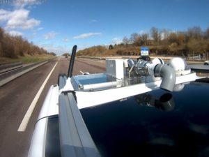
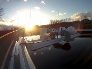
Along its trip, the car takes continuous measurements of the atmosphere.

Scientists on board follow them and make sure that all the instruments work properly. The car is not only equipped with a wide range of instruments, but also with a camera and an internet connexion: all needed to document the trip of the car in real time!

Follow the adventure of the #CaPPA_Mobile on twitter.

If the system has already been used locally, this time the route extends from Lille to Aix-en-Provence, nearly 1000 km. This experience is part of Ioana Popovici’s thesis work: “Measurement of aerosol variability at high spatial and temporal resolution, in connection with air quality, using an innovative mobile system. »

This time, the vehicle is equipped with a Cimel CE370 LiDAR (532 nm), the mobile PLASMA photometer (340-1600 nm), a granulometer (GRIMM) and a weather station.

The data collected by the mobile system is being analysed and validated. An inter-comparison of the data will be made with the data collected by the fixed measurement stations of the Haute Provence Observatory and the ATMO stations located along the route. Access to online data of the instrumented car.

The science team relied on good weather to collect as much data as possible. Although the sky cleared several times, clear, cloudless sky conditions were not frequently encountered. Under these circumstances it is difficult to carry out solar photometry measurements and to obtain additional information by combining LIDAR with a solar photometer. However, LIDAR has observed the vertical and spatial variability of the atmosphere. The observation was limited to about 2-3 km altitude by the presence of clouds over most of the trip.

A camera fixed on the roof of the car “confirms” the LIDAR measurements, as follows:

Spatio-temporal series LIDAR obtained between Lille and Valence on 28/03/2016

Aerosol measurements with shipborne sun-sky-lunar photometer and collocated multiwavelength Raman polarization lidar over the Atlantic Ocean

Aerosol measurements with shipborne sun-sky-lunar photometer and collocated multiwavelength Raman polarization lidar over the Atlantic Ocean

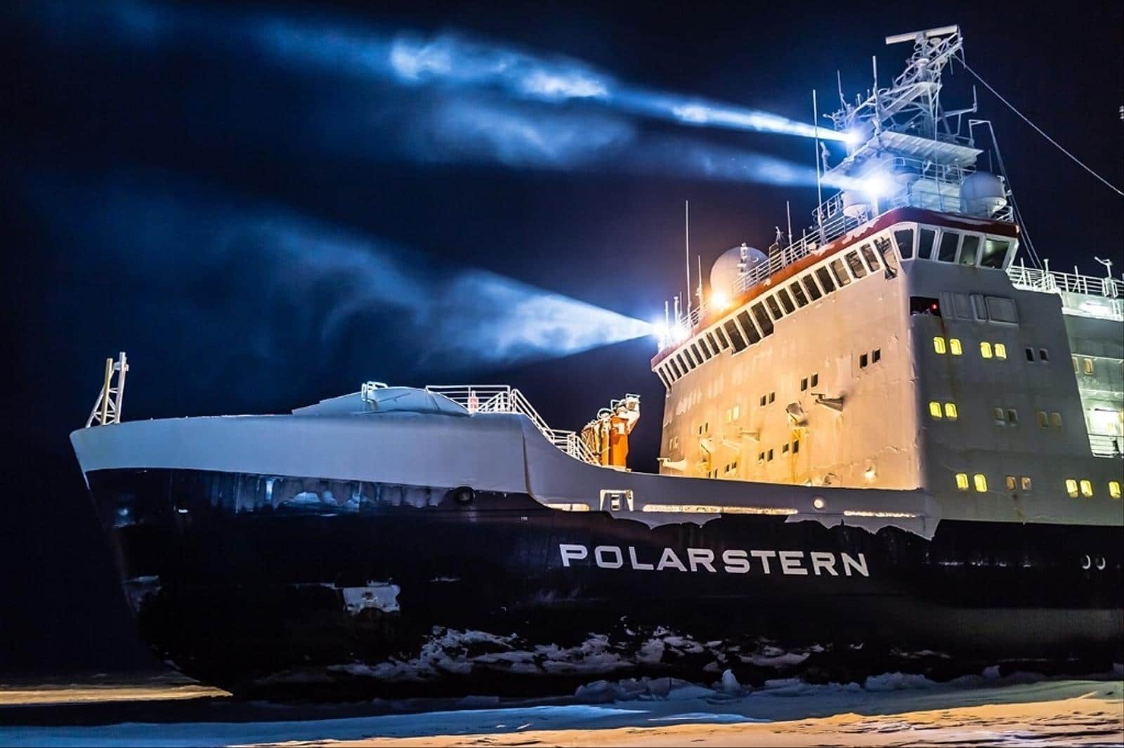
A shipborne sun-sky-lunar photometer was tested in two trans-Atlantic cruises aboard the German research vessel Polarstern from 54° N to 54° S. A full diurnal cycle of mixed dust-smoke episode measured with shipborne CE318-T is presented for the first time. Latitudinal distribution of AOD from the shipborne CE318-T, Raman lidar and MICROTOPS II shows the same trend with high values at 0 ~ 20° N dust transported belt and low values at Southern Hemisphere. Coefficient of determination for the linear regression between MICROTOPS II and shipborne sun-sky-lunar photometer was 0.993 for AOD at 500 nm and 0.896 for Ångström exponent at 440–870 nm.

Citation: Yin, Zhenping & Ansmann, Albert & Baars, Holger & Martin, Radenz & Jimenez, Cristofer & Engelmann, Ronny & Seifert, Patric & Herzog, Alina & Ohneiser, Kevin & Hanbuch, Karsten & Blarel, L & Goloub, Philippe & Dubois, Gael & Victori, Stephane & Maupin, Fabrice. (2019). Aerosol measurements with shipborne sun-sky-lunar photometer and collocated multiwavelength Raman polarization lidar over the Atlantic Ocean. Atmospheric Measurement Techniques Discussions. 1-21. 10.5194/amt-2019-132.  

READ THE ARTICLE

Photo: Alfred Wegener Institute/Stefan Hendricks