French LiDAR research: From fundamental science to industrial applications
A recent feature article published in Photoniques(issue 136) offers a broad overview of LiDAR remote sensing in France, covering the technology’s scientific foundations, current research directions, and ongoing efforts to translate laboratory developments into operational systems.
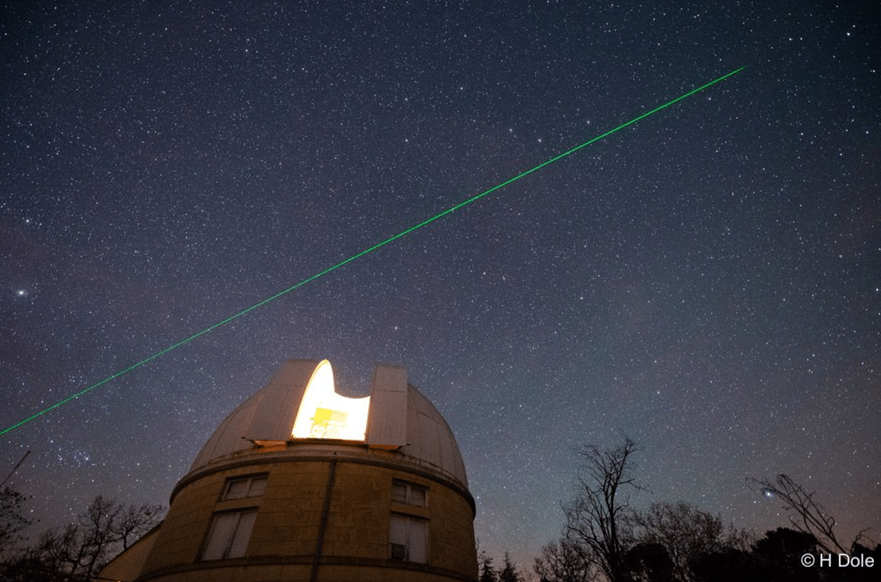
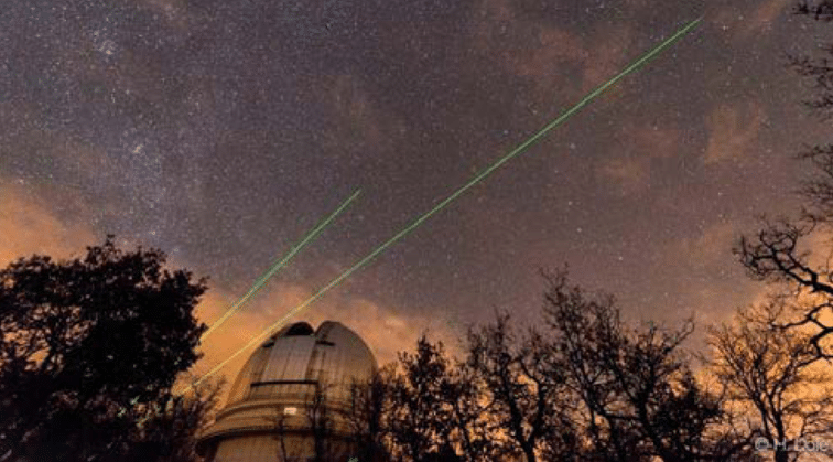
The article, co-authored by researchers from several leading French institutions, including ONERA, LATMOS, LOA, LMD, iLMand Thales, describes how LiDAR systems exploit the directional and spectral properties of laser light to measure atmospheric constituents, wind fields, aerosol distributions, and terrain topography. As illustrated by the photograph of a laser shot at the Observatoire de Haute-Provence (OHP), these systems operate across a wide range of platforms, from ground-based observatories to airborne and spaceborne configurations.
Photograph of a lidar measurement at the Haute Provence Observatory (OHP – Photo: Hervé Dole).
On the measurement side, the article discusses advances in both direct-detection and coherent-detection architectures. For atmospheric characterisation, techniques combining Raman scattering, elastic backscatter, polarimetry, and laser-induced fluorescence allow increasingly fine classification of aerosol types, distinguishing mineral dust, pollen, urban particles and smoke, as shown in the depolarisation–fluorescence diagram reproduced from recent ACTRIS network publications. Long-term ozone profile series measured at French observatories are noted as among the longest continuous records of their kind worldwide.
The article also highlights successful technology transfers from academic research to industry. In this context, the AGORA-Lab, a joint laboratory between LOAand CIMEL, is cited as an example of collaborative development that has led to compact, automated LiDAR instruments, including Raman and multi-wavelength fluorescence systems, now integrated within the ACTRIS European research infrastructure.
The national LiDAR HD programme, illustrated through a point cloud map of central Paris, demonstrates how these technologies are already being deployed at scale for land use, flood risk management and urban planning purposes.
The article concludes that while French LiDAR research maintains a strong international standing, further work on system miniaturisation, cost reduction and automation remains necessary to broaden industrial uptake.
To understand climate and improve weather forecasting, we must first understand aerosols. These tiny particles suspended in the atmosphere influence the Earth’s radiation balance, cloud formation, visibility, and the movement of air masses across the globe. Over the oceans, their role is especially important. And yet, these immense marine expanses remain among the least documented regions on Earth when it comes to continuous atmospheric observations.
That is what makes the Persévérance campaign so exceptional.
Conceived by explorer Jean-Louis Etienne, Persévéranceis a polar-capable schooner designed to support scientific missions in remote marine regions, where observations are rare and logistics remain challenging. By operating far from permanent stations and conventional routes, it offers a unique opportunity to collect valuable environmental data in areas that are still sparsely documented.
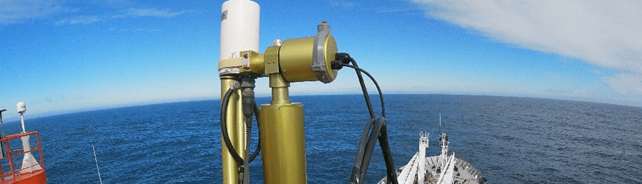
Figure 1 – Example of autonomous shipborne photometer operation over the open ocean.
On board, a CIMEL CE318 photometer operated autonomously throughout the voyage, performing day-and-night aerosol observations over the open ocean. Tracking the Sun by day and the Moon by night, the instrument transformed the vessel into a moving atmospheric observatory. Quietly and continuously, it captured the optical signature of aerosols across regions of the world where few instruments ever operate with such regularity.
This deployment is remarkable not only because of the challenge of operating an automatic photometer at sea, but because of the scientific value of the route itself. The open ocean remains one of the great blind spots of atmospheric observation. In these remote marine regions, every reliable measurement is precious for documenting aerosol background conditions, tracking long-range transport, improving satellite validation, and strengthening meteorological and climate studies.
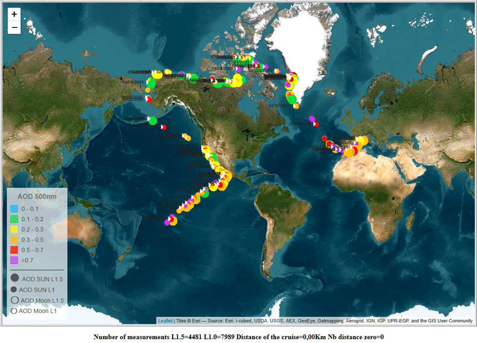
Figure 2 – PHOTONS Mobile campaign snapshot for Persévérance (TourDuMonde #1443), showing the route and measurement record.
The campaign also reflects the strength of the scientific framework behind these observations. The data are part of the PHOTONS / AERONET ecosystem, with PHOTONSrepresenting the French component of AERONETand LOA/CNRS in Lille playing a central role in aerosol observation and photometric data processing. Through this broader international framework, measurements collected far from land acquire even greater value: they can be compared, interpreted, and integrated into a long-term effort to better understand the atmosphere on a global scale.
In this sense, Persévérance was not simply crossing oceans. It was helping reveal them – not only as routes of travel and exploration, but as atmospheric frontiers still waiting to be observed in greater detail.
By extending aerosol monitoring beyond fixed land-based stations, the CE318 deployment aboard Persévérance contributes to a more complete picture of the marine atmosphere. It is a reminder that some of the most valuable observations are still made at the edge of the map, where science follows exploration, and where each measurement brings us closer to a better understanding of climate and weather.
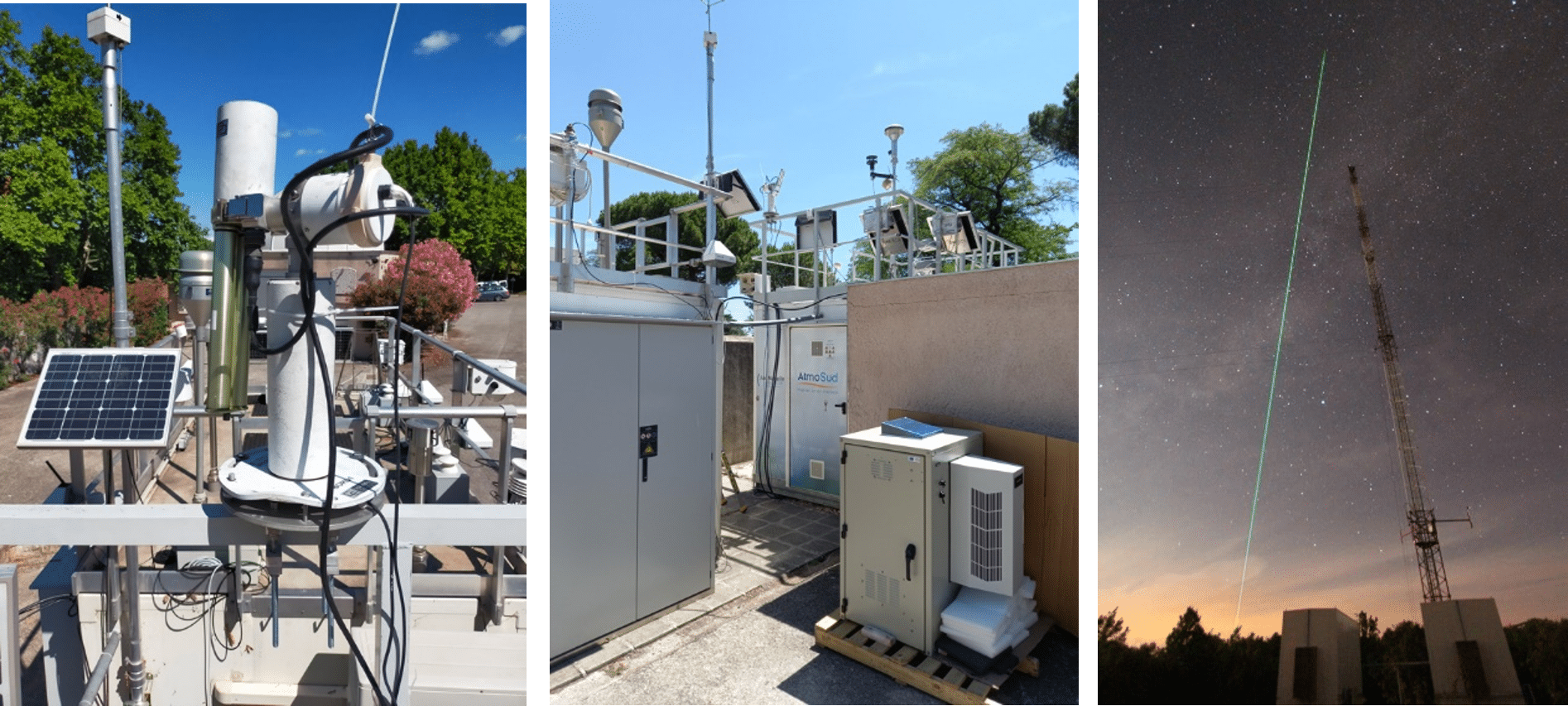
CIMEL instruments supporting urban air quality and atmospheric process studies across ATMOSUD and OHP reference sites
ATMOSUD operates a network of long-term atmospheric reference sites in Southern France dedicated to air quality and greenhouse gas studies. These super sites combine in situ measurements, remote sensing observations and modelling tools to better understand pollutant dispersion, atmospheric mixing and emission reduction scenarios at the metropolitan scale.
Within this framework, CIMEL Automatic Aerosol Monitoring Solutions (AAMS) play a key role by providing continuous, high-quality observations of both the vertical and column-integrated structure of the atmosphere.
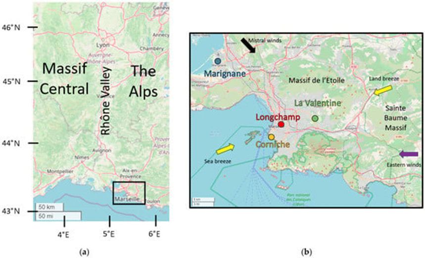
Figure 1. Map of the SUD–PACA region (left, (a)) and zoomed in on Marseille (right, (b)) showing the location of the measurement stations (blue: Marignane (AER), orange: Corniche (COR), red: Longchamp (LCP), green: La Valentine (LAV)). Arrows in yellow, black, and purple indicate the main wind regimes over the study periods, respectively, sea/land breezes (28%), mistral winds (21%), and eastern winds (17%).
Marseille–Longchamp: an urban reference site for air quality applications
The Marseille–Longchamp site, located in the city centre, is a flagship ATMOSUD urban reference observatory. It captures air quality conditions in a dense urban environment strongly influenced by local emissions, complex meteorology and coastal effects.
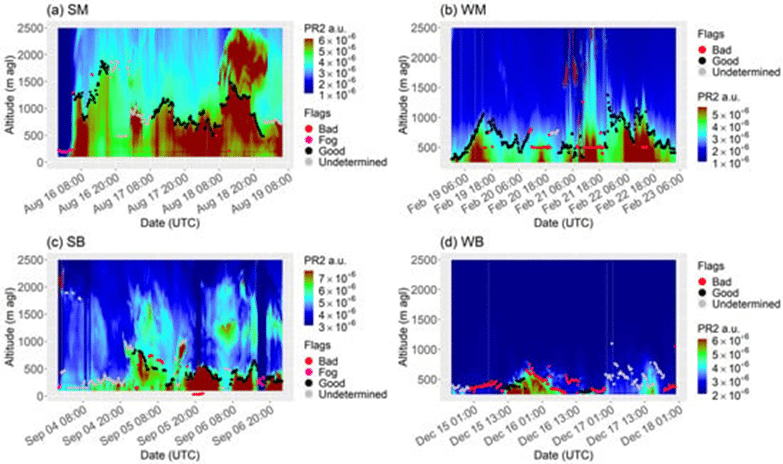
A CIMEL CE376 aerosol LiDAR is deployed on the rooftop of the site to continuously monitor atmospheric vertical structure, with a particular focus on atmospheric boundary layer height (ABLH). This parameter is a key driver of pollutant dilution and accumulation in cities. LiDAR observations reveal strong contrasts between wind regimes, such as mistral conditions inducing intense turbulence and deeper mixing layers, and sea–land breeze situations associated with shallow boundary layers and pollutant buildup. These LiDAR-derived mixing height observations provide essential physical context for the interpretation of in situ air quality measurements, strengthening the operational and scientific value of the Marseille–Longchamp site.
Figure 2. Time series of the green channel PR2 for the SM event (a), the WM event (b), the SB event (c), and the WB event (d). Color dots represent the ABLH (pink, black, red, and gray stand for fog, good, bad, and undetermined flags, respectively).
Complementing the LiDAR, a CIMEL CE318 sun photometer provides long-term measurements of aerosol optical properties, contributing to the characterization of the atmospheric column above the urban area.
Figure 3 : Picture of the CE318-T photometer at Marseille–Longchamp site.
Complementary sites: urban, coastal and rural altitude observations
Beyond Marseille–Longchamp, ATMOSUD and its scientific partners operate complementary reference sites covering contrasted environments, including coastal and industrial areas and the Observatoire de Haute-Provence (OHP), a rural high-altitude site representative of background atmospheric conditions.
The OHP site plays a central role in regional atmospheric studies by documenting free-tropospheric conditions, long-range transport and baseline aerosol and gas concentrations. The scientific collaboration between ATMOSUD and OHP enables a consistent interpretation of observations across environments, from urban emission-dominated areas to rural background conditions.
Across this network, CIMEL instruments ensure observational continuity, allowing comparisons between sites and supporting studies of local versus regional contributions to air quality and greenhouse gas signals.
From observations to applications
Data collected at ATMOSUD and OHP super sites feed a wide range of applications, including:
interpretation of urban air quality measurements,
analysis of pollutant accumulation and dilution regimes,
support to atmospheric modelling,
evaluation of metropolitan-scale emission reduction scenarios.
By integrating CE376 LiDAR vertical profiling and CE318 photometer column observations within operational reference sites, CIMEL’s AAMS contributes directly to advancing air quality monitoring and atmospheric process understanding in complex urban and regional environments.
Bibliography
Xueref-Remy, I., Riandet, A., Bellon, C., Khaykin, S., Blanc, P.-E., Gomez, F., Armengaud, A., Gille, G., Popovici, I., Pascal, N., Podvin, T., and Goloub, P.: Continuous monitoring of atmospheric aerosols by LIDAR remote sensing technics in the south-east of France at the Observatoire de Haute Provence and Marseille Longchamp sites in the framework of ACTRIS-France and of the ANR COoL-AMmetropolis project., EGU General Assembly 2022, Vienna, Austria, 23–27 May 2022, EGU22-3126, https://doi.org/10.5194/egusphere-egu22-3126, 2022.
Riandet, A., Xueref-Remy, I., Popovici, I., Lelandais, L., Armengaud, A., & Goloub, P. (2023). Diurnal and Seasonal Variability of the Atmospheric Boundary-Layer Height in Marseille (France) for Mistral and Sea/Land Breeze Conditions. Remote Sensing, 15(5), 1185. https://doi.org/10.3390/rs15051185
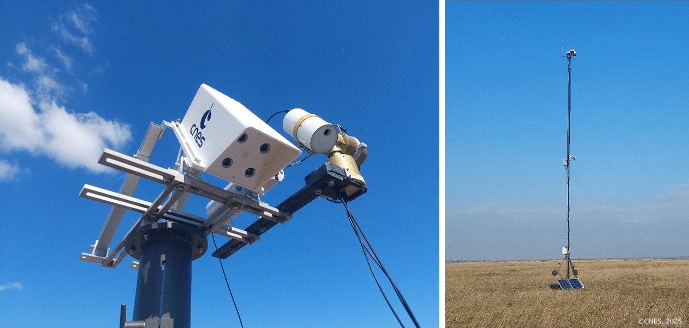
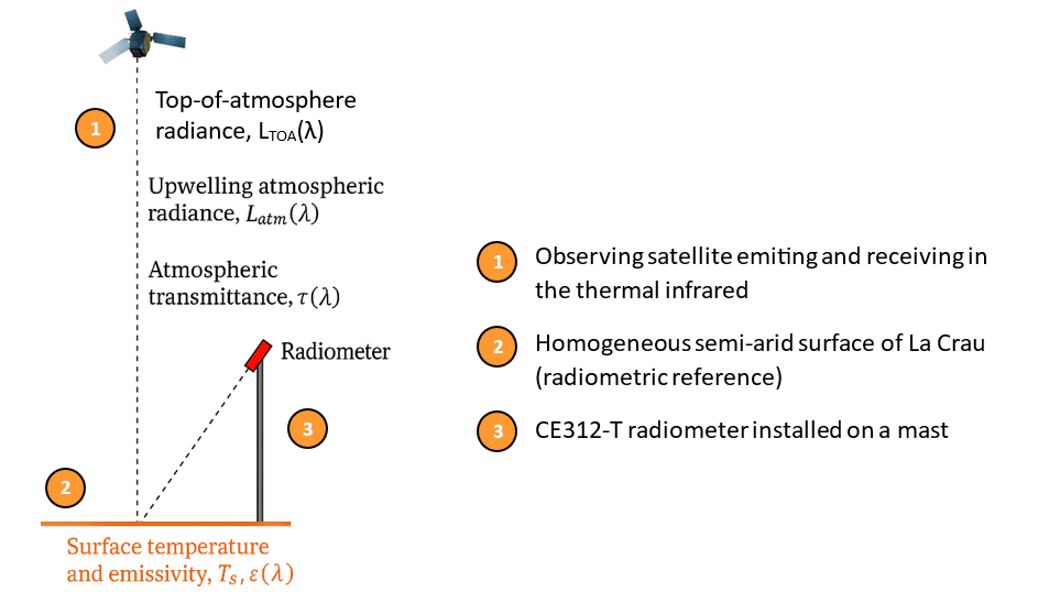
In June 2023, the new robotized version of the CE312 thermal infrared radiometer was installed on a dedicated mast at the La Crau reference site, one of CNES’s strategic Calibration and Validation (CAL/VAL) locations for current and next-generation thermal satellite missions. This installation marks a significant reinforcement of France’s long-term capability to generate the high-quality ground truth data required to validate Land Surface Temperature (LST) and surface emissivity products with scientific rigor.
The CE312 provides high radiometric accuracy, excellent thermal stability and a fine angular sampling capability that directly supports advanced thermal remote sensing applications. Its multispectral thermal channels and differential measurement principle deliver traceable radiances and brightness temperatures, forming the quantitative foundation for stringent LST product validation. The robotized head adds an essential dimension: automated multi-angle observations. These directional measurements are critical for Temperature–Emissivity Separation (TES) techniques, characterization of surface anisotropy, and the reduction of emissivity-related uncertainties that remain a long-standing challenge in comparing in situ measurements with satellite-derived LST.
Inspired by established ground-based networks such as AERONET for aerosol optical properties and RadCalNet for surface reflectance and BRDF reference measurements, the CE312 installation extends this philosophy to the thermal domain, enabling consistent, traceable multi-angle observations of ground surfaces for enhanced satellite CAL/VAL.
Integrated into CNES’s CAL/VAL strategy, the CE312 now contributes to cross-sensor thermal product intercomparisons, supports the preparation of new missions such as TRISHNA, and provides datasets used in agriculture, hydrology and land–atmosphere energy flux modeling.
La Crau is part of the international TIRCalNet initiative, which aims to establish a harmonized network of ground reference sites for thermal infrared calibration and validation. Within this network, La Crau provides:
Well-characterized surface temperature and emissivity measurements for generating reference top-of-atmosphere (TOA) signals.
Traceable, stable datasets that help verify and cross-calibrate satellite radiometers.
Multi-angle, in situ observations used to reduce LST and emissivity uncertainties and to improve algorithm robustness across missions.
TIRCalNet targets TOA brightness temperature uncertainties on the order of 0.5 K, and the CE312’s radiometric performance and robotic acquisition geometry at La Crau directly support this objective.
Since mid-2023, the CE312 has operated continuously, enhancing the long-term radiometric archive of La Crau, a semi-arid area well known for its stability and suitability for thermal infrared validation. Its directional and multispectral measurements underpin more reliable satellite LST retrievals and strengthen continuity across current and future thermal missions.
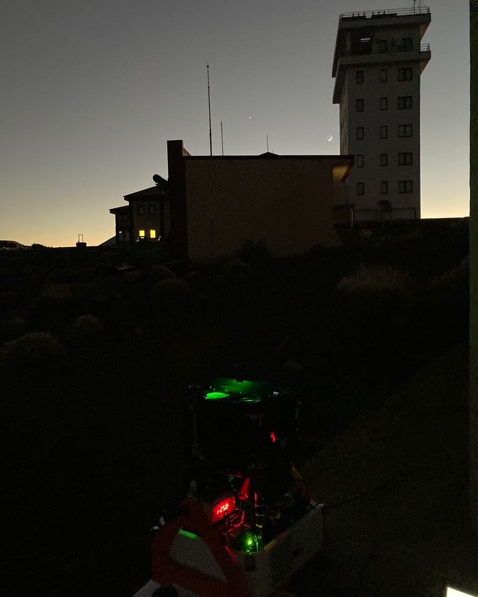
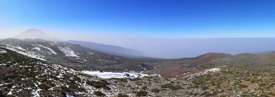
High above the clouds in the Canary Islands, scientists at the Izaña Observatory (AEMET) are using the CE376 LiDAR to explore the vertical structure of the atmosphere with unprecedented detail. This advanced instrument allows the aerosol science team to monitor aerosols moving across the Atlantic Ocean, providing critical insights into climate, air quality, and weather processes.
The CE376 is a compact dual-wavelength depolarization elastic lidar (532 and 808 nm). Its continuous monitoring capability makes it particularly valuable for atmospheric research. By analyzing data from both channels, the instrument provides detailed information on aerosol properties, allowing our team to capture the vertical distribution and dynamics of aerosols with unmatched precision.
Every day, the CE376 monitors Saharan dust events as they sweep across the Atlantic, revealing how mineral particles interact with clouds and affect radiation. Over time, it has also recorded comprehensive data on various aerosol types, including volcanic sulfate aerosols from the Cumbre Vieja eruption in September 2021, the devastating wildfire event on the island in August 2023, as well as long-range transported, aged wildfire plumes originating from Canadian wildfires during the late spring seasons. These observations have highlighted clear differences in particle size, shape, and optical properties, demonstrating the CE376’s suitability for continuous monitoring and characterization of both the temporal and vertical evolution of atmospheric aerosols.
Fig 1. MODIS VIS channel satellite image showing the Saharan dust over the Canary Islands on 20 August 2020.
Looking ahead, our team is continuously advancing the integration of CE376 lidar data together with sun photometer and in-situ measurements, while appliying sophisticated retrieval techniques such as GRASP (Generalized Retrieval of Aerosol and Surface Properties). This ongoing collaborative synergy is contributing to a more comprehensive understanding of aerosol optical properties and their effects on radiative forcing and regional climate.
More than just an instrument, the CE376 serves as a window into the atmosphere, revealing processes invisible to the naked eye but essential for science, society, and our understanding of a changing climate.
Fig 2. Saharan Air layer reaching the Izaña Observatory (AEMET). Courtesy of Conchy Bayo (AEMET)
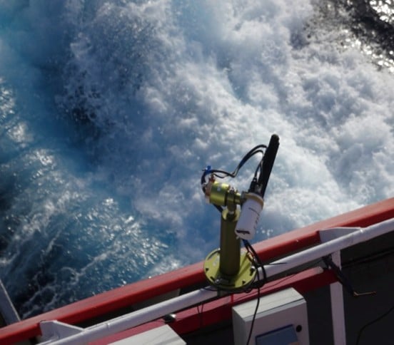
In 2023, NASA and NOAA launched a groundbreaking Atlantic campaign, placing an automated, AERONET-compatible sun photometer aboard a research vessel for the first time. The goal was simple but ambitious: collect high-quality aerosol optical depth (AOD) data over ocean regions, long neglected by traditional land-based monitoring networks. By measuring directly from the sea, scientists could fill a critical observational gap and strengthen satellite validation where fixed stations are sparse.
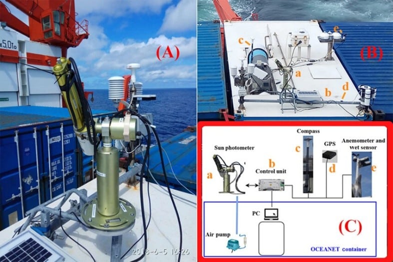
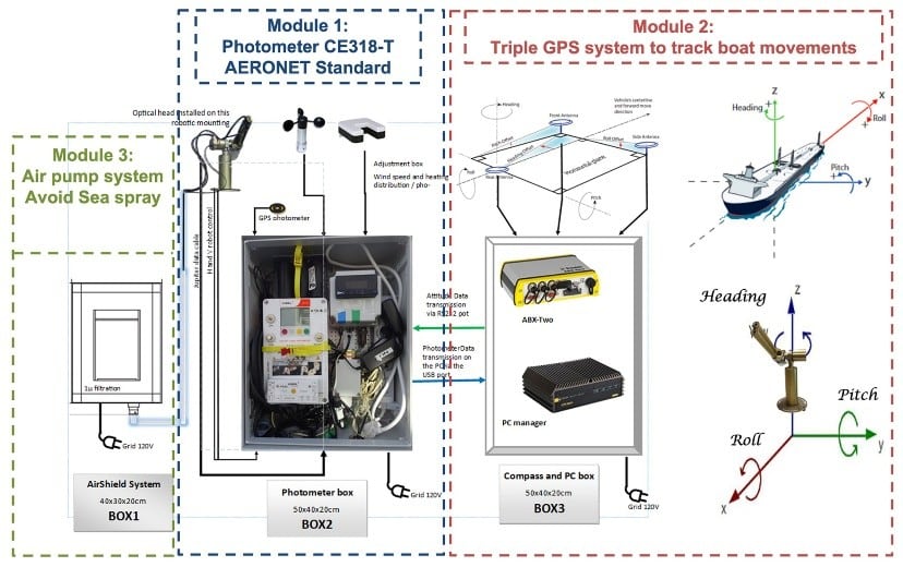
The instrument, a CIMEL CE318‑T, was specially adapted for shipborne deployment. Engineers stabilized it against vessel motion, added protective enclosures to withstand sea spray, and updated the firmware to maintain accurate sun-tracking and sky radiance measurements. Calibrations were aligned with AERONET protocols, ensuring the data matched the rigorous standards of land-based sites.
Adapted CIMEL CE 318‑T photometer installed on the vessel, stabilized against motion and protected from spray
Voyage across the Atlantic
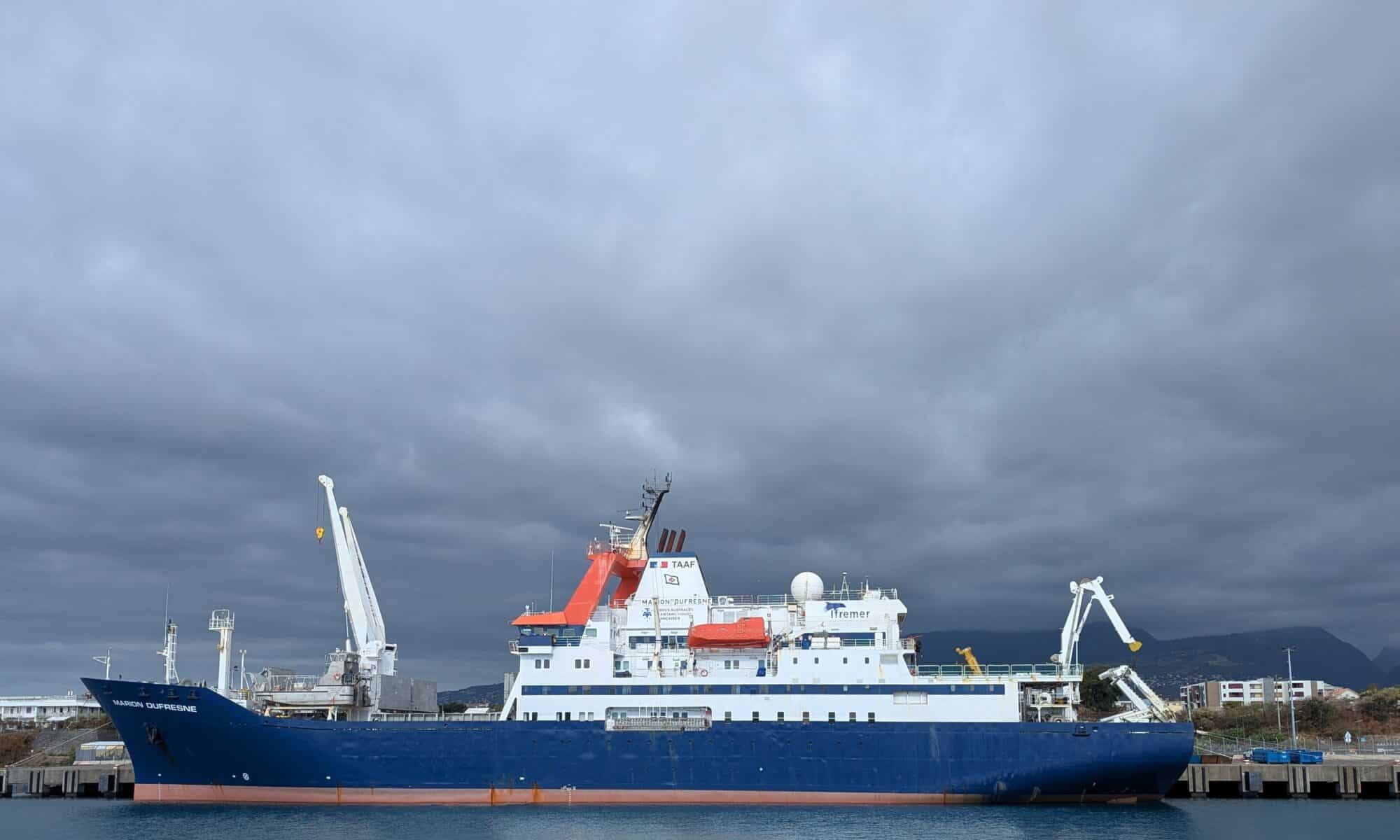
Aboard the RV Marion Dufresne, the photometer captured aerosol characteristics along a route stretching from the tropical Atlantic, across the Intertropical Convergence Zone (ITCZ), and into the mid-latitudes. The ship crossed the ITCZ three times, recording interactions between Saharan dust, marine aerosols, and cloud systems. Over the three-year period, the dataset revealed patterns of episodic dust transport, background sea-spray, and long-range aerosol variability.
The campaign was conducted in close collaboration with the LOAthrough the AGORA-Lab, which ensured data quality control, calibration traceability, and scientific analysis in coordination with NASA’s AERONET team.
RV Marion Dufresne cruise track across the Atlantic, showing key aerosol sampling regions.
Key insights include:
Shipborne AOD retrievals were on par with established AERONET sites, confirming data quality.
The measurements provide essential reference points for satellite sensors like PACE and support improved aerosol transport modeling.
Bridging the gap in ocean observations
Oceanic aerosol measurements are scarce but essential for accurate climate modeling and satellite validation. By deploying high-precision, automated photometers on ships, NASA and NOAA created a bridge between sparse ground stations and satellite footprints. This approach allows for continuous monitoring, capturing both episodic events like dust storms and consistent background conditions.
The campaign also sets a template for future maritime aerosol monitoring. Plans include deploying similar instruments on additional vessels, extending geographic coverage, and integrating vertical profiling systems or unmanned aerial platforms. Data are archived in standardized formats and made publicly available, ensuring the scientific community can leverage the measurements for satellite match-ups, climate model validation, and process studies.
By venturing directly into the Atlantic, NASA and NOAA have opened a new chapter in aerosol observation. This initiative not only fills a critical gap in global monitoring but also enhances our understanding of aerosol-cloud-climate interactions in remote ocean regions.
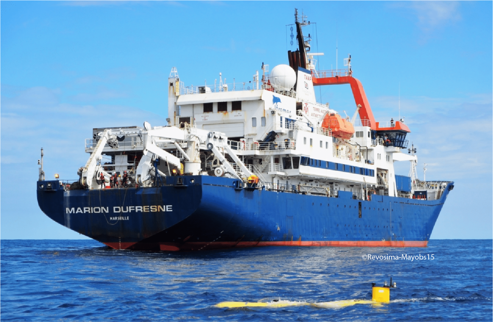
In April–May 2023, the French research vessel Marion Dufresne II set sail from La Réunion Island toward Barbados on a unique mission: the TRANSAMA campaign (Transit to AMARYLLIS-AMAGAS). As part of the MAP-IO program (Marion Dufresne Atmospheric Program–Indian Ocean), this expedition aimed to deepen our understanding of aerosols — tiny particles suspended in the atmosphere – and their behavior over the open ocean.
Aerosols, whether transported from distant continents or generated locally, play a critical role in cloud formation, sunlight reflection, and climate dynamics. Yet, their behavior over the oceans remains poorly documented due to the logistical challenges of conducting continuous measurements at sea. TRANSAMA was designed to fill this gap by deploying state-of-the-art instrumentation capable of capturing both column-integrated and vertically resolved aerosol data in a fully autonomous, shipborne environment.
To meet this challenge, CIMEL collaborated closely with the Laboratoire d’Optique Atmosphérique (LOA) through their joint research structure,AGORA-Lab, which coordinated and supported all the instrumental installations aboard the ship.
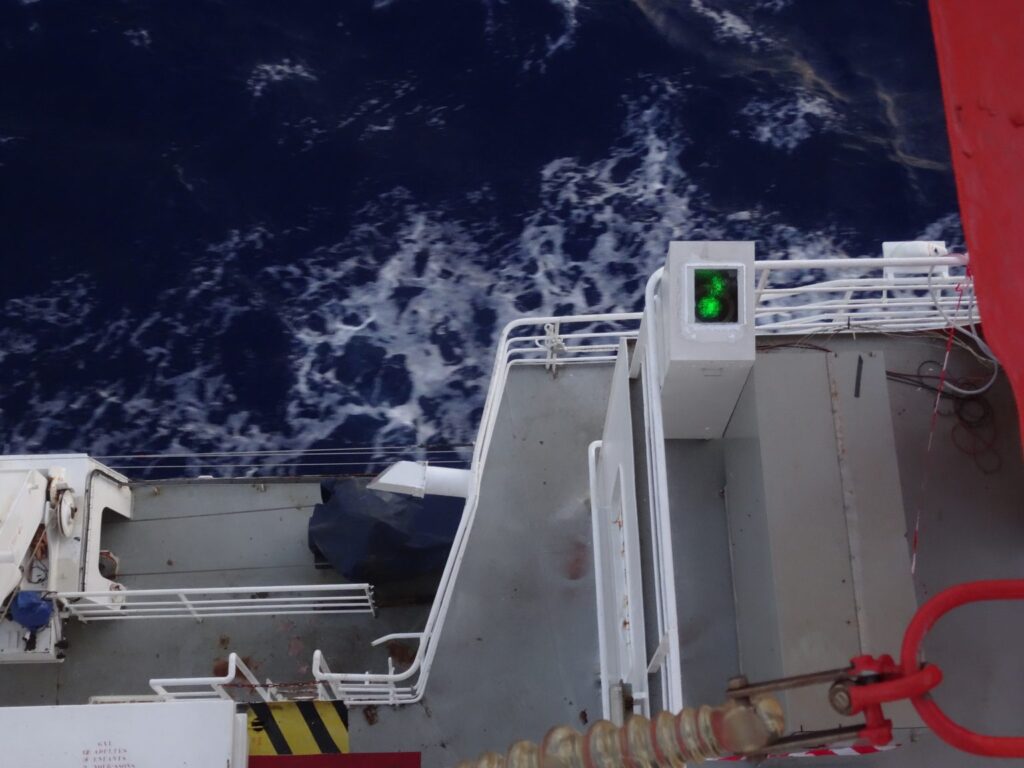
Two CIMEL instruments formed the backbone of this observational campaign. The CE318-T Sun/Sky-Lunar photometer, set up permanently on board the ship since 2021, continuously recorded aerosol optical depth and particle size distribution during daylight hours, while the micro-LiDAR scanned the vertical structure of the atmosphere, revealing the layering of aerosols and their interactions with clouds.
Installed on the deck and carefully adapted for marine conditions, these instruments worked in harmony, providing a detailed picture of the atmosphere above the Atlantic.
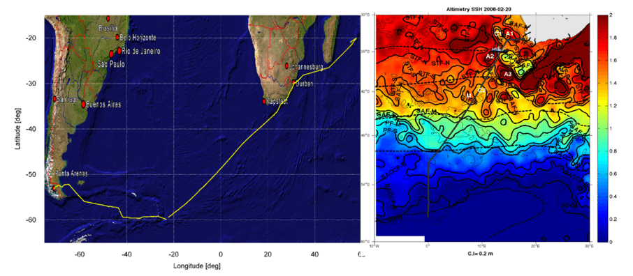
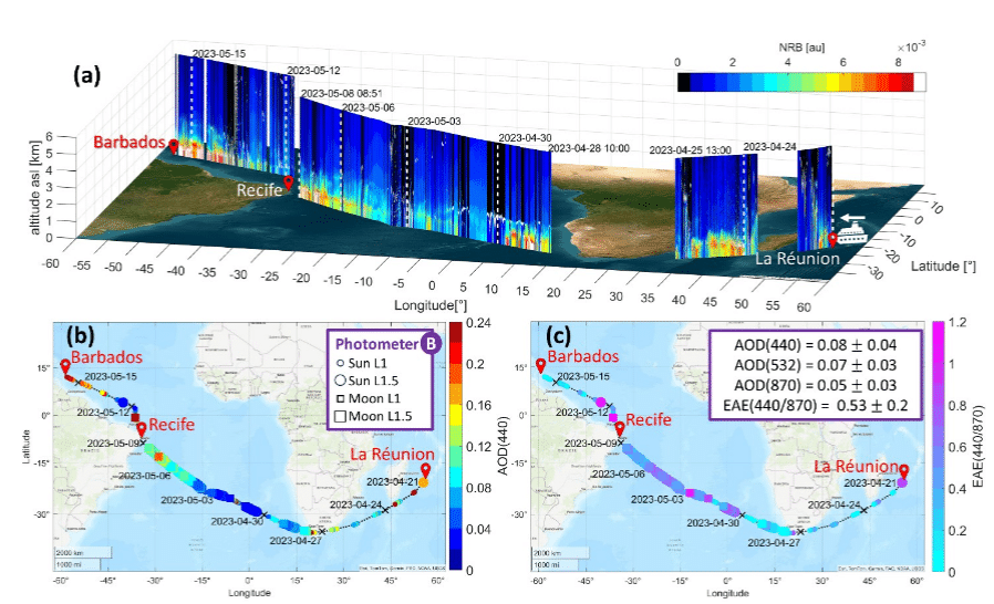
Spatio-temporal variability of aerosol properties during the TRANSAMA campaign (21 April–15 May 2023) aboard the RV Marion Dufresne II. Measurements were conducted along the route from La Réunion Island to Barbados. (a) 3D variation of NRB at 532 nm from lidar measurements overlaid on a true-color image of the covered regions. (b) AOD at 440 nm and (c) EAE at 440/870 nm derived from photometer observations, displayed on topographic maps. Photometer data include L1 and L1.5 solar and lunar observations. Red345 pins mark the ports at Le Port (La Réunion), Recife (Brazil), and Bridgetown (Barbados).
Each observation contributed to a growing dataset that bridges the gap between local measurements and global atmospheric models.
Following the success of the 2023 campaign, the set up of a new CE376 lidar aboard Marion Dufresne in the framework of the OBS4CLIM project is scheduled for late October 2025. Once the lidar will be set up on board the vessel, it will record regular mobile measurements during the ship’s rotations from La Réunion island to the French Southern and Antarctic Lands (TAAF). These next voyages will further extend the temporal coverage of aerosol observations and help scientists understand the seasonal variations and long-range transport processes over the Indian and Atlantic Oceans.
NASA-ARSET reveals how AERONET contributes to air quality and climate applications
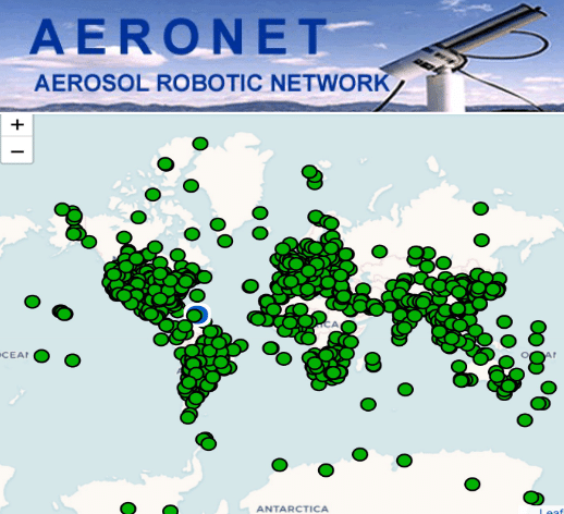
Ground-based networks such as AERONET play a crucial role in atmospheric science and air quality monitoring. During its latest NASA ARSET training titled “Atmospheric Composition Ground Networks Supporting Air Quality,” AERONET was showcased as a global benchmark in providing high-quality aerosol optical data for researchers, air quality managers, and decision-makers.
CIMELCE318-T photometer enables fully autonomous, standardized, and long-term aerosol monitoring across diverse environments—from megacities to deserts and polar regions. With over 600 stations in 80+ countries, AERONET has become a global reference in satellite validation and atmospheric composition studies.
The ARSET training session reveals:
How ground-based observations complement satellite missions
The role of AERONET in policy-relevant applications
Global data integration: As part of AERONET, CE318-T data integrates into a global network, allowing users to compare and access high-quality, standardized aerosol data worldwide, enhancing research with broader data context.
Real-time data accessibility: AERONET provides near real-time data processing and availability on its online platform, allowing end-users to access and analyze current aerosol measurements efficiently.
High-quality data: CE318-T photometers within AERONET are regularly calibrated at NASA’s calibration facilities, ensuring consistent, reliable, and high-quality data that meet strict scientific standards.
Comprehensive aerosol data products: AERONET processes raw CE318-T measurements to deliver aerosol properties like aerosol optical depth (AOD), particle size distribution, and water vapor content, providing users with valuable insights without needing to process the raw data manually.
Research collaboration opportunities: By participating in AERONET, end-users gain access to a collaborative network of scientists and research institutions globally, fostering opportunities for joint research projects and data sharing.
Data validation for satellite missions: AERONET data is widely used to validate satellite aerosol measurements, allowing end-users to contribute to and benefit from satellite-derived aerosol research and applications in atmospheric studies.
Recognition and credibility: Being part of AERONET enhances the credibility of the data collected, as the network is globally recognized in atmospheric sciences, potentially increasing the impact and visibility of users’ research.
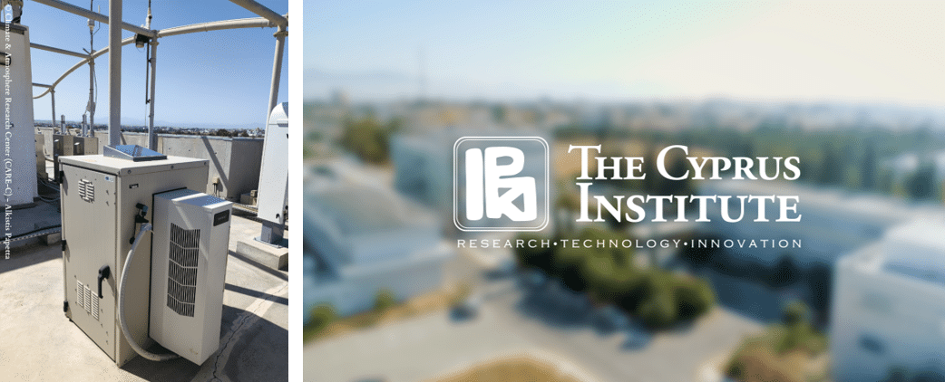
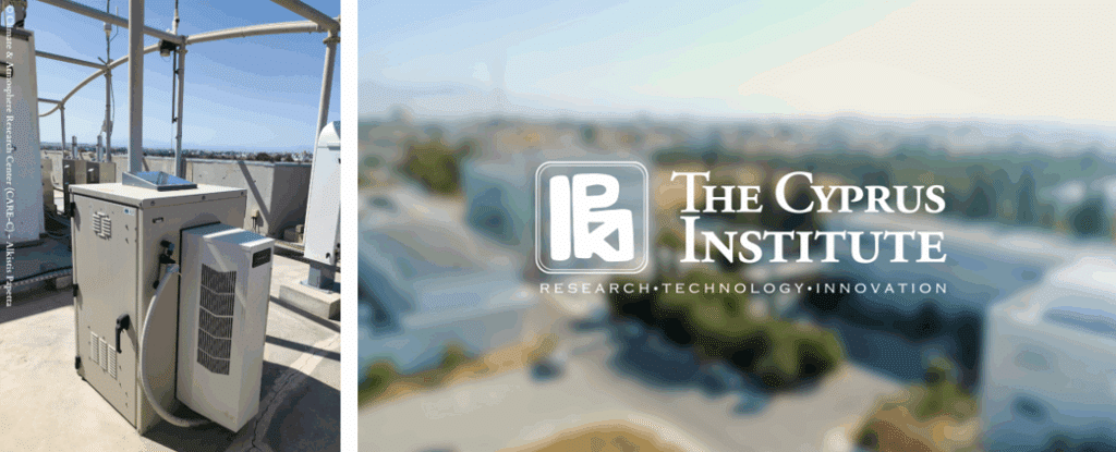
CIMEL CE376 Lidar Strengthens Aerosol and Dust Monitoring at the Cyprus Institute
Nicosia, Cyprus –June 2025
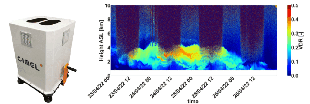
TThe Cyprus Institute’s Climate and Atmosphere Research Center (CARE-C) continues to enhance its atmospheric observation capabilities with the CIMEL CE376, a compact, automatic aerosol lidar system providing high-resolution vertical profiles of aerosols and dust over the Eastern Mediterranean.
Installed on the institute’s rooftop platform, the CE376 has been operating continuously since late 2021, supporting advanced research and real-time environmental monitoring as part of the EMME-CARE project.
Advanced Technical Features:
Dual-wavelength operation at 532 nm and 808 nm.
Polarization channel at 532 nm for depolarization ratio retrievals.
Vertical range: Up to 10 km in daytime and 18 km at night.
Vertical resolution: 15 m; Temporal resolution: 1 s.
This system is designed to be compact and energy-efficient, suitable for continuous, remote, and even mobile operations — ideal for climate-sensitive regions like the Eastern Mediterranean and the Middle East.
Accurate Dust and Aerosol Profiling
The CE376 provides real-time vertical profiles of:
Particle backscatter and extinction coefficients
Volume depolarization ratios for aerosol typing
Planetary boundary layer (PBL) height estimation
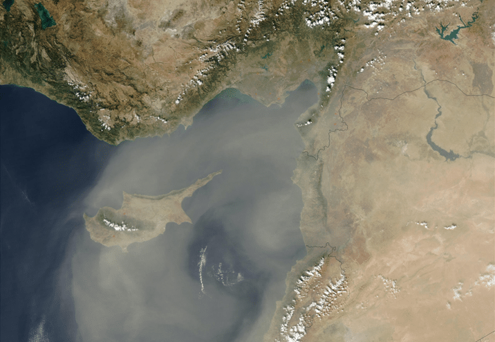
Recent observations show the lidar’s capacity to clearly distinguish between clean atmospheric layers and dust intrusions originating from North Africa. Notably, during spring 2024, several Saharan dust events were recorded over Cyprus, with elevated layers reaching above 5 km and enhanced depolarization ratios indicating non-spherical particles consistent with mineral dust.
Calibration and Data Quality
An internal calibration and data correction procedure has been implemented to ensure the high accuracy of depolarization ratio measurements. Molecular depolarization values are now well-aligned with theoretical expectations (~0.0033), allowing for robust identification and classification of aerosol types.
The processed and corrected data are openly available via the Cyprus Institute’s EMME-CARE Upper-Air Data Portal, providing the scientific community and policymakers with vital insights into aerosol dynamics, air quality, and climate interactions across the region.
The site also hosts a CIMEL CE318-T photometer as part of the AERONET network, enabling valuable synergy with the CE376 for improved aerosol classification and dust monitoring.
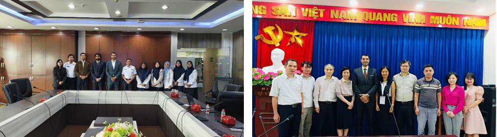
As part of the official visit of French President Emmanuel Macron to Southeast Asia in May 2025, a delegation of French companies and institutions took part in a strategic mission in Vietnam and Indonesia under the “France-Vietnam: A Shared Future” initiative.
CIMEL, represented by Idris SANHAJ, our Sales and Marketing Director, was honored to be part of the French delegation, reaffirming our commitment to international scientific and environmental cooperation.
During this mission, CIMEL had the opportunity to engage with several national authorities and scientific institutions:
In Indonesia, Idris visited the BMKG (Badan Meteorologi, Klimatologi, dan Geofisika), the national agency for meteorology, climatology, and geophysics, to explore avenues for collaboration on atmospheric observation and extreme weather monitoring (picture on the left).
In Vietnam, he met with the Vietnam Academy of Science and Technology (VAST) and several research teams to discuss cooperation in aerosol monitoring, dust events, and solar radiation measurements (picture on the right).
This mission, supported by Team France Export and the French Embassy, highlighted CIMEL’s role as a key player in atmospheric observation technologies in the Asia-Pacific region — particularly in the context of the Just Energy Transition Partnership (JETP) and climate change adaptation strategies.
We are deeply grateful to all our partners for their warm welcome and shared ambition to tackle pressing environmental challenges through science and innovation.
CIMEL is proud to contribute to global initiatives for a cleaner, more resilient, and sustainable future.