
TRANSAMA Campaign: Exploring aerosols across the oceans
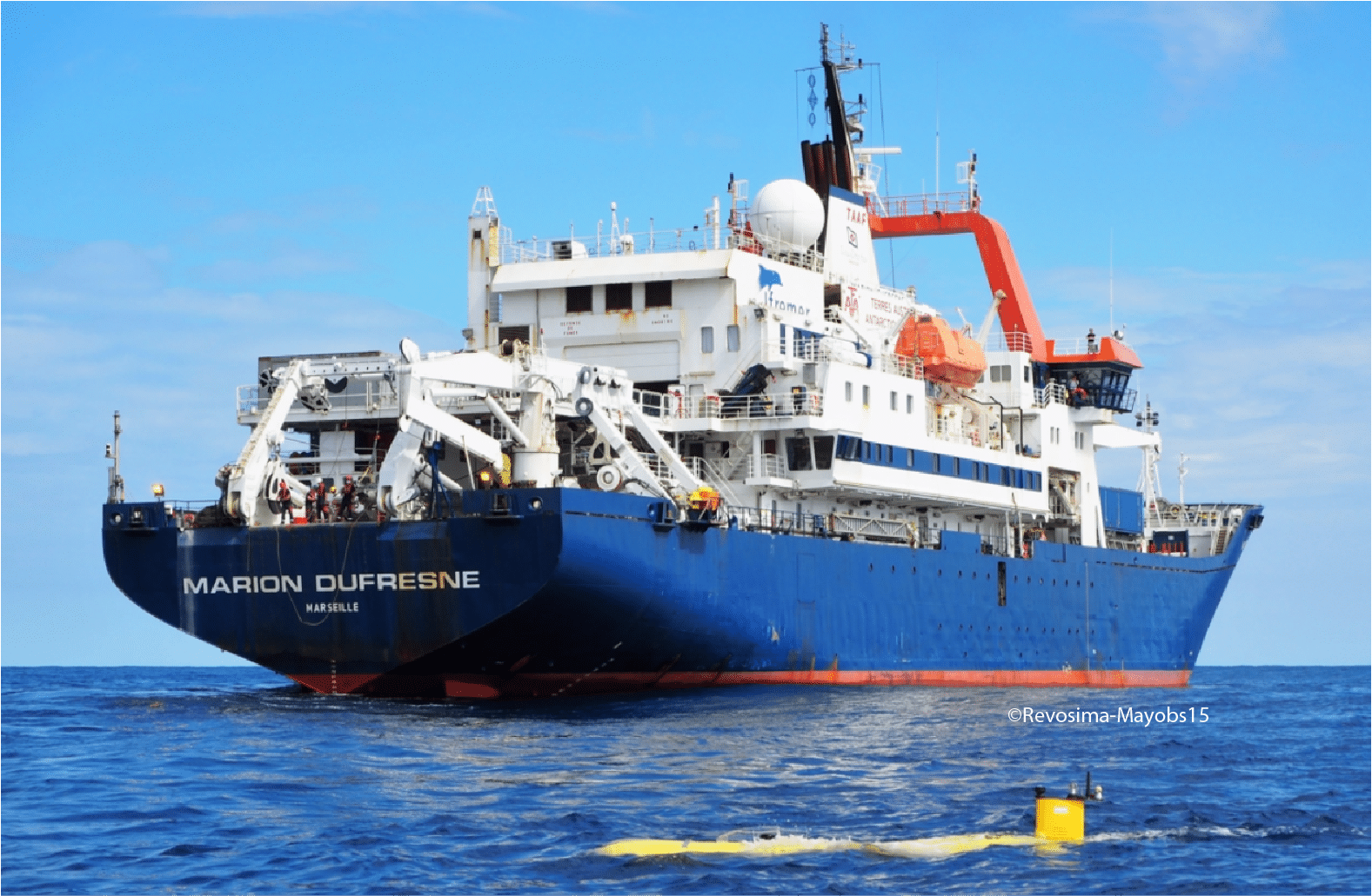
In April–May 2023, the French research vessel Marion Dufresne II set sail from La Réunion Island toward Barbados on a unique mission: the TRANSAMA campaign (Transit to AMARYLLIS-AMAGAS). As part of the MAP-IO program (Marion Dufresne Atmospheric Program–Indian Ocean), this expedition aimed to deepen our understanding of aerosols — tiny particles suspended in the atmosphere – and their behavior over the open ocean.
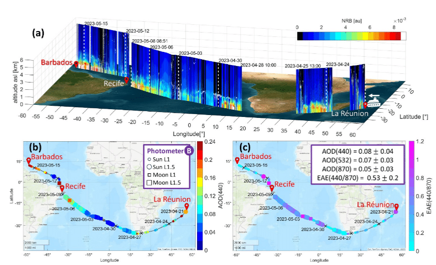
Aerosols, whether transported from distant continents or generated locally, play a critical role in cloud formation, sunlight reflection, and climate dynamics. Yet, their behavior over the oceans remains poorly documented due to the logistical challenges of conducting continuous measurements at sea. TRANSAMA was designed to fill this gap by deploying state-of-the-art instrumentation capable of capturing both column-integrated and vertically resolved aerosol data in a fully autonomous, shipborne environment.
To meet this challenge, CIMEL collaborated closely with the Laboratoire d’Optique Atmosphérique (LOA) through their joint research structure, AGORA-Lab, which coordinated and supported all the instrumental installations aboard the ship.
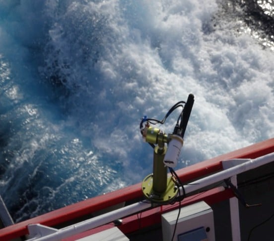
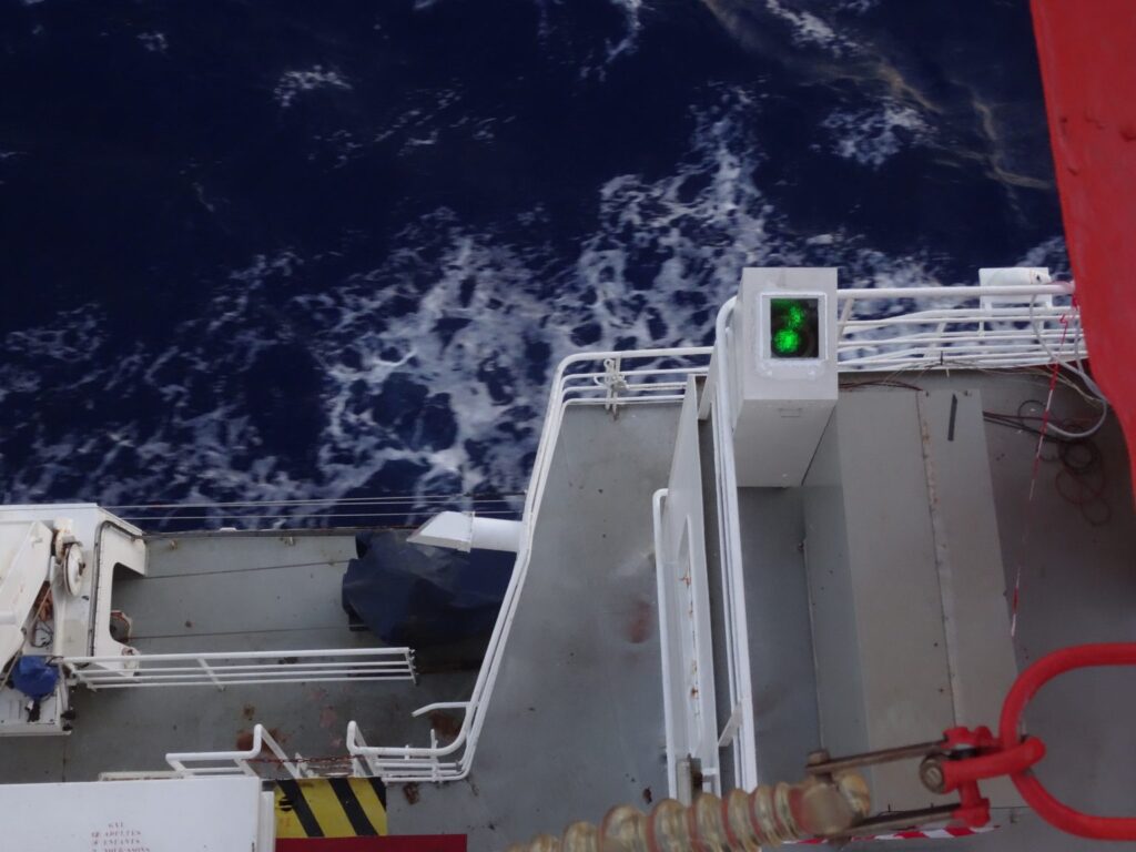
Two CIMEL instruments formed the backbone of this observational campaign. The CE318-T Sun/Sky-Lunar photometer, set up permanently on board the ship since 2021, continuously recorded aerosol optical depth and particle size distribution during daylight hours, while the micro-LiDAR scanned the vertical structure of the atmosphere, revealing the layering of aerosols and their interactions with clouds.
Installed on the deck and carefully adapted for marine conditions, these instruments worked in harmony, providing a detailed picture of the atmosphere above the Atlantic.
Each observation contributed to a growing dataset that bridges the gap between local measurements and global atmospheric models.
Following the success of the 2023 campaign, the set up of a new CE376 lidar aboard Marion Dufresne in the framework of the OBS4CLIM project is scheduled for late October 2025. Once the lidar will be set up on board the vessel, it will record regular mobile measurements during the ship’s rotations from La Réunion island to the French Southern and Antarctic Lands (TAAF). These next voyages will further extend the temporal coverage of aerosol observations and help scientists understand the seasonal variations and long-range transport processes over the Indian and Atlantic Oceans.
Key publications
- Sanchez-Barrero, M. F., et al. (2025). “Aerosol variability over oceans using micro-pulse lidar and photometer: Insights from TRANSAMA ship-based campaign.” EGUsphere.
- Torres, B., et al. (2025). “Adaptation of the CIMEL-318T to shipborne use: Three years of automated AERONET-compatible aerosol measurements onboard the research vessel Marion Dufresne.” Atmospheric Measurement Techniques.
